Skip to content
Mountain

Argentière Glacier
Haute-Savoie

The video is only loaded from YouTube (youtube-nocookie.com) when you start it.

1 pilot review

“D’expérience, je valide! Plus beau spot à mon actif!” — Tanguylebg, 5 years ago

Read the reviews + Write my review

Description

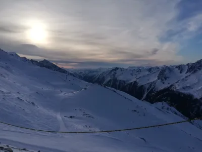
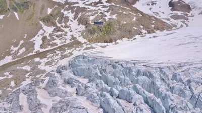
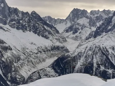
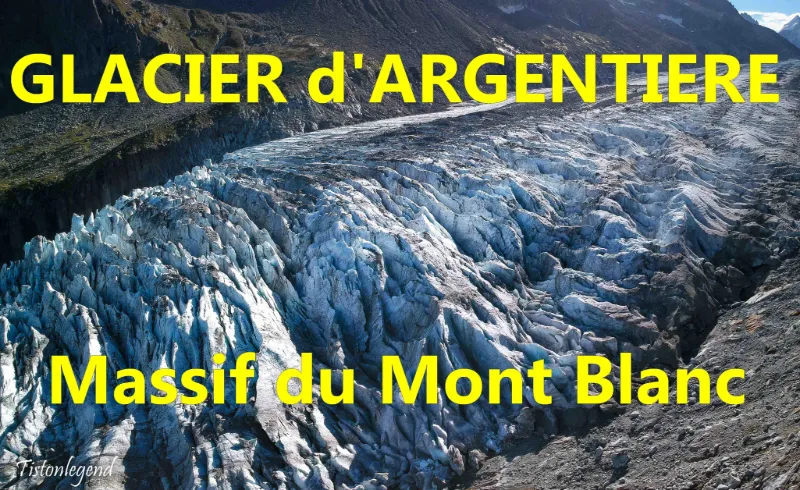
A magical place where you feel very small in front of the force of nature. A majestic glacier, impressive seracs and crevasses

Map and restricted areas

Open in the main map

Nearby aerodromes

Open aerodromes within 25 km of the spot, heliports included, with their distance and direction from the spot. Near an aerodrome, drone flying is prohibited or height-limited: check the UAS zones map.

Aerodrome Type Distance ElevationDifference
Croix De Lognan Heliport Heliport 1.8 km W 1,941 mspot 366 m higher
Altisurface du Glacier du Passon "du haut" Aerodrome 2.0 km NE 2,972 mspot 665 m lower
Glacier d'Argentière Altiport Aerodrome 3.6 km SE 2,850 mspot 543 m lower
Altisurface du Glacier Du Tour Aerodrome 4.3 km NE 3,100 mspot 793 m lower
Sécurité Heliport Heliport 6.2 km SW 1,077 mspot 1,231 m higher

Indicative list: it does not replace official aeronautical information.

Aviation weather (METAR and TAF)

LIMW – Aosta Airport · 39 km SE VFR

METAR

Observed 21/11 11:50 · 17 min ago

METAR LIMW 211050Z 24011KT CAVOK 11/02 Q1018

Wind
240°, 20 km/h
Visibility
10 km or more
Clouds
–
Temperature
11 °C, dew point 2 °C
QNH
1018 hPa
Flight category
VFR: ceiling > 3,000 ft and visibility > 5 mi

TAF

Issued 21/11 09:00 · valid from 21/11 10:00 to 21/11 19:00

TAF LIMW 210800Z 2109/2118 26008KT 9999 SCT040

Period (local time) Change Wind Visibility Weather Clouds
21/11 10:00 → 21/11 19:00 Initial conditions 260°, 15 km/h 10 km or more Scattered (3-4/8) at 4,000 ft (1220 m)

Empty cell: no change forecast for that element.

METAR and TAF from NOAA (Aviation Weather Center), for guidance only: they do not replace flight planning with official sources (SIA, Météo-France). Nearest station that issues a METAR, not necessarily the nearest aerodrome.

Plan the light

Weather and Kp index

Loading forecast…

Sunrise and sunset

Local times at the spot (UTC+01:00). The golden hour, the warm, low light sought after for photos and videos, runs from sunrise until the sun reaches 6° above the horizon, and in the evening from 6° until sunset.

Day Dawn Sunrise Golden hour Sunset Dusk Day length
Sat 21 Nov07:08 07:41 07:41–08:28 · 16:08–16:55 16:55 17:289 h 14
Sun 22 Nov07:09 07:42 07:42–08:29 · 16:07–16:54 16:54 17:279 h 12
Mon 23 Nov07:10 07:43 07:43–08:31 · 16:06–16:54 16:54 17:279 h 10
Tue 24 Nov07:12 07:45 07:45–08:32 · 16:06–16:53 16:53 17:269 h 08
Wed 25 Nov07:13 07:46 07:46–08:34 · 16:05–16:52 16:52 17:259 h 06
Thu 26 Nov07:14 07:47 07:47–08:35 · 16:04–16:52 16:52 17:259 h 04
Fri 27 Nov07:15 07:48 07:48–08:36 · 16:03–16:51 16:51 17:249 h 02

Nearby on Wikipedia

  • Glacier d'Argentière · 1.1 km away

    Le glacier d'Argentière est un glacier du massif du Mont-Blanc. Il s'épanche en direction du village d'Argentière (commune de Chamonix-Mont-Blanc), d'où son nom. Le glacier prend naissance vers dans un cirque glaciaire, dominé et alimenté en neige par de hauts sommets délimitant la frontière avec la (...)

  • Aiguille des Grands Montets · 1.8 km away

    L'aiguille des Grands Montets, dans le massif du Mont-Blanc, est le nom donné à l'un des sommets dominant le village d'Argentière , sur la commune de Chamonix-Mont-Blanc. Elle culmine à . Par métonymie, les Grands-Montets désignent aussi le domaine skiable placé sur ses pentes depuis Argentière (...)

  • Petite Aiguille Verte · 1.9 km away

    La Petite Aiguille Verte, ou Petite Verte, est un sommet du massif du Mont-Blanc qui culmine à d'altitude. Son ascension peu difficile en terrain mixte et la rapidité de son ascension depuis le haut du téléphérique des Grands Montets en fait un sommet prisé par les alpinistes novices. (...)

  • Aiguille du Chardonnet · 2.7 km away

    L'aiguille du Chardonnet est un sommet du massif du Mont-Blanc dont le versant Nord, neigeux et glaciaire, propose un large choix de voies dont l'arête Forbes. Son versant Sud, bien plus chaotique avec ses nombreux éperons rocheux accueille quelques voies en paroi peu connues ainsi que deux couloirs (...)

  • Aiguille Verte · 3.2 km away

    L'aiguille Verte est un sommet du massif du Mont-Blanc, en Haute-Savoie, culminant à . Elle fait partie des 82 sommets de plus de recensés dans les Alpes. Cette vaste montagne, d'accès difficile et longtemps invaincue, s'articule en trois versants : * Le versant sud, où se développe notamment sa (...)

Articles found by GeoNames from the spot's position.

Nearby spots

Reviews

Log in to review this spot. Log in · Create a free account

  1. Tanguylebg

    D’expérience, je valide! Plus beau spot à mon actif!

Connection to the site lost. Trying again…

The site is not responding. Trying again in seconds.

The site is no longer responding.

The site has been updated. Reloading the page…

This page has expired.

Resuming failed. Please reload the page.

The site is no longer responding.