

The Méouge Gorges

No reviews yet
Have you flown here? Share your experience with other pilots.
+ Write the first reviewDescription
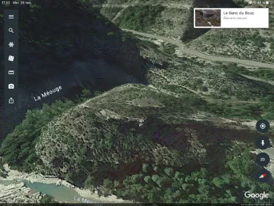
Classified as a biological reserve, the Méouge gorges, located near Châteauneuf-de-Chabre, are a cool haven in summer for nature-loving walkers and swimming fans. In spring or after heavy rain, the waters of the Méouge also attract kayakers.
Along the river, the walk lets you admire, besides the many natural riches of this protected area, a medieval bridge with three arches and the ruins of a mill. Natura 2000 site.
Located 5 km south of Laragne, the Méouge gorges are classified as a biological reserve and are a true gem of the department. Named a Wonder of the Hautes-Alpes, the Méouge gorges are bathed in warmth and light and are a well-known spot for swimming and walks.
Deep, winding gorges surround a fiery torrent that leaps in cascades, forming whirlpools, pools, beaches of polished pebbles, natural basins…
Even lovers of old stones will be pleased, admiring an old Romanesque bridge with three arches, still in very good condition, as well as the remains of a mill that was swept away by a flood in 1901.
Budding geologists will admire the huge rock blocks forming beautiful ivory-colored strata. The curious will profit from reading the information panels on the fauna and flora: you are in a Natura 2000 site teeming with alpine, Provençal, Mediterranean, Iberian and even North African plants.
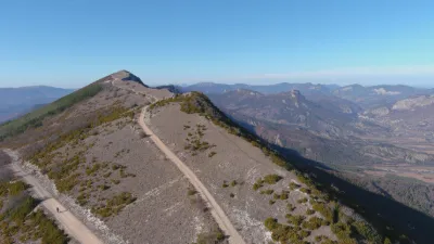
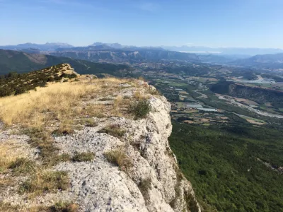
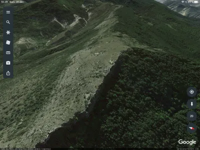
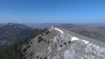
So refreshing in summer, the Méouge can also be descended by kayak in spring or flown over by hang glider or paraglider: take-off from the Chabre site, which also offers a superb panoramic view!
Map and restricted areas
Open in the main mapNearby aerodromes
Open aerodromes within 25 km of the spot, heliports included, with their distance and direction from the spot. Near an aerodrome, drone flying is prohibited or height-limited: check the UAS zones map.
| Aerodrome | Type | Distance | Elevation | Difference |
|---|---|---|---|---|
| Aérodrome de Sistéron-Vaumeilh | Aerodrome | 11 km E | 540 m | spot 30 m higher |
| La Motte du Caire Glider Field | Aerodrome | 20 km E | 650 m | spot 80 m lower |
| Altisurface du Grand Terrus | Aerodrome | 20 km NW | 875 m | spot 305 m lower |
| Serres - La Bâtie-Montsaléon Airfield | Aerodrome | 21 km N | 715 m | spot 145 m lower |
Aviation weather (METAR and TAF)
No METAR station within 50 km.
Weather and Kp index
| Day | Weather | Temp. min. / max. | Wind | Rain | Max Kp |
|---|---|---|---|---|---|
| Sat 21 Nov | Fair | 4° / 13° | 9 km/h W | – | 2 |
| Sun 22 Nov | Showers | 5° / 10° | 23 km/h NW | 22 mm | 2 |
| Mon 23 Nov | Cloudy | 3° / 8° | 23 km/h NW | – | 4 |
| Tue 24 Nov | Cloudy | 0° / 10° | 10 km/h W | 0.4 mm | 2 |
| Wed 25 Nov | Rain | 3° / 6° | 6 km/h E | 24 mm | – |
| Thu 26 Nov | Clear sky | -2° / 6° | 3 km/h W | 2.1 mm | – |
| Fri 27 Nov | Fair | -3° / 6° | 3 km/h W | – | – |
Hour by hour: Saturday 21 November
| Time | Weather | Temp. | Wind | Rain | Clouds | Kp |
|---|---|---|---|---|---|---|
| 12:00 | Partly cloudy | 10° | 9 km/h W | – | 39 % | 2 |
| 13:00 | Fair | 12° | 7 km/h W | – | 21 % | 1 |
| 14:00 | Fair | 13° | 6 km/h W | – | 18 % | 1 |
| 15:00 | Partly cloudy | 13° | 7 km/h W | – | 64 % | 1 |
| 16:00 | Partly cloudy | 12° | 7 km/h SW | – | 70 % | 2 |
| 17:00 | Partly cloudy | 8° | 5 km/h SW | – | 91 % | 2 |
| 18:00 | Partly cloudy | 6° | 4 km/h SW | – | 88 % | 2 |
| 19:00 | Partly cloudy | 5° | 6 km/h SW | – | 70 % | 2 |
| 20:00 | Partly cloudy | 4° | 5 km/h S | – | 84 % | 2 |
| 21:00 | Cloudy | 4° | 4 km/h S | – | 100 % | 2 |
| 22:00 | Cloudy | 5° | 4 km/h SE | – | 100 % | 2 |
Hour by hour: Sunday 22 November
| Time | Weather | Temp. | Wind | Rain | Clouds | Kp |
|---|---|---|---|---|---|---|
| 06:00 | Heavy rain | 6° | 10 km/h NE | 2.1 mm | 100 % | 2 |
| 07:00 | Heavy rain | 6° | 8 km/h NE | 4.4 mm | 100 % | 2 |
| 08:00 | Heavy rain | 6° | 7 km/h N | 3.5 mm | 100 % | 2 |
| 09:00 | Heavy rain | 7° | 6 km/h SE | 1.4 mm | 100 % | 2 |
| 10:00 | Light rain | 8° | 13 km/h W | 0.4 mm | 100 % | 2 |
| 11:00 | Showers | 9° | 20 km/h W | 0.5 mm | 86 % | 2 |
| 12:00 | Showers | 10° | 19 km/h NW | 0.5 mm | 68 % | 2 |
| 13:00 | Showers | 9° | 21 km/h NW | 0.5 mm | 56 % | 2 |
| 14:00 | Showers | 9° | 22 km/h NW | 1.0 mm | 44 % | 2 |
| 15:00 | Showers | 8° | 22 km/h NW | 0.3 mm | 52 % | 2 |
| 16:00 | Clear sky | 8° | 20 km/h NW | – | 9 % | 2 |
| 17:00 | Fair | 7° | 21 km/h NW | – | 14 % | 2 |
| 18:00 | Fair | 7° | 18 km/h NW | – | 26 % | 2 |
| 19:00 | Fair | 6° | 16 km/h W | – | 16 % | 2 |
| 20:00 | Fair | 6° | 17 km/h W | – | 16 % | 2 |
| 21:00 | Fair | 6° | 19 km/h W | – | 31 % | 2 |
| 22:00 | Partly cloudy | 6° | 22 km/h W | – | 58 % | 2 |
Sunrise and sunset
| Day | Dawn | Sunrise | Golden hour | Sunset | Dusk | Day length |
|---|---|---|---|---|---|---|
| Sat 21 Nov | 07:09 | 07:40 | 07:40–08:25 · 16:20–17:05 | 17:05 | 17:37 | 9 h 24 |
| Sun 22 Nov | 07:10 | 07:42 | 07:42–08:27 · 16:19–17:04 | 17:04 | 17:36 | 9 h 22 |
| Mon 23 Nov | 07:11 | 07:43 | 07:43–08:28 · 16:18–17:04 | 17:04 | 17:35 | 9 h 20 |
| Tue 24 Nov | 07:12 | 07:44 | 07:44–08:29 · 16:18–17:03 | 17:03 | 17:35 | 9 h 18 |
| Wed 25 Nov | 07:13 | 07:45 | 07:45–08:31 · 16:17–17:02 | 17:02 | 17:34 | 9 h 17 |
| Thu 26 Nov | 07:14 | 07:46 | 07:46–08:32 · 16:16–17:02 | 17:02 | 17:34 | 9 h 15 |
| Fri 27 Nov | 07:16 | 07:48 | 07:48–08:34 · 16:15–17:01 | 17:01 | 17:33 | 9 h 13 |

Reviews
Log in to review this spot. Log in · Create a free account
No reviews yet. Share yours!