

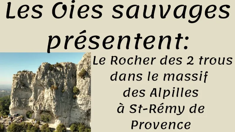
Saint Rémy de Provence, the Rocher des 2 Trous.
No reviews yet
Have you flown here? Share your experience with other pilots.
+ Write the first reviewDescription
The Rocher des Deux Trous, a geological gem located in Saint-Rémy de Provence, captivates with its fascinating history and unique formation. Shaped by centuries of erosion, this site stands out for its two natural openings that seem to watch over the Alpilles, a chain of small limestone mountains. These "holes" are not just natural phenomena; they are steeped in legends and stories that fuel the local imagination.
The Saint-Rémy de Provence area, rich in archaeological remains, bears witness to human presence dating back to prehistoric times. The Alpilles in particular were a favored place for ancient civilizations, as shown by the many sites built by the Romans. Set in this dense historical context, the Rocher des Deux Trous was no doubt a landmark for the inhabitants and travelers of the time.
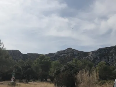
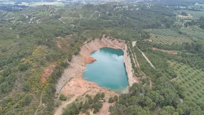
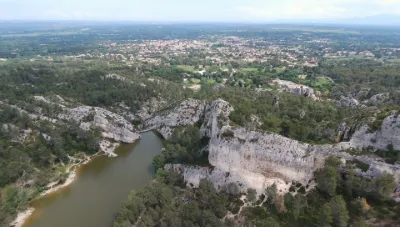
Geographically, the rock sits in a remarkable environment, characterized by limestone terrain, Mediterranean flora and rich biodiversity. This area, protected within the Parc naturel régional des Alpilles, offers exceptional panoramas where olive groves, vineyards and lavender fields, typical of Provence, blend together.
The Rocher des Deux Trous is therefore more than a natural curiosity; it is a symbol of the history and geography of the region, a place where the past and natural beauty meet, inviting visitors on a journey through time and nature.
Map and restricted areas
Open in the main mapNearby aerodromes
Open aerodromes within 25 km of the spot, heliports included, with their distance and direction from the spot. Near an aerodrome, drone flying is prohibited or height-limited: check the UAS zones map.
| Aerodrome | Type | Distance | Elevation | Difference |
|---|---|---|---|---|
| Le Mazet De Romanin Airfield | Aerodrome | 3.8 km NE | 118 m | spot 152 m higher |
| Aérodrome d'Eyguières | Aerodrome | 16 km SE | 75 m | spot 195 m higher |
| Avignon-Caumont Airport | Airport | 18 km N | 38 m | spot 232 m higher |
| Centre Hospitalier Heliport | Heliport | 20 km N | 21 m | spot 249 m higher |
| Societe Europeenne de Propulsion Heliport | Heliport | 24 km S | 22 m | spot 248 m higher |
Aviation weather (METAR and TAF)
LFMV – Avignon-Caumont Airport VFR
METAR
METAR LFMV 210700Z AUTO VRB01KT CAVOK 05/04 Q1020 NOSIG
- Wind
- Variable, 2 km/h
- Visibility
- 10 km or more
- Clouds
- –
- Temperature
- 5 °C, dew point 4 °C
- QNH
- 1020 hPa
- Flight category
- VFR: ceiling > 3,000 ft and visibility > 5 mi
TAF
TAF LFMV 210200Z 2103/2203 VRB03KT CAVOK BECMG 2119/2121 13010KT -RA BKN020 PROB40 TEMPO 2122/2203 13015G25KT 4000 RA BKN012 BKN025
| Period (local time) | Change | Wind | Visibility | Weather | Clouds |
|---|---|---|---|---|---|
| 21/11 04:00 → 21/11 20:00 | Initial conditions | Variable, 6 km/h | 10 km or more | No significant weather | No significant cloud |
| 21/11 20:00 → 22/11 04:00 | Becoming | 130°, 19 km/h | 10 km or more | Rain light | Broken (5-7/8) at 2,000 ft (610 m) |
| 21/11 23:00 → 22/11 04:00 | Temporarily, probability 40% | 130°, 28 km/h, gusts 46 km/h | 4.0 km | Rain | Broken (5-7/8) at 1,200 ft (370 m) ; Broken (5-7/8) at 2,500 ft (760 m) |
Weather and Kp index
Sunrise and sunset
| Day | Dawn | Sunrise | Golden hour | Sunset | Dusk | Day length |
|---|---|---|---|---|---|---|
| Sat 21 Nov | 07:11 | 07:42 | 07:42–08:27 · 16:26–17:10 | 17:10 | 17:42 | 9 h 27 |
| Sun 22 Nov | 07:12 | 07:44 | 07:44–08:28 · 16:25–17:10 | 17:10 | 17:41 | 9 h 25 |
| Mon 23 Nov | 07:13 | 07:45 | 07:45–08:30 · 16:24–17:09 | 17:09 | 17:40 | 9 h 23 |
| Tue 24 Nov | 07:15 | 07:46 | 07:46–08:31 · 16:23–17:08 | 17:08 | 17:40 | 9 h 22 |
| Wed 25 Nov | 07:16 | 07:47 | 07:47–08:32 · 16:23–17:08 | 17:08 | 17:39 | 9 h 20 |
| Thu 26 Nov | 07:17 | 07:49 | 07:49–08:34 · 16:22–17:07 | 17:07 | 17:39 | 9 h 18 |
| Fri 27 Nov | 07:18 | 07:50 | 07:50–08:35 · 16:21–17:07 | 17:07 | 17:38 | 9 h 16 |
Reviews
Log in to review this spot. Log in · Create a free account
No reviews yet. Share yours!