Skip to content
Heritage

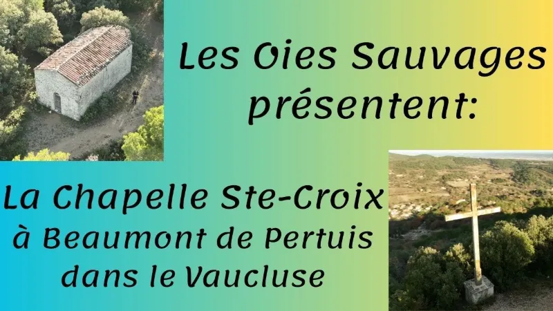
Beaumont de Pertuis, the Ste Croix chapel
Vaucluse

The video is only loaded from YouTube (youtube-nocookie.com) when you start it.

No reviews yet

Have you flown here? Share your experience with other pilots.

+ Write the first review

Description

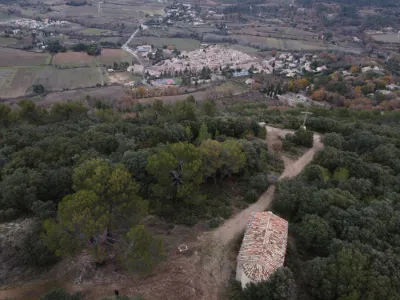
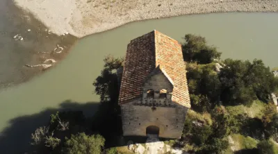
The Sainte-Croix chapel is built on top of a hill overlooking the village. You can reach it either by the drivable track that comes in from the back of the hill, or by a steep path that comes out in front of the building. From the top you can enjoy a wide panorama over the valley. The building dates from before 1300, and a hermitage was added in the 16th century. The hermitage was later abandoned and then demolished before 1789. A bay was added to the nave of the chapel, probably toward the end of the 16th century.

Automatic translation.

Map and restricted areas

Open in the main map

Nearby aerodromes

Open aerodromes within 25 km of the spot, heliports included, with their distance and direction from the spot. Near an aerodrome, drone flying is prohibited or height-limited: check the UAS zones map.

Aerodrome Type Distance ElevationDifference
Aérodrome de Vinon Aerodrome 8.0 km E 275 mspot 178 m higher
Saint Martin de Castillon Aerodrome 17 km NW 335 mspot 118 m higher

Indicative list: it does not replace official aeronautical information.

Aviation weather (METAR and TAF)

LFMY – Salon-de-Provence (BA 701) Air Base · 49 km W VFR

METAR

Observed 21/11 07:30 · 39 min ago

METAR LFMY 210630Z AUTO 00000KT CAVOK 04/04 Q1020

Wind
Calm
Visibility
10 km or more
Clouds
–
Temperature
4 °C, dew point 4 °C
QNH
1020 hPa
Flight category
VFR: ceiling > 3,000 ft and visibility > 5 mi

TAF

This station does not issue a TAF (or none is currently valid).

METAR and TAF from NOAA (Aviation Weather Center), for guidance only: they do not replace flight planning with official sources (SIA, Météo-France). Nearest station that issues a METAR, not necessarily the nearest aerodrome.

Plan the light

Weather and Kp index

Loading forecast…

Sunrise and sunset

Local times at the spot (UTC+01:00). The golden hour, the warm, low light sought after for photos and videos, runs from sunrise until the sun reaches 6° above the horizon, and in the evening from 6° until sunset.

Day Dawn Sunrise Golden hour Sunset Dusk Day length
Sat 21 Nov07:08 07:39 07:39–08:24 · 16:23–17:07 17:07 17:389 h 27
Sun 22 Nov07:09 07:40 07:40–08:25 · 16:22–17:06 17:06 17:389 h 25
Mon 23 Nov07:10 07:42 07:42–08:26 · 16:21–17:06 17:06 17:379 h 24
Tue 24 Nov07:11 07:43 07:43–08:28 · 16:20–17:05 17:05 17:379 h 22
Wed 25 Nov07:12 07:44 07:44–08:29 · 16:19–17:04 17:04 17:369 h 20
Thu 26 Nov07:14 07:45 07:45–08:30 · 16:19–17:04 17:04 17:369 h 18
Fri 27 Nov07:15 07:46 07:46–08:32 · 16:18–17:03 17:03 17:359 h 16

Nearby on Wikipedia

  • Beaumont-de-Pertuis · 0.7 km away

    Beaumont-de-Pertuis est une commune française, située respectivement dans le canton de Pertuis, l'arrondissement d'Apt, le département du Vaucluse en région Provence-Alpes-Côte d'Azur. Ses habitants sont appelés les Beaumontais(es) (en langue d'oc : Béu-mountès le plus souvent, voire (...)

  • Mirabeau (Vaucluse) · 3.9 km away

    Mirabeau est une commune française, située dans le département de Vaucluse en région Provence-Alpes-Côte d'Azur. Ses habitants sont appelés les Mirabelains et Mirabelaines. (...)

  • Gare de Mirabeau · 4.4 km away

    La gare de Mirabeau est une gare ferroviaire française de la ligne de Lyon-Perrache à Marseille-Saint-Charles (via Grenoble), située sur le territoire de la commune de Mirabeau dans le département de Vaucluse en région Provence-Alpes-Côte d'Azur. C'est une gare fermée au service ferroviaire. (...)

  • Pont de Mirabeau · 5.0 km away

    Le pont de Mirabeau est un pont-route français entre Vaucluse et Bouches-du-Rhône, par lequel la route d'Aix-en-Provence à Manosque traverse la Durance. Les piles d'un ancien pont suspendu datant de 1845, conservées, sont inscrites aux monuments historiques. (...)

  • Verdon (rivière) · 5.3 km away

    Le Verdon (Verdoun en occitan provençal de norme mistralienne) est une rivière française qui prend sa source au pied de la Tête de la Sestrière, entre le col d'Allos et le Pic des Trois-Évêchés, et se jette dans la Durance, près de Vinon-sur-Verdon, après avoir parcouru et collecté les eaux d’un (...)

Articles found by GeoNames from the spot's position.

Nearby spots

Reviews

Log in to review this spot. Log in · Create a free account

No reviews yet. Share yours!

Connection to the site lost. Trying again…

The site is not responding. Trying again in seconds.

The site is no longer responding.

The site has been updated. Reloading the page…

This page has expired.

Resuming failed. Please reload the page.

The site is no longer responding.