

Étretat
No reviews yet
Have you flown here? Share your experience with other pilots.
+ Write the first reviewDescription
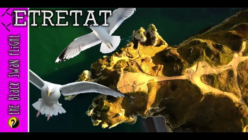
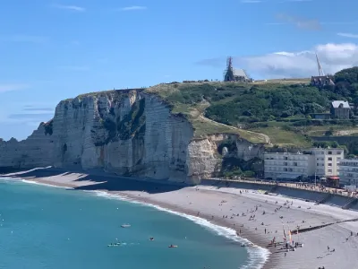
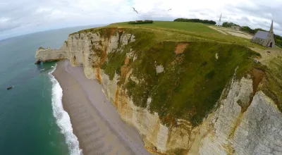
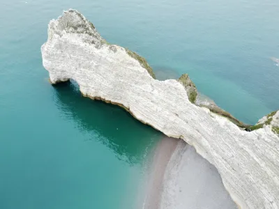
Étretat is a French commune located in the department of Seine-Maritime in Normandy. Once a modest fishing village, Étretat became a renowned seaside resort in the century. Guy de Maupassant organises landmark parties there. This village is located north of Le Havre, on the Channel coast, on the Alabaster coast which is part of the Caux country. The extraordinary and monumental aspect of its almost immaculate white chalk cliffs and its greyish pebble beaches have made it one of the places of international tourism. Painters such as Gustave Courbet, Eugène Boudin and Claude Monet contributed to its publicity, while immortalizing its specificity. Writers such as Maupassant and Gustave Flaubert are faithful to the place. Maurice Leblanc, who lived there, contributed to the myth surrounding the site maintained in an adventure by Arsène Lupin entitled L'Aiguille creuse (The Hollow Needle).
Map and restricted areas
Open in the main mapNearby aerodromes
Open aerodromes within 25 km of the spot, heliports included, with their distance and direction from the spot. Near an aerodrome, drone flying is prohibited or height-limited: check the UAS zones map.
| Aerodrome | Type | Distance | Elevation | Difference |
|---|---|---|---|---|
| Centre Hospitalier Heliport | Heliport | 12 km E | 97 m | spot 8 m lower |
| Hopital Jacques Monod Heliport | Heliport | 21 km S | 12 m | spot 77 m higher |
| Aérodrome du Havre - Saint-Romain | Aerodrome | 22 km SE | 129 m | spot 40 m lower |
| Le Havre Octeville Airport | Airport | 22 km SW | 95 m | spot 6 m lower |
Aviation weather (METAR and TAF)
LFOH – Le Havre Octeville Airport LIFR
METAR
METAR LFOH 221700Z AUTO 11004KT 030V200 5000 -RA BR OVC003/// ///TCU 08/07 Q1009 RERA TEMPO 2500 RA BECMG BKN030
- Wind
- 110°, 7 km/h
- Visibility
- 5 km
- Weather
- Rain light ; mist
- Clouds
- Overcast (8/8) at 300 ft (90 m)
- Temperature
- 8 °C, dew point 7 °C
- QNH
- 1009 hPa
- Flight category
- LIFR: ceiling < 500 ft or visibility < 1 mi
TAF
TAF LFOH 221100Z 2212/2312 10010KT 9999 BKN030 TEMPO 2212/2224 4500 RA OVC007 PROB40 TEMPO 2212/2224 2500 RA OVC004
| Period (local time) | Change | Wind | Visibility | Weather | Clouds |
|---|---|---|---|---|---|
| 22/11 13:00 → 23/11 13:00 | Initial conditions | 100°, 19 km/h | 10 km or more | Broken (5-7/8) at 3,000 ft (910 m) | |
| 22/11 13:00 → 23/11 01:00 | Temporarily | 4.5 km | Rain | Overcast (8/8) at 700 ft (210 m) | |
| 22/11 13:00 → 23/11 01:00 | Temporarily, probability 40% | 2.5 km | Rain | Overcast (8/8) at 400 ft (120 m) |
Weather and Kp index
Sunrise and sunset
| Day | Dawn | Sunrise | Golden hour | Sunset | Dusk | Day length |
|---|---|---|---|---|---|---|
| Sun 22 Nov | 07:46 | 08:22 | 08:22–09:14 · 16:16–17:09 | 17:09 | 17:45 | 8 h 46 |
| Mon 23 Nov | 07:47 | 08:23 | 08:23–09:16 · 16:15–17:08 | 17:08 | 17:44 | 8 h 44 |
| Tue 24 Nov | 07:49 | 08:25 | 08:25–09:18 · 16:14–17:07 | 17:07 | 17:43 | 8 h 41 |
| Wed 25 Nov | 07:50 | 08:26 | 08:26–09:20 · 16:13–17:06 | 17:06 | 17:42 | 8 h 39 |
| Thu 26 Nov | 07:51 | 08:28 | 08:28–09:21 · 16:11–17:05 | 17:05 | 17:41 | 8 h 37 |
| Fri 27 Nov | 07:53 | 08:29 | 08:29–09:23 · 16:10–17:04 | 17:04 | 17:41 | 8 h 35 |
| Sat 28 Nov | 07:54 | 08:31 | 08:31–09:25 · 16:09–17:04 | 17:04 | 17:40 | 8 h 32 |


Reviews
Log in to review this spot. Log in · Create a free account
No reviews yet. Share yours!