

Unusual
The sulfur quarry in the Calimani Mountains
No reviews yet
Have you flown here? Share your experience with other pilots.
+ Write the first reviewDescription
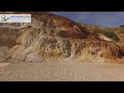
Operational from 1969 to 1997, the Calimani sulfur quarry, although abandoned, is still a place that attracts tourists today. Atypical for the Calimani National Park in which it is located, this wound in the mountain has its own beauty, but it is still sad to think about the ecological disaster that went on for 28 years.
Since around the 2000s, attempts have been made to restore the area where the waste rock was deposited, but bureaucracy still keeps things from moving forward much.
DroneMaster brings you some unique 4K footage filmed from the air of the Calimani park, the tailings settling pond and the quarry itself.
Map and restricted areas
Open in the main mapWeather and Kp index
Sunrise and sunset
| Day | Dawn | Sunrise | Golden hour | Sunset | Dusk | Day length |
|---|---|---|---|---|---|---|
| Sat 21 Nov | 06:57 | 07:31 | 07:31–08:20 · 15:50–16:39 | 16:39 | 17:12 | 9 h 07 |
| Sun 22 Nov | 06:59 | 07:33 | 07:33–08:21 · 15:49–16:38 | 16:38 | 17:11 | 9 h 05 |
| Mon 23 Nov | 07:00 | 07:34 | 07:34–08:23 · 15:48–16:37 | 16:37 | 17:11 | 9 h 02 |
| Tue 24 Nov | 07:01 | 07:35 | 07:35–08:24 · 15:47–16:36 | 16:36 | 17:10 | 9 h 00 |
| Wed 25 Nov | 07:03 | 07:37 | 07:37–08:26 · 15:46–16:35 | 16:35 | 17:09 | 8 h 58 |
| Thu 26 Nov | 07:04 | 07:38 | 07:38–08:27 · 15:45–16:35 | 16:35 | 17:09 | 8 h 56 |
| Fri 27 Nov | 07:05 | 07:39 | 07:39–08:29 · 15:44–16:34 | 16:34 | 17:08 | 8 h 54 |
Reviews
Log in to review this spot. Log in · Create a free account
No reviews yet. Share yours!