Skip to content
Mountain

The La Lavey waterfall in the Vénéon valley in Isère.
Isère

The video is only loaded from YouTube (youtube-nocookie.com) when you start it.

2 pilot reviews

“Merci 👍” — Dabus, 5 years ago

Read the reviews + Write my review

Description

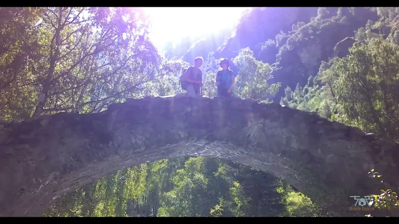
From the La Lavey waterfall to the refuge of the same name: very pretty scenery, lovely flowers and an easy climb. In accordance with the regulations, the views of the park are taken by hand and from the ground. The drone shots were taken in an authorized zone.

Automatic translation.

Map and restricted areas

Open in the main map

Nearby aerodromes

Open aerodromes within 25 km of the spot, heliports included, with their distance and direction from the spot. Near an aerodrome, drone flying is prohibited or height-limited: check the UAS zones map.

Aerodrome Type Distance ElevationDifference
Altisurface Dôme de la Lauze Aerodrome 8.2 km N 3,550 mspot 2,102 m lower
Les Deux Alpes Heliport Heliport 12 km NW 1,582 mspot 134 m lower
Altiport du Col de Sarenne Aerodrome 18 km N 1,980 mspot 532 m lower
Altiport L'Alpe d'Huez - Henri GIRAUD Aerodrome 20 km NW 1,860 mspot 412 m lower
Altisurface du Glacier Lombard Aerodrome 22 km NE 3,260 mspot 1,812 m lower

Indicative list: it does not replace official aeronautical information.

Aviation weather (METAR and TAF)

No METAR station within 50 km.

METAR and TAF from NOAA (Aviation Weather Center), for guidance only: they do not replace flight planning with official sources (SIA, Météo-France). Nearest station that issues a METAR, not necessarily the nearest aerodrome.

Plan the light

Weather and Kp index

Loading forecast…

Sunrise and sunset

Local times at the spot (UTC+01:00). The golden hour, the warm, low light sought after for photos and videos, runs from sunrise until the sun reaches 6° above the horizon, and in the evening from 6° until sunset.

Day Dawn Sunrise Golden hour Sunset Dusk Day length
Sun 22 Nov07:10 07:42 07:42–08:28 · 16:15–17:01 17:01 17:339 h 18
Mon 23 Nov07:11 07:43 07:43–08:29 · 16:14–17:00 17:00 17:329 h 16
Tue 24 Nov07:12 07:44 07:44–08:31 · 16:13–16:59 16:59 17:329 h 14
Wed 25 Nov07:13 07:46 07:46–08:32 · 16:12–16:59 16:59 17:319 h 12
Thu 26 Nov07:14 07:47 07:47–08:33 · 16:12–16:58 16:58 17:319 h 11
Fri 27 Nov07:15 07:48 07:48–08:35 · 16:11–16:57 16:57 17:309 h 09
Sat 28 Nov07:17 07:49 07:49–08:36 · 16:10–16:57 16:57 17:309 h 07

Nearby on Wikipedia

  • Refuge de la Lavey · 3.5 km away

    Le refuge de la Lavey est un refuge du massif des Écrins sur la commune de Saint-Christophe-en-Oisans, dans le vallon de la Lavey qui donne au nord sur la vallée du Vénéon. En 1949, la section de l'Isère du Club alpin français achète deux bâtiments au hameau de la Lavey (...)

  • Saint-Christophe-en-Oisans · 3.7 km away

    Saint-Christophe-en-Oisans est une commune française située dans le département français de l’Isère, en région Auvergne-Rhône-Alpes. (...)

  • Aiguille du Plat de la Selle · 3.9 km away

    L'aiguille du Plat de la Selle est un sommet du massif des Écrins qui culmine à . (...)

  • Lac des Bèches · 3.9 km away

    Le lac des Bèches est un lac glaciaire situé à 2417 m dans le vallon de la Lavey, dans le massif des Écrins. Sa superficie est de 0.6 ha, et sa profondeur d'au moins 3.6 mMichel Coûteaux Michel et Jean-Louis Edouard, « La déglaciation du site du lac des Bèches (massif des Écrins) (...)

  • Tête des Fétoules · 4.2 km away

    La Tête des Fétoules est un sommet du massif des Écrins qui culmine à d'altitude. La Tête des Fétoules appartient, avec la Tête de l'Étret entre autres, à une série de sommets qui séparent le vallon des Étages à l'est du vallon de la Lavey à l'ouest. (...)

Articles found by GeoNames from the spot's position.

Nearby spots

Reviews

Log in to review this spot. Log in · Create a free account

  1. Dabus

    Merci 👍

  2. jypai83

    Salut, joli vidéo comme j'aime jypai83

Connection to the site lost. Trying again…

The site is not responding. Trying again in seconds.

The site is no longer responding.

The site has been updated. Reloading the page…

This page has expired.

Resuming failed. Please reload the page.

The site is no longer responding.