

Mountain
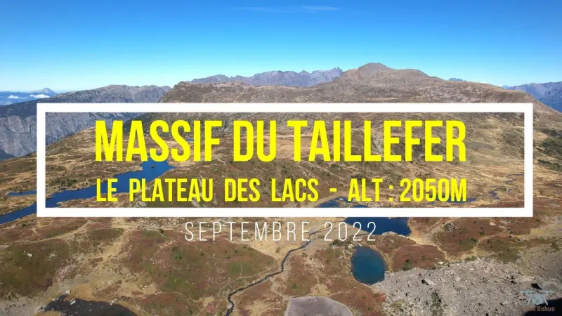
TAILLEFER MASSIF - PLATEAU DES LACS
Description
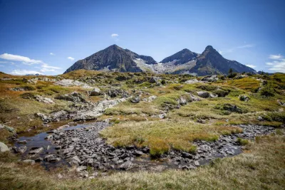
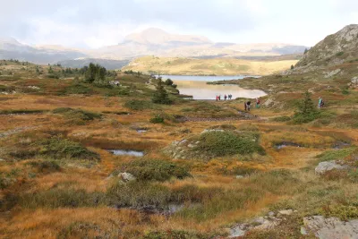
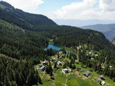
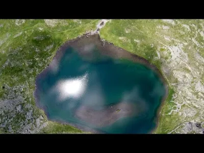
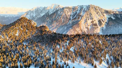
The Plateau des Lacs (2050m) lets you admire Lac Fourchu, Lac Agneau, Lac de la Vache, Lac Noir, etc... From this plateau there is a superb view of the Dôme de la Lauze glacier at Les 2 Alpes (3650m) and the 3 Aiguilles d'Arves (3514m) Lac Canard is home to a remarkable peat bog that holds, deep within, perfectly preserved tree trunks, sheltered from any oxidation. They are the last remnants of the primeval forests.
Map and restricted areas
Open in the main mapNearby aerodromes
Open aerodromes within 25 km of the spot, heliports included, with their distance and direction from the spot. Near an aerodrome, drone flying is prohibited or height-limited: check the UAS zones map.
| Aerodrome | Type | Distance | Elevation | Difference |
|---|---|---|---|---|
| Altiport L'Alpe d'Huez - Henri GIRAUD | Aerodrome | 13 km E | 1,860 m | spot 192 m higher |
| Altiport du Col De Belledonne | Aerodrome | 13 km N | 2,800 m | spot 748 m lower |
| Les Deux Alpes Heliport | Heliport | 16 km E | 1,582 m | spot 470 m higher |
| Altiport du Col de Sarenne | Aerodrome | 18 km E | 1,980 m | spot 72 m higher |
| Aérodrome de Grenoble Le Versoud | Aerodrome | 19 km N | 220 m | spot 1,831 m higher |
Aviation weather (METAR and TAF)
No METAR station within 50 km.
Weather and Kp index
| Day | Weather | Temp. min. / max. | Wind | Rain | Max Kp |
|---|---|---|---|---|---|
| Sun 22 Nov | Snow | -6° / -3° | 10 km/h W | 14 mm | 2 |
| Mon 23 Nov | Snow | -8° / -5° | 10 km/h NE | 8.7 mm | 4 |
| Tue 24 Nov | Cloudy | -11° / 1° | 9 km/h SW | 2.4 mm | 2 |
| Wed 25 Nov | Snow | -8° / -4° | 10 km/h SE | 27 mm | 2 |
| Thu 26 Nov | Cloudy | -9° / -6° | 5 km/h NW | 1.4 mm | – |
| Fri 27 Nov | Snow | -14° / -9° | 5 km/h E | 1.9 mm | – |
| Sat 28 Nov | Partly cloudy | -15° / -6° | 4 km/h NW | – | – |
Hour by hour: Sunday 22 November
| Time | Weather | Temp. | Wind | Rain | Clouds | Kp |
|---|---|---|---|---|---|---|
| 16:00 | Snow | -3° | 7 km/h SW | 1.5 mm | 100 % | 2 |
| 17:00 | Snow | -4° | 10 km/h W | 0.9 mm | 100 % | 2 |
| 18:00 | Snow | -4° | 9 km/h NE | 0.7 mm | 89 % | 2 |
| 19:00 | Snow | -4° | 9 km/h N | 0.7 mm | 100 % | 2 |
| 20:00 | Snow | -4° | 8 km/h NW | 1.8 mm | 100 % | 2 |
| 21:00 | Snow | -4° | 8 km/h NW | 2.5 mm | 100 % | 2 |
| 22:00 | Snow | -5° | 8 km/h NW | 3.0 mm | 100 % | 2 |
Hour by hour: Monday 23 November
| Time | Weather | Temp. | Wind | Rain | Clouds | Kp |
|---|---|---|---|---|---|---|
| 06:00 | Snow | -7° | 7 km/h E | 0.3 mm | 95 % | 2 |
| 07:00 | Snow | -8° | 6 km/h E | 0.3 mm | 94 % | 2 |
| 08:00 | Snow | -8° | 5 km/h E | 0.3 mm | 100 % | 2 |
| 09:00 | Snow | -7° | 6 km/h E | 0.2 mm | 98 % | 2 |
| 10:00 | Snow | -6° | 9 km/h N | 0.3 mm | 100 % | 2 |
| 11:00 | Snow | -5° | 7 km/h N | 0.4 mm | 100 % | 2 |
| 12:00 | Cloudy | -6° | 5 km/h NE | – | 100 % | 2 |
| 13:00 | Snow | -5° | 5 km/h N | 0.1 mm | 100 % | 4 |
| 14:00 | Snow | -5° | 5 km/h NW | 0.4 mm | 100 % | 4 |
| 15:00 | Snow | -5° | 5 km/h N | 0.3 mm | 100 % | 4 |
| 16:00 | Snow | -5° | 5 km/h N | 0.2 mm | 100 % | 4 |
| 17:00 | Snow | -6° | 5 km/h N | 0.1 mm | 100 % | 4 |
| 18:00 | Snow | -5° | 6 km/h N | 0.1 mm | 100 % | 4 |
| 19:00 | Snow | -6° | 5 km/h N | 0.2 mm | 100 % | 3 |
| 20:00 | Snow | -6° | 4 km/h NW | 0.2 mm | 100 % | 3 |
| 21:00 | Fog | -6° | 5 km/h N | – | 96 % | 3 |
| 22:00 | Fog | -6° | 4 km/h N | – | 94 % | 2 |
Sunrise and sunset
| Day | Dawn | Sunrise | Golden hour | Sunset | Dusk | Day length |
|---|---|---|---|---|---|---|
| Sun 22 Nov | 07:11 | 07:43 | 07:43–08:29 · 16:15–17:01 | 17:01 | 17:34 | 9 h 18 |
| Mon 23 Nov | 07:12 | 07:45 | 07:45–08:31 · 16:15–17:01 | 17:01 | 17:33 | 9 h 16 |
| Tue 24 Nov | 07:13 | 07:46 | 07:46–08:32 · 16:14–17:00 | 17:00 | 17:32 | 9 h 14 |
| Wed 25 Nov | 07:15 | 07:47 | 07:47–08:34 · 16:13–16:59 | 16:59 | 17:32 | 9 h 12 |
| Thu 26 Nov | 07:16 | 07:48 | 07:48–08:35 · 16:12–16:59 | 16:59 | 17:31 | 9 h 10 |
| Fri 27 Nov | 07:17 | 07:50 | 07:50–08:36 · 16:11–16:58 | 16:58 | 17:31 | 9 h 08 |
| Sat 28 Nov | 07:18 | 07:51 | 07:51–08:38 · 16:11–16:58 | 16:58 | 17:30 | 9 h 06 |
Reviews
Log in to review this spot. Log in · Create a free account
Cujo
Superbe vidéo. Merci