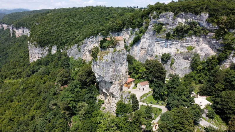
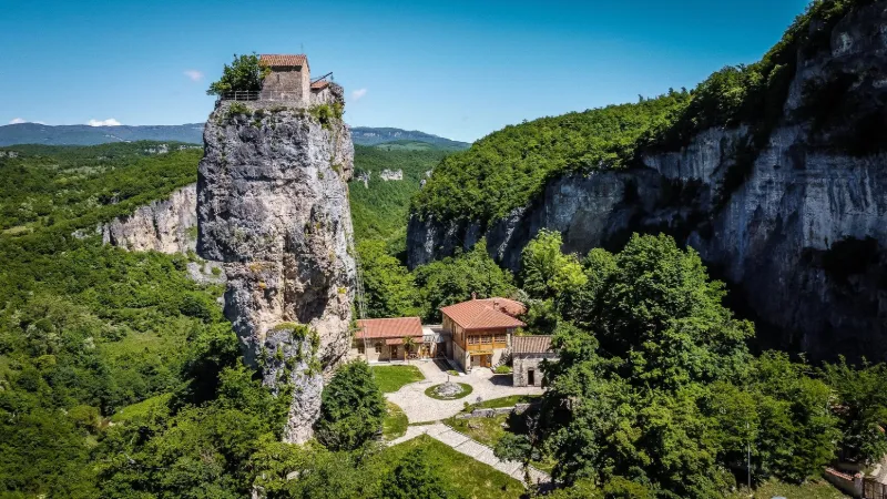
The Katskhi Pillar is a natural limestone monolith, about forty meters high, located in the village of Katskhi. The rock, whose summit of about 150 m2 holds the ruins of a hermitage dating from the 9th or 10th century. Religious activity associated with the pillar began to revive in the 1990s and the monastery building was restored in 2009. Near CHIATURA
METAR UGAM 211730Z AUTO 13002KT //// ////// 08/08 Q1013
Wind
130°, 4 km/h
Visibility
–
Clouds
–
Temperature
8 °C, dew point 8 °C
QNH
1013 hPa
Flight category
Unknown category
TAF
This station does not issue a TAF (or none is currently valid).
METAR and TAF from NOAA (Aviation Weather Center), for guidance only: they do not replace flight planning with official sources (SIA, Météo-France). Nearest station that issues a METAR, not necessarily the nearest aerodrome.
Local times at the spot (UTC+04:00). The golden hour, the warm, low light sought after for photos and videos, runs from sunrise until the sun reaches 6° above the horizon, and in the evening from 6° until sunset.
Le piton de Katskhi (en géorgien : , kac'xis svet'i) est un monolithe naturel de calcaire, d'une quarantaine de mètres, situé dans le village de Katskhi, en Géorgie. Le rocher, dont le sommet d'une superficie d'environ comprend les ruines d'un édifice religieux, a été vénéré localement comme pilier (...)
La municipalité de Tchiatoura (en géorgien : ჭიათურის მუნიციპალიტეტი) est un district de la région d'Iméréthie en Géorgie. Au recensement de 2002, Tchiatoura comptait 56 341 habitants. (...)
Tchiatoura (en , phonétiquement tchiatoura) est une ville de la région de Géorgie occidentale d'Iméréthie. Située dans une vallée montagneuse sur les rives de la rivière Kvirila, la ville est depuis 1879 un centre majeur de production de manganèse (...)
La bataille de Tchikhori (en , chikhoris brdzola) est un affrontement entre les armées du roi Georges VIII de Géorgie et une coalition de nobles rebelles sous la conduite du prétendant au trône Bagrat en 1463. Elle eut lieu près de la forteresse de Tchikhori dans le district d'Argveti en Géorgie (...)
Articles found by GeoNames from the spot's position.
Audience measurement
Drone-Spot, which shows no ads, would like to count its visits with Google Analytics (anonymous statistics) to improve the site. Do you agree?
Learn more


Reviews
Log in to review this spot. Log in · Create a free account
No reviews yet. Share yours!