Skip to content
Mountain

Réunion, the volcano seen from the sky
La Réunion

The video is only loaded from YouTube (youtube-nocookie.com) when you start it.

No reviews yet

Have you flown here? Share your experience with other pilots.

+ Write the first review

Description

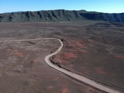
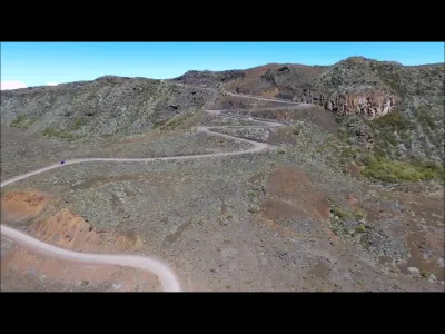
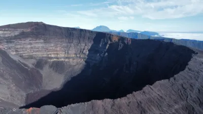
In this video, I take you to see 3 sites of the Fournaise volcano on Réunion Island, a French overseas department in the Indian Ocean.

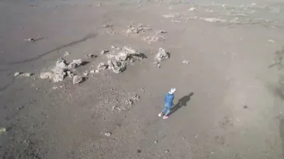
The Plaine des Sables is a lunar-like plateau, completely devoid of vegetation. It is covered with volcanic scoria, rock fragments thrown out during eruptions. The colors of the Plaine des Sables vary with the daylight, ranging from red to yellow through brown.

The Piton Chisny is a dormant volcano, peaking at 2,440 meters above sea level. It offers a stunning view of the Plaine des Sables and the Piton de la Fournaise.

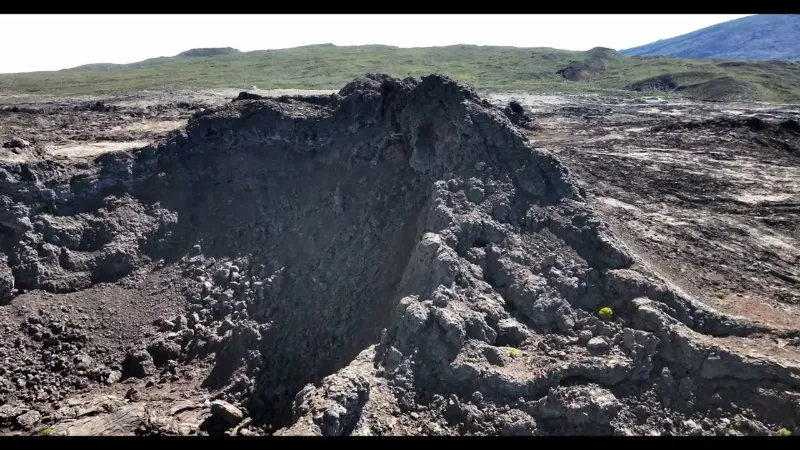
The Aubert de la Rüe crater is a maar-type volcanic crater, formed by the explosion of underground gas. It is located on the flank of the Piton Chisny.

Automatic translation.

Map and restricted areas

Open in the main map

Nearby aerodromes

Open aerodromes within 25 km of the spot, heliports included, with their distance and direction from the spot. Near an aerodrome, drone flying is prohibited or height-limited: check the UAS zones map.

No known open aerodrome within 25 km.

Indicative list: it does not replace official aeronautical information.

Aviation weather (METAR and TAF)

FMEP – Pierrefonds Airport · 27 km W VFR

METAR

Observed 23/11 00:30 · 32 min ago

METAR FMEP 222030Z AUTO 04006KT CAVOK 24/17 Q1020

Wind
040°, 11 km/h
Visibility
10 km or more
Clouds
–
Temperature
24 °C, dew point 17 °C
QNH
1020 hPa
Flight category
VFR: ceiling > 3,000 ft and visibility > 5 mi

TAF

This station does not issue a TAF (or none is currently valid).

METAR and TAF from NOAA (Aviation Weather Center), for guidance only: they do not replace flight planning with official sources (SIA, Météo-France). Nearest station that issues a METAR, not necessarily the nearest aerodrome.

Plan the light

Weather and Kp index

Loading forecast…

Sunrise and sunset

Local times at the spot (UTC+04:00). The golden hour, the warm, low light sought after for photos and videos, runs from sunrise until the sun reaches 6° above the horizon, and in the evening from 6° until sunset.

Day Dawn Sunrise Golden hour Sunset Dusk Day length
Mon 23 Nov05:02 05:27 05:27–05:58 · 18:09–18:41 18:41 19:0513 h 14
Tue 24 Nov05:02 05:26 05:26–05:58 · 18:10–18:41 18:41 19:0613 h 15
Wed 25 Nov05:02 05:26 05:26–05:58 · 18:11–18:42 18:42 19:0613 h 15
Thu 26 Nov05:02 05:26 05:26–05:58 · 18:11–18:43 18:43 19:0713 h 16
Fri 27 Nov05:02 05:26 05:26–05:58 · 18:12–18:43 18:43 19:0813 h 17
Sat 28 Nov05:02 05:26 05:26–05:58 · 18:12–18:44 18:44 19:0813 h 17
Sun 29 Nov05:02 05:26 05:26–05:58 · 18:13–18:45 18:45 19:0913 h 18

Nearby on Wikipedia

  • Piton Chisny · 0.3 km away

    Le piton Chisny est un édifice volcanique appartenant au massif du Piton de la Fournaise, sur l'île de La Réunion. Il culmine à d'altitude et domine d'environ le plateau environnant. L'éruption strombolienne dont il est issu, s'est produite il y a environ ans (...)

  • Demi-Piton · 0.9 km away

    Le Demi-Piton est un cône volcanique parasite du massif du Piton de la Fournaise sur l'île de La Réunion, département français d'outre-mer de l'océan Indien. (...)

  • Piton Rouge (Saint-Joseph) · 1.6 km away

    Le piton Rouge est un sommet de montagne de l'île de La Réunion, département d'outre-mer français dans le sud-ouest de l'océan Indien. Culminant à d'altitude, il est formé par un cône volcanique couronné d'un cratère à proximité de la crête du rempart de Bellecombe (...)

  • Pas des Sables · 2.0 km away

    Le Pas des Sables est un point géographique de l'île de La Réunion, un département d'outre-mer français dans le sud-ouest de l'océan Indien. Lieu de passage permettant le franchissement du rempart des Sables, il est situé à environ mètres d'altitude sur la frontière communale entre Saint-Joseph à (...)

  • Piton Haüy · 2.0 km away

    Le piton Haüy , anciennement cratère Hauy , est une petite structure géologique composée de deux cônes volcaniques et située sur l'île de La Réunion, sur les flancs du piton de la Fournaise, le volcan actif de cette île. (...)

Articles found by GeoNames from the spot's position.

Nearby spots

Reviews

Log in to review this spot. Log in · Create a free account

No reviews yet. Share yours!

Connection to the site lost. Trying again…

The site is not responding. Trying again in seconds.

The site is no longer responding.

The site has been updated. Reloading the page…

This page has expired.

Resuming failed. Please reload the page.

The site is no longer responding.