

Chez Constance - Plateau des Glières - Glières Val de Borne
No reviews yet
Have you flown here? Share your experience with other pilots.
+ Write the first reviewDescription
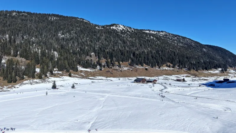
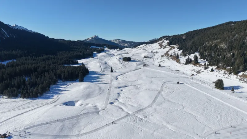
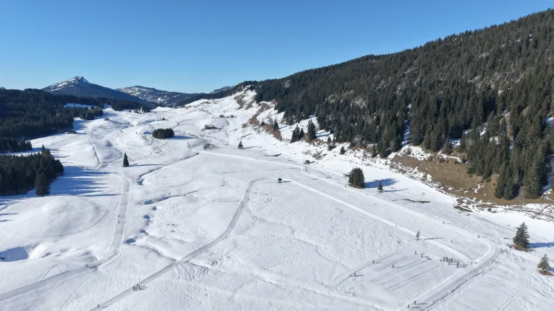
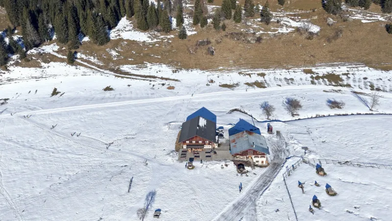
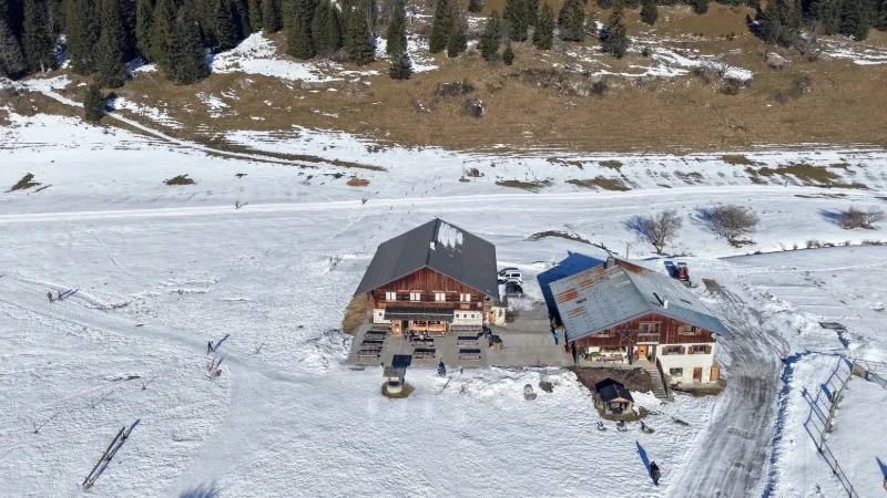
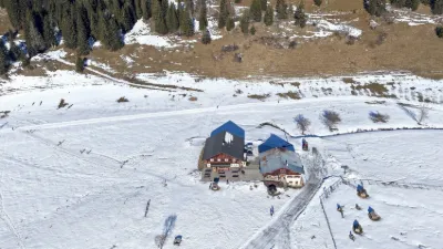
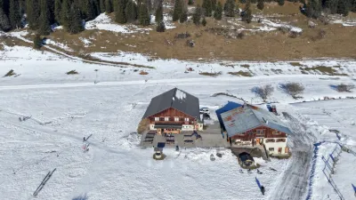
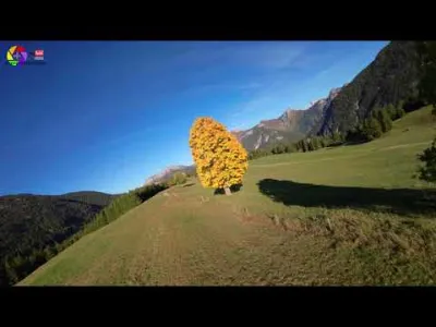
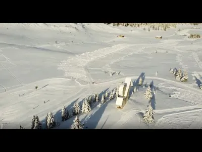
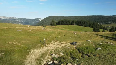
It all began in 1974 when Constance and her husband Joseph opened a café-restaurant in their mountain pasture farm on the Plateau des Glières, in Haute-Savoie. A must-visit spot on the Plateau des Glières for tasting potato fritters, the story continues with Yves, Constance's son, Joëlle, her daughter-in-law, and now Delphine, her granddaughter. Near BONNEVILLE
Map and restricted areas
Open in the main mapNearby aerodromes
Open aerodromes within 25 km of the spot, heliports included, with their distance and direction from the spot. Near an aerodrome, drone flying is prohibited or height-limited: check the UAS zones map.
| Aerodrome | Type | Distance | Elevation | Difference |
|---|---|---|---|---|
| Altiport du Col de Cenise | Aerodrome | 9.0 km NE | 1,724 m | spot 314 m lower |
| Altisurface de Saint-Roch Mayères | Aerodrome | 18 km E | 1,560 m | spot 150 m lower |
| Centre Hospitalier Heliport | Heliport | 19 km SW | 485 m | spot 925 m higher |
| Annecy-Haute-Savoie-Mont Blanc Airport | Airport | 20 km W | 464 m | spot 946 m higher |
| Centre Hospitalier Heliport | Heliport | 23 km E | 546 m | spot 864 m higher |
Aviation weather (METAR and TAF)
LFLP – Annecy-Haute-Savoie-Mont Blanc Airport VFR
METAR
METAR LFLP 221900Z AUTO 19008KT 9999 RA FEW015/// SCT025/// BKN033/// ///TCU 08/08 Q1014 TEMPO 3000 RA BKN012
- Wind
- 190°, 15 km/h
- Visibility
- 10 km or more
- Weather
- Rain
- Clouds
- Few (1-2/8) at 1,500 ft (460 m) ; Scattered (3-4/8) at 2,500 ft (760 m) ; Broken (5-7/8) at 3,300 ft (1010 m)
- Temperature
- 8 °C, dew point 8 °C
- QNH
- 1014 hPa
- Flight category
- VFR: ceiling > 3,000 ft and visibility > 5 mi
TAF
TAF LFLP 221400Z 2215/2315 22009KT 8000 RA OVC040 TEMPO 2215/2223 3000 RA SCT025TCU BKN030 PROB30 TEMPO 2215/2223 BKN012 BECMG 2300/2302 9999 NSW PROB40 TEMPO 2300/2303 BKN009
| Period (local time) | Change | Wind | Visibility | Weather | Clouds |
|---|---|---|---|---|---|
| 22/11 16:00 → 23/11 01:00 | Initial conditions | 220°, 17 km/h | 8 km | Rain | Overcast (8/8) at 4,000 ft (1220 m) |
| 22/11 16:00 → 23/11 00:00 | Temporarily, probability 30% | Broken (5-7/8) at 1,200 ft (370 m) | |||
| 22/11 16:00 → 23/11 00:00 | Temporarily | 3.0 km | Rain | Scattered (3-4/8) at 2,500 ft (760 m) (towering cumulus) ; Broken (5-7/8) at 3,000 ft (910 m) | |
| 23/11 01:00 → 23/11 04:00 | Temporarily, probability 40% | Broken (5-7/8) at 900 ft (270 m) | |||
| 23/11 01:00 → 23/11 16:00 | Becoming | 220°, 17 km/h | 10 km or more | No significant weather | Overcast (8/8) at 4,000 ft (1220 m) |
Weather and Kp index
| Day | Weather | Temp. min. / max. | Wind | Rain | Max Kp |
|---|---|---|---|---|---|
| Sun 22 Nov | Sleet | 0° / 1° | 20 km/h SW | 12 mm | 1 |
| Mon 23 Nov | Snow | -2° / 0° | 14 km/h SW | 18 mm | 4 |
| Tue 24 Nov | Cloudy | -5° / 4° | 8 km/h SE | 0.4 mm | 2 |
| Wed 25 Nov | Snow | -2° / -0° | 6 km/h SE | 20 mm | 2 |
| Thu 26 Nov | Snow | -2° / -1° | 4 km/h W | 1.7 mm | – |
| Fri 27 Nov | Cloudy | -4° / -2° | 5 km/h N | 1.1 mm | – |
| Sat 28 Nov | Fair | -10° / -1° | 4 km/h NE | – | – |
Hour by hour: Sunday 22 November
| Time | Weather | Temp. | Wind | Rain | Clouds | Kp |
|---|---|---|---|---|---|---|
| 20:00 | Sleet | 1° | 20 km/h SW | 3.2 mm | 100 % | 1 |
| 21:00 | Snow | 1° | 17 km/h SW | 2.8 mm | 100 % | 1 |
| 22:00 | Snow | 0° | 15 km/h SW | 2.9 mm | 100 % | 1 |
Hour by hour: Monday 23 November
| Time | Weather | Temp. | Wind | Rain | Clouds | Kp |
|---|---|---|---|---|---|---|
| 06:00 | Snow | -0° | 13 km/h SW | 1.0 mm | 100 % | 2 |
| 07:00 | Snow | -1° | 13 km/h SW | 1.5 mm | 100 % | 2 |
| 08:00 | Snow | -1° | 14 km/h SW | 1.7 mm | 100 % | 2 |
| 09:00 | Snow | -1° | 12 km/h S | 0.9 mm | 100 % | 2 |
| 10:00 | Snow | -1° | 11 km/h S | 0.4 mm | 100 % | 2 |
| 11:00 | Snow | -0° | 11 km/h S | 0.4 mm | 100 % | 2 |
| 12:00 | Snow | -0° | 13 km/h S | 0.4 mm | 100 % | 2 |
| 13:00 | Snow | -0° | 13 km/h S | 0.4 mm | 100 % | 4 |
| 14:00 | Snow | -0° | 12 km/h S | 0.7 mm | 100 % | 4 |
| 15:00 | Snow | -0° | 12 km/h S | 0.4 mm | 100 % | 4 |
| 16:00 | Snow | -0° | 10 km/h S | 0.2 mm | 100 % | 4 |
| 17:00 | Snow | -0° | 9 km/h S | 0.1 mm | 100 % | 4 |
| 18:00 | Cloudy | -0° | 9 km/h S | – | 100 % | 4 |
| 19:00 | Cloudy | -0° | 8 km/h S | – | 100 % | 3 |
| 20:00 | Cloudy | -0° | 6 km/h S | – | 100 % | 3 |
| 21:00 | Fog | -0° | 5 km/h S | – | 73 % | 3 |
| 22:00 | Fog | -2° | 4 km/h SE | – | 72 % | 2 |
Sunrise and sunset
| Day | Dawn | Sunrise | Golden hour | Sunset | Dusk | Day length |
|---|---|---|---|---|---|---|
| Sun 22 Nov | 07:12 | 07:44 | 07:44–08:32 · 16:10–16:57 | 16:57 | 17:30 | 9 h 12 |
| Mon 23 Nov | 07:13 | 07:46 | 07:46–08:33 · 16:09–16:56 | 16:56 | 17:29 | 9 h 10 |
| Tue 24 Nov | 07:14 | 07:47 | 07:47–08:35 · 16:08–16:55 | 16:55 | 17:28 | 9 h 08 |
| Wed 25 Nov | 07:15 | 07:48 | 07:48–08:36 · 16:07–16:55 | 16:55 | 17:28 | 9 h 06 |
| Thu 26 Nov | 07:16 | 07:50 | 07:50–08:38 · 16:06–16:54 | 16:54 | 17:27 | 9 h 04 |
| Fri 27 Nov | 07:18 | 07:51 | 07:51–08:39 · 16:05–16:53 | 16:53 | 17:27 | 9 h 02 |
| Sat 28 Nov | 07:19 | 07:52 | 07:52–08:40 · 16:05–16:53 | 16:53 | 17:26 | 9 h 00 |

Reviews
Log in to review this spot. Log in · Create a free account
No reviews yet. Share yours!