

The Fort de l'Heurt
No reviews yet
Have you flown here? Share your experience with other pilots.
+ Write the first reviewDescription
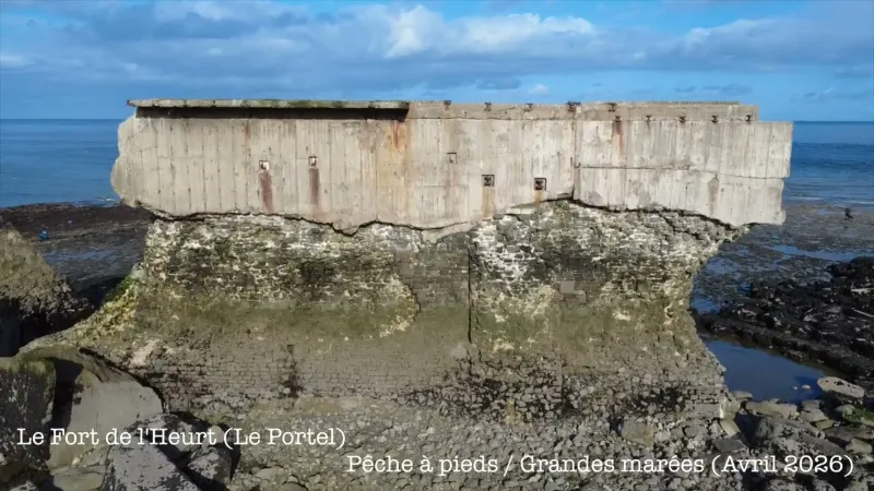
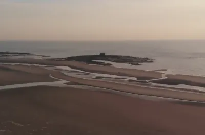
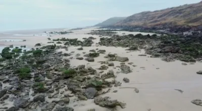
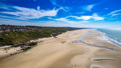
In 1803, Napoleon, determined to invade England, set up his troops in Boulogne-sur-Mer. To protect his camp (of 120,000 men) and the Boulogne roadstead from British attacks, he had the Fort de la Crèche built off Wimereux and the Fort de l'Heurt off Le Portel. While the first was swept away by a storm, the second still shows off its massive silhouette today. -At the foot of this giant lies one of the largest mussel beds on the Opal Coast. At low tide, fishermen have a field day.
Map and restricted areas
Open in the main mapNearby aerodromes
Open aerodromes within 25 km of the spot, heliports included, with their distance and direction from the spot. Near an aerodrome, drone flying is prohibited or height-limited: check the UAS zones map.
| Aerodrome | Type | Distance | Elevation | Difference |
|---|---|---|---|---|
| Boulogne Sur Mer Centre Hospitalier Heliport | Heliport | 5.1 km E | 85 m | spot 86 m lower |
| Le Touquet-Côte d'Opale Airport | Airport | 22 km S | 11 m | spot 12 m lower |
| Saint-Inglevert Aerodrome | Aerodrome | 23 km NE | 117 m | spot 118 m lower |
Aviation weather (METAR and TAF)
LFAT – Le Touquet-Côte d'Opale Airport VFR
METAR
METAR LFAT 221930Z AUTO 10010KT CAVOK 05/02 Q1014
- Wind
- 100°, 19 km/h
- Visibility
- 10 km or more
- Clouds
- –
- Temperature
- 5 °C, dew point 2 °C
- QNH
- 1014 hPa
- Flight category
- VFR: ceiling > 3,000 ft and visibility > 5 mi
TAF
TAF LFAT 221400Z 2215/2224 09010KT CAVOK
| Period (local time) | Change | Wind | Visibility | Weather | Clouds |
|---|---|---|---|---|---|
| 22/11 16:00 → 23/11 01:00 | Initial conditions | 090°, 19 km/h | 10 km or more | No significant weather | No significant cloud |
Weather and Kp index
| Day | Weather | Temp. min. / max. | Wind | Rain | Max Kp |
|---|---|---|---|---|---|
| Sun 22 Nov | Partly cloudy | 3° / 4° | 31 km/h E | – | 1 |
| Mon 23 Nov | Fair | 0° / 5° | 28 km/h E | – | 4 |
| Tue 24 Nov | Clear sky | 0° / 5° | 27 km/h SE | – | 2 |
| Wed 25 Nov | Light rain | 2° / 4° | 26 km/h E | 0.7 mm | 2 |
| Thu 26 Nov | Clear sky | -3° / 1° | 20 km/h NE | – | – |
| Fri 27 Nov | Clear sky | -3° / 2° | 14 km/h E | – | – |
| Sat 28 Nov | Cloudy | -1° / 2° | 18 km/h SE | – | – |
Hour by hour: Sunday 22 November
| Time | Weather | Temp. | Wind | Rain | Clouds | Kp |
|---|---|---|---|---|---|---|
| 21:00 | Partly cloudy | 4° | 31 km/h E | – | 100 % | 1 |
| 22:00 | Partly cloudy | 4° | 31 km/h E | – | 98 % | 1 |
Hour by hour: Monday 23 November
| Time | Weather | Temp. | Wind | Rain | Clouds | Kp |
|---|---|---|---|---|---|---|
| 06:00 | Cloudy | 2° | 22 km/h E | – | 90 % | 2 |
| 07:00 | Partly cloudy | 1° | 22 km/h E | – | 80 % | 2 |
| 08:00 | Partly cloudy | 1° | 22 km/h E | – | 58 % | 2 |
| 09:00 | Fair | 1° | 20 km/h E | – | 31 % | 2 |
| 10:00 | Fair | 2° | 18 km/h E | – | 14 % | 2 |
| 11:00 | Clear sky | 2° | 16 km/h E | – | 9 % | 2 |
| 12:00 | Clear sky | 4° | 16 km/h E | – | 9 % | 2 |
| 13:00 | Fair | 4° | 16 km/h E | – | 17 % | 4 |
| 14:00 | Fair | 5° | 16 km/h E | – | 30 % | 4 |
| 15:00 | Fair | 5° | 17 km/h E | – | 20 % | 4 |
| 16:00 | Fair | 4° | 15 km/h SE | – | 26 % | 4 |
| 17:00 | Fair | 2° | 16 km/h SE | – | 13 % | 4 |
| 18:00 | Clear sky | 2° | 19 km/h E | – | 1 % | 4 |
| 19:00 | Clear sky | 1° | 19 km/h SE | – | 0 % | 3 |
| 20:00 | Clear sky | 1° | 19 km/h SE | – | 2 % | 3 |
| 21:00 | Clear sky | 0° | 21 km/h SE | – | 2 % | 3 |
| 22:00 | Partly cloudy | 0° | 22 km/h SE | – | 73 % | 2 |
Sunrise and sunset
| Day | Dawn | Sunrise | Golden hour | Sunset | Dusk | Day length |
|---|---|---|---|---|---|---|
| Sun 22 Nov | 07:43 | 08:20 | 08:20–09:15 · 16:05–16:59 | 16:59 | 17:36 | 8 h 39 |
| Mon 23 Nov | 07:45 | 08:22 | 08:22–09:17 · 16:04–16:58 | 16:58 | 17:36 | 8 h 36 |
| Tue 24 Nov | 07:46 | 08:23 | 08:23–09:18 · 16:03–16:57 | 16:57 | 17:35 | 8 h 34 |
| Wed 25 Nov | 07:48 | 08:25 | 08:25–09:20 · 16:01–16:57 | 16:57 | 17:34 | 8 h 31 |
| Thu 26 Nov | 07:49 | 08:26 | 08:26–09:22 · 16:00–16:56 | 16:56 | 17:33 | 8 h 29 |
| Fri 27 Nov | 07:50 | 08:28 | 08:28–09:24 · 15:59–16:55 | 16:55 | 17:32 | 8 h 27 |
| Sat 28 Nov | 07:52 | 08:29 | 08:29–09:25 · 15:58–16:54 | 16:54 | 17:32 | 8 h 24 |
Reviews
Log in to review this spot. Log in · Create a free account
No reviews yet. Share yours!