

Castle
No reviews yet
Have you flown here? Share your experience with other pilots.
+ Write the first reviewHistory
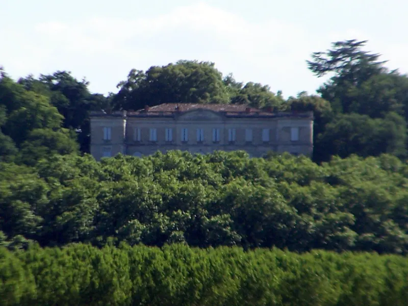
Les terres et le château de Marcellus, appartenait jusqu'en 1581 à Henri de Navarre et faisait partie du duché d'Albret. Le château médiéval devait être une forteresse qui défendait la plaine de la Garonne, et dont il ne subsiste rien. La construction d'un nouveau château est entreprise vers 1585. Les travaux conduisant au château actuel sont menés entre 1772 et 1778 sous la direction de l'architecte Bonfins. Le terrain a nécessité la construction d'une terrasse creusée de caves voûtées, sur laquelle repose l'habitation. Séparant le parc de la cour d'honneur, une grille soutenue par deux piliers ornés de pilastres cerne la façade sud composée de deux avant-corps et d'un corps central. Le porche d'entrée présente quatre colonnes à chapiteau ionique, soutenant un balcon répétant l'attique. Les avant-corps sont couronnés d'un fronton semi-circulaire. Du côté nord, des arcades supportent la terrasse fermée par deux pavillons carrés. A l'intérieur, le salon et le petit salon ont conservé leur décoration d'origine. Il reste quelques traces du château Renaissance, sans doute dans l'édifice actuel.
Map and restricted areas
Open in the main mapRestricted zones
| Zone | Category | Limits | Conditions |
|---|---|---|---|
| Gironde Sud | Zone réglementée | 244 m above ground level → 762 m above sea level | Vols interdits sauf lorsque the official document of the zone l'autorise explicitement ou avec l'accord du gestionnaire de la zone lorsqu'il est désigné par the official document of the zone |
| Zena Perigord Low | ZRT | FL 165 / FL 195 | SUP AIP 062/26 · Du jeudi 23 avril 2026 au jeudi 25 mars 2027 |
Nearby aerodromes
Open aerodromes within 25 km of the spot, heliports included, with their distance and direction from the spot. Near an aerodrome, drone flying is prohibited or height-limited: check the UAS zones map.
| Aerodrome | Type | Distance | Elevation |
|---|---|---|---|
| Marmande-Virazeil Airport | Aerodrome | 9.3 km E | 32 m |
| La Réole Floudes Airport | Aerodrome | 15 km NW | 13 m |
| Bazas Cazats | Aerodrome | 22 km W | 91 m |
Aviation weather (METAR and TAF)
No METAR station within 50 km.
Weather and Kp index
Sunrise and sunset
| Day | Dawn | Sunrise | Golden hour | Sunset | Dusk | Day length |
|---|---|---|---|---|---|---|
| Tue 17 Nov | 07:27 | 07:59 | 07:59–08:43 · 16:46–17:31 | 17:31 | 18:02 | 9 h 32 |
| Wed 18 Nov | 07:28 | 08:00 | 08:00–08:45 · 16:45–17:30 | 17:30 | 18:01 | 9 h 29 |
| Thu 19 Nov | 07:30 | 08:01 | 08:01–08:46 · 16:44–17:29 | 17:29 | 18:01 | 9 h 27 |
| Fri 20 Nov | 07:31 | 08:02 | 08:02–08:47 · 16:43–17:28 | 17:28 | 18:00 | 9 h 25 |
| Sat 21 Nov | 07:32 | 08:04 | 08:04–08:49 · 16:42–17:27 | 17:27 | 17:59 | 9 h 23 |
| Sun 22 Nov | 07:33 | 08:05 | 08:05–08:50 · 16:41–17:27 | 17:27 | 17:58 | 9 h 21 |
| Mon 23 Nov | 07:34 | 08:06 | 08:06–08:52 · 16:40–17:26 | 17:26 | 17:58 | 9 h 19 |
Reviews (0)
Log in to review this spot. Log in · Create a free account
No reviews yet. Share yours!