

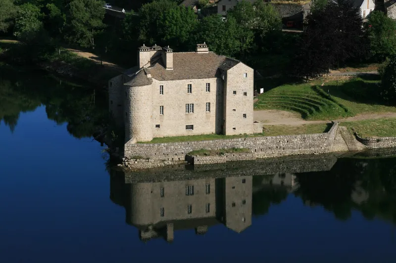
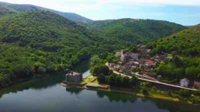
Castanet Castle
No reviews yet
Have you flown here? Share your experience with other pilots.
+ Write the first reviewHistory
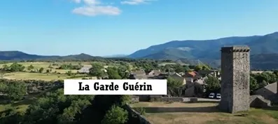
Cet édifice offre actuellement un exemple unique d'architecture cévenole de la deuxième moitié du 16e siècle. Au Moyen Age, la terre de Castanet était comprise dans les domaines des seigneurs pariers de la Garde-Guérin, qui assuraient la police de la route par la voie Regordane, route de Nîmes à Clermont. En 1684, Marie-Suzanne de Varicourt épouse Jacques-Joseph Isarn, propriétaire du château. Celle-ci, protégée de Mme de Maintenon, devint sous-gouvernante des enfants de France. L'éducation du futur Louis XV lui fut confiée. Sa belle-fille eut en charge celles des futurs Louis XVI, Louis XVIII et Charles X. De plan rectangulaire, le château est flanqué de quatre tours dont trois rondes et une barlongue contenant l'escalier. Chacune des tours était munie de canonières, pour la plupart disposées en flanquement. De la tour sud-est partait un élément de courtine se raccordant à un ouvrage avancé, sans doute une poterne débouchant à mi-hauteur de l'escarpement de base et permettant d'accéder à la rivière. D'autres dépendances devaient entourer la cour.
Map and restricted areas
Open in the main mapRestricted zones
| Zone | Category | Limits | Conditions |
|---|---|---|---|
| Allier | Zone réglementée | 244 m above ground level → 2012 m above sea level | Vols interdits sauf lorsque the official document of the zone l'autorise explicitement ou avec l'accord du gestionnaire de la zone lorsqu'il est désigné par the official document of the zone |
| Orange Caritat | Zone réglementée | 1219 m above sea level → 2602 m above sea level | Vols interdits sauf lorsque the official document of the zone l'autorise explicitement ou avec l'accord du gestionnaire de la zone lorsqu'il est désigné par the official document of the zone |
| Orange Caritat | Zone réglementée | 1834 m above sea level → 6259 m above sea level | Vols interdits sauf lorsque the official document of the zone l'autorise explicitement ou avec l'accord du gestionnaire de la zone lorsqu'il est désigné par the official document of the zone |
| Istres | Zone réglementée | 5491 m above sea level → 30766 m above sea level | Vols interdits sauf lorsque the official document of the zone l'autorise explicitement ou avec l'accord du gestionnaire de la zone lorsqu'il est désigné par the official document of the zone |
| Istres | Zone réglementée | 5491 m above sea level → 30766 m above sea level | Vols interdits sauf lorsque the official document of the zone l'autorise explicitement ou avec l'accord du gestionnaire de la zone lorsqu'il est désigné par the official document of the zone |
Nearby aerodromes
Open aerodromes within 25 km of the spot, heliports included, with their distance and direction from the spot. Near an aerodrome, drone flying is prohibited or height-limited: check the UAS zones map.
| Aerodrome | Type | Distance | Elevation |
|---|---|---|---|
| Altisurface Notre-Dame-des-Neiges-Abbaye | Aerodrome | 17 km N | 1,146 m |
| Altiport du Bez | Aerodrome | 24 km NE | 1,317 m |
| La Grand'combe Airfield | Aerodrome | 25 km S | 502 m |
Aviation weather (METAR and TAF)
No METAR station within 50 km.
Weather and Kp index
| Day | Weather | Temp. min. / max. | Wind | Rain | Max Kp |
|---|---|---|---|---|---|
| Tue 17 Nov | Cloudy | 9° / 13° | 24 km/h W | 2.3 mm | 5 |
| Wed 18 Nov | Partly cloudy | 8° / 12° | 28 km/h W | 1.4 mm | 5 |
| Thu 19 Nov | Showers | 7° / 10° | 33 km/h W | 14 mm | 3 |
| Fri 20 Nov | Partly cloudy | 6° / 10° | 26 km/h W | 0.9 mm | 3 |
| Sat 21 Nov | Fair | 7° / 13° | 11 km/h W | 0.1 mm | – |
| Sun 22 Nov | Fair | 7° / 11° | 24 km/h W | 6.9 mm | – |
| Mon 23 Nov | Cloudy | 6° / 10° | 16 km/h NW | 0.1 mm | – |
Hour by hour: Tuesday 17 November
| Time | Weather | Temp. | Wind | Rain | Clouds | Kp |
|---|---|---|---|---|---|---|
| 15:00 | Cloudy | 13° | 22 km/h W | – | 97 % | 4 |
| 16:00 | Cloudy | 12° | 22 km/h W | – | 95 % | 4 |
| 17:00 | Light rain | 11° | 19 km/h W | 0.4 mm | 99 % | 4 |
| 18:00 | Light rain | 10° | 17 km/h W | 0.3 mm | 100 % | 4 |
| 19:00 | Rain | 10° | 18 km/h W | 0.8 mm | 100 % | 5 |
| 20:00 | Light rain | 9° | 18 km/h W | 0.4 mm | 100 % | 5 |
| 21:00 | Cloudy | 9° | 20 km/h W | – | 99 % | 5 |
| 22:00 | Light rain | 9° | 24 km/h W | 0.2 mm | 99 % | 5 |
Hour by hour: Wednesday 18 November
| Time | Weather | Temp. | Wind | Rain | Clouds | Kp |
|---|---|---|---|---|---|---|
| 06:00 | Light rain | 10° | 27 km/h W | 0.1 mm | 100 % | 4 |
| 07:00 | Light rain | 10° | 26 km/h W | 0.1 mm | 100 % | 4 |
| 08:00 | Fog | 10° | 26 km/h W | – | 98 % | 4 |
| 09:00 | Fog | 10° | 26 km/h W | – | 87 % | 4 |
| 10:00 | Fog | 11° | 26 km/h W | – | 93 % | 4 |
| 11:00 | Partly cloudy | 11° | 26 km/h W | – | 55 % | 4 |
| 12:00 | Partly cloudy | 12° | 26 km/h W | – | 42 % | 4 |
| 13:00 | Partly cloudy | 12° | 25 km/h W | – | 52 % | 3 |
| 14:00 | Partly cloudy | 12° | 25 km/h W | – | 55 % | 3 |
| 15:00 | Cloudy | 12° | 23 km/h W | – | 91 % | 3 |
| 16:00 | Partly cloudy | 11° | 18 km/h W | – | 86 % | 3 |
| 17:00 | Cloudy | 10° | 18 km/h W | – | 91 % | 3 |
| 18:00 | Cloudy | 9° | 17 km/h W | – | 88 % | 3 |
| 19:00 | Cloudy | 9° | 13 km/h W | – | 92 % | 2 |
| 20:00 | Fog | 9° | 13 km/h W | – | 100 % | 2 |
| 21:00 | Fog | 9° | 12 km/h SW | – | 98 % | 2 |
| 22:00 | Fog | 9° | 10 km/h S | – | 94 % | 2 |
Sunrise and sunset
| Day | Dawn | Sunrise | Golden hour | Sunset | Dusk | Day length |
|---|---|---|---|---|---|---|
| Tue 17 Nov | 07:12 | 07:43 | 07:43–08:28 · 16:31–17:16 | 17:16 | 17:47 | 9 h 32 |
| Wed 18 Nov | 07:13 | 07:45 | 07:45–08:29 · 16:30–17:15 | 17:15 | 17:46 | 9 h 30 |
| Thu 19 Nov | 07:14 | 07:46 | 07:46–08:31 · 16:29–17:14 | 17:14 | 17:45 | 9 h 27 |
| Fri 20 Nov | 07:15 | 07:47 | 07:47–08:32 · 16:28–17:13 | 17:13 | 17:45 | 9 h 25 |
| Sat 21 Nov | 07:17 | 07:48 | 07:48–08:34 · 16:27–17:12 | 17:12 | 17:44 | 9 h 23 |
| Sun 22 Nov | 07:18 | 07:50 | 07:50–08:35 · 16:26–17:11 | 17:11 | 17:43 | 9 h 21 |
| Mon 23 Nov | 07:19 | 07:51 | 07:51–08:36 · 16:25–17:11 | 17:11 | 17:43 | 9 h 19 |

Reviews (0)
Log in to review this spot. Log in · Create a free account
No reviews yet. Share yours!