

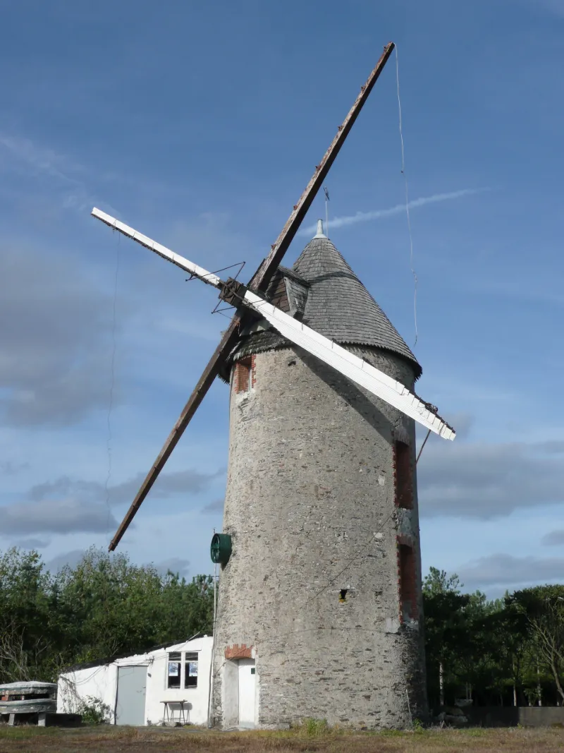
Windmill known as Le Moulin Neuf
No reviews yet
Have you flown here? Share your experience with other pilots.
+ Write the first reviewHistory
Mentionné en 1681 le Moulin-Neuf, ou Moulin de la Marmite, présente une tour en moellons de schiste légèrement tronconique (hauteur, 11 mètres) , surmontée d'une coiffe couverte de bardeaux de châtaignier. Rehaussé vers 1865 lors de l'installation d'ailes Berton (envergure, 17 mètres) , il compte trois étages. Les baies à arcs segmentaires à encadrements de brique sont de la même époque. Les capacités du moulin furent encore augmentées en 1930, grâce à un moteur à huile lourde Ruston-Hornsby, de 15 CV, fabriqué à Lincoln, conservé. Le rouet, en orme, et la transmission mettaient en mouvement deux paires de meules (diamètre, 1, 60 mètres) , tournant six fois plus vite que les ailes. L'arbre, les ailes et la toiture ont été refaits à neuf et, depuis le 27 décembre 1980, le moulin fonctionne à nouveau.
Map and restricted areas
Open in the main mapRestricted zones
| Zone | Category | Limits | Conditions |
|---|---|---|---|
| Maine-Anjou | Zone réglementée | 244 m above ground level → 549 m above ground level | Vols interdits sauf lorsque the official document of the zone l'autorise explicitement ou avec l'accord du gestionnaire de la zone lorsqu'il est désigné par the official document of the zone |
Nearby aerodromes
Open aerodromes within 25 km of the spot, heliports included, with their distance and direction from the spot. Near an aerodrome, drone flying is prohibited or height-limited: check the UAS zones map.
| Aerodrome | Type | Distance | Elevation |
|---|---|---|---|
| Saint Sigismond ULM | Aerodrome | 15 km S | 76 m |
| Ancenis Airfield | Aerodrome | 21 km SW | 34 m |
| Châteaubriant Pouancé Airfield | Aerodrome | 24 km NW | 98 m |
Aviation weather (METAR and TAF)
No METAR station within 50 km.
Weather and Kp index
Sunrise and sunset
| Day | Dawn | Sunrise | Golden hour | Sunset | Dusk | Day length |
|---|---|---|---|---|---|---|
| Tue 17 Nov | 07:38 | 08:12 | 08:12–09:00 · 16:38–17:26 | 17:26 | 18:00 | 9 h 13 |
| Wed 18 Nov | 07:40 | 08:13 | 08:13–09:02 · 16:37–17:25 | 17:25 | 17:59 | 9 h 11 |
| Thu 19 Nov | 07:41 | 08:15 | 08:15–09:03 · 16:35–17:24 | 17:24 | 17:58 | 9 h 09 |
| Fri 20 Nov | 07:42 | 08:16 | 08:16–09:05 · 16:34–17:23 | 17:23 | 17:57 | 9 h 06 |
| Sat 21 Nov | 07:44 | 08:18 | 08:18–09:07 · 16:33–17:22 | 17:22 | 17:56 | 9 h 04 |
| Sun 22 Nov | 07:45 | 08:19 | 08:19–09:08 · 16:32–17:21 | 17:21 | 17:55 | 9 h 01 |
| Mon 23 Nov | 07:46 | 08:21 | 08:21–09:10 · 16:31–17:20 | 17:20 | 17:55 | 8 h 59 |




Reviews (0)
Log in to review this spot. Log in · Create a free account
No reviews yet. Share yours!