

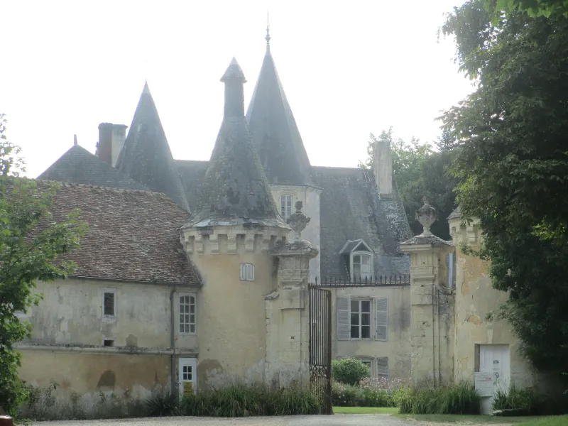
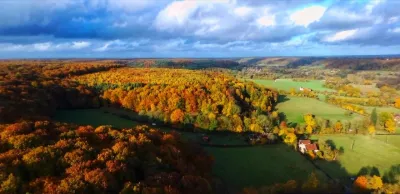
La Pellonière Castle
No reviews yet
Have you flown here? Share your experience with other pilots.
+ Write the first reviewHistory
Au Moyen-Age, l'ancien château se trouvait près de l'église paroissiale. Il fut détruit dans les guerres qui opposèrent la famille de Bellème aux Giroie et aux ducs de Normandie. Au 13e siècle, le château fut transféré sur la colline, à l'emplacement du château actuel. Durant les guerres de Cent ans, Henri V d'Angleterre en prit possession. Au 15e siècle, l'édifice était pratiquement en ruine. Il fut rasé et un nouveau château fut construit à partir du quadrilatère entouré de douves qui délimitait les quatre côtés de la place forte du 13e siècle. Le logis seigneurial possède une haute tour pentagonale. Sous le règne de Henri IV, une nouvelle campage de travaux fut entreprise avec l'édification d'un pavillon rectangulaire avec mâchicoulis, d'un grand colombier et d'une porte d'entrée défendue par deux tours latérales. Au début du 18e siècle, édification d'une construction en équerre qui réunissait le logis primitif au pavillon situé à l'angle nord de la cour d'honneur. Au 19e siècle, une tour néo-gothique a été accolée au pavillon Henri IV.
Map and restricted areas
Open in the main mapRestricted zones
| Zone | Category | Limits | Conditions |
|---|---|---|---|
| ZRT LE MANS (IHEDN uniquement) | ZRT | From about 3,800 m to about 4,100 m above sea level | SUP AIP 053/26 · Du jeudi 16 avril 2026 au mercredi 12 avril 2028 |
Nearby aerodromes
Open aerodromes within 25 km of the spot, heliports included, with their distance and direction from the spot. Near an aerodrome, drone flying is prohibited or height-limited: check the UAS zones map.
| Aerodrome | Type | Distance | Elevation |
|---|---|---|---|
| Aérodrome de Mortagne Au Perche | Aerodrome | 11 km N | 270 m |
| Aérodrome de Monhoudou | Aerodrome | 24 km SW | 106 m |
Aviation weather (METAR and TAF)
No METAR station within 50 km.
Weather and Kp index
Sunrise and sunset
| Day | Dawn | Sunrise | Golden hour | Sunset | Dusk | Day length |
|---|---|---|---|---|---|---|
| Tue 17 Nov | 07:34 | 08:09 | 08:09–08:58 · 16:28–17:17 | 17:17 | 17:51 | 9 h 08 |
| Wed 18 Nov | 07:36 | 08:10 | 08:10–09:00 · 16:26–17:16 | 17:16 | 17:50 | 9 h 05 |
| Thu 19 Nov | 07:37 | 08:12 | 08:12–09:01 · 16:25–17:15 | 17:15 | 17:49 | 9 h 03 |
| Fri 20 Nov | 07:38 | 08:13 | 08:13–09:03 · 16:24–17:14 | 17:14 | 17:48 | 9 h 00 |
| Sat 21 Nov | 07:40 | 08:15 | 08:15–09:05 · 16:23–17:13 | 17:13 | 17:48 | 8 h 58 |
| Sun 22 Nov | 07:41 | 08:16 | 08:16–09:06 · 16:21–17:12 | 17:12 | 17:47 | 8 h 55 |
| Mon 23 Nov | 07:42 | 08:17 | 08:17–09:08 · 16:20–17:11 | 17:11 | 17:46 | 8 h 53 |
Reviews (0)
Log in to review this spot. Log in · Create a free account
No reviews yet. Share yours!