

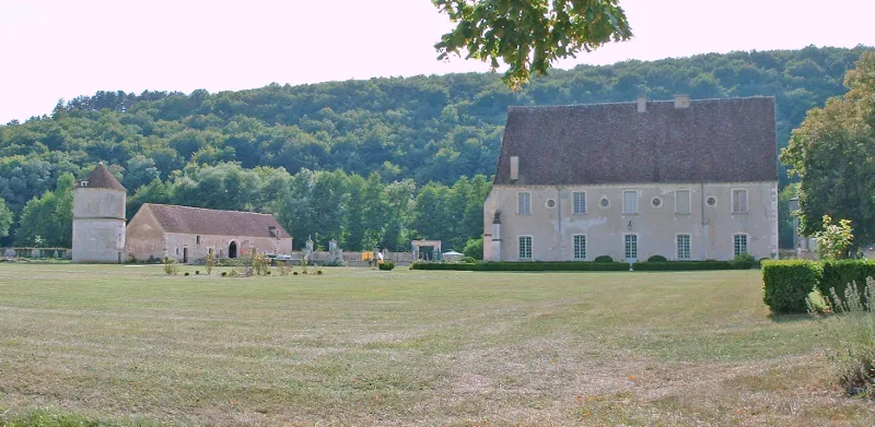
Former Cistercian Abbey of Reigny, located in the hamlet of Reigny
No reviews yet
Have you flown here? Share your experience with other pilots.
+ Write the first reviewHistory
Fondée en 1128 puis mise sous la protection du Pape Eugène III en 1147, l'abbaye fut puissante et prospère au moyen-âge. En 1493, Charles VIII en fait une fondation royale. Des vestiges d'un grand intérêt subsistent aujourd'hui tels le réfectoire cistercien du 14ème siècle, la salle et le dortoir des moines, la salle à manger, réaménagés au 18ème siècle, le portail du 18ème siècle ainsi qu'un pigeonnier du 17ème siècle. Le réseau hydraulique cistercien a également été conservé. Le logis des abbés (17ème siècle), le moulin (19ème siècle) ainsi que la grange dîmière du 14ème siècle viennent compléter cet ensemble abbatial.
Map and restricted areas
Open in the main mapRestricted zones
Nearby aerodromes
Open aerodromes within 25 km of the spot, heliports included, with their distance and direction from the spot. Near an aerodrome, drone flying is prohibited or height-limited: check the UAS zones map.
| Aerodrome | Type | Distance | Elevation |
|---|---|---|---|
| Avallon Airfield | Aerodrome | 20 km SE | 238 m |
| Centre Hospitalier Heliport | Heliport | 22 km NW | 161 m |
Aviation weather (METAR and TAF)
No METAR station within 50 km.
Weather and Kp index
Sunrise and sunset
| Day | Dawn | Sunrise | Golden hour | Sunset | Dusk | Day length |
|---|---|---|---|---|---|---|
| Tue 17 Nov | 07:20 | 07:53 | 07:53–08:42 · 16:18–17:07 | 17:07 | 17:40 | 9 h 13 |
| Wed 18 Nov | 07:21 | 07:55 | 07:55–08:43 · 16:17–17:06 | 17:06 | 17:40 | 9 h 10 |
| Thu 19 Nov | 07:22 | 07:56 | 07:56–08:45 · 16:16–17:05 | 17:05 | 17:39 | 9 h 08 |
| Fri 20 Nov | 07:24 | 07:58 | 07:58–08:47 · 16:15–17:04 | 17:04 | 17:38 | 9 h 06 |
| Sat 21 Nov | 07:25 | 07:59 | 07:59–08:48 · 16:14–17:03 | 17:03 | 17:37 | 9 h 03 |
| Sun 22 Nov | 07:26 | 08:00 | 08:00–08:50 · 16:13–17:02 | 17:02 | 17:36 | 9 h 01 |
| Mon 23 Nov | 07:28 | 08:02 | 08:02–08:51 · 16:11–17:01 | 17:01 | 17:35 | 8 h 59 |

Reviews (0)
Log in to review this spot. Log in · Create a free account
No reviews yet. Share yours!