

De Biesbosch National Park
No reviews yet
Have you flown here? Share your experience with other pilots.
+ Write the first reviewHistory
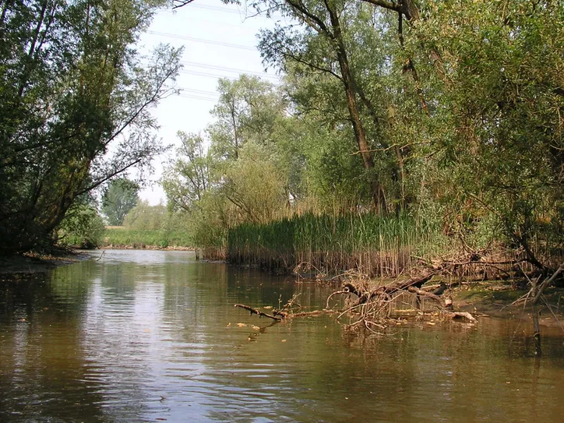
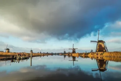
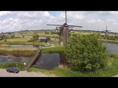
De Biesbosch national park is one of the largest national parks in the Netherlands. It spreads over three parts covering nearly 40,000 ha, of which 7,100 are submerged, with a 280 ha recreational area. A wetland of pan-European importance, it is one of the cores of the Dutch ecological network, and part of it is recognised as a wetland of international importance.
Map and restricted areas
Open in the main mapRestricted zones
Nearby aerodromes
Open aerodromes within 25 km of the spot, heliports included, with their distance and direction from the spot. Near an aerodrome, drone flying is prohibited or height-limited: check the UAS zones map.
| Aerodrome | Type | Distance | Elevation |
|---|---|---|---|
| Albert Schweitzer Ziekenhuis. Locatie Amstelwijck Heliport | Heliport | 7.6 km W | 2 m |
| Vliegveld Numansdorp | Aerodrome | 21 km W | 1 m |
| Medisch Centrum Rijnmond. Locatie Zuid Heliport | Heliport | 23 km NW | 1 m |
| Gilze Rijen Air Base | Airport | 24 km SE | 15 m |
Aviation weather (METAR and TAF)
EHGR – Gilze Rijen Air Base MVFR
METAR
METAR EHGR 171155Z AUTO 25016G26KT 210V300 9999 BKN018 OVC021 14/11 Q0980 REDZ WHT TEMPO 25020G30KT
- Wind
- 250°, 30 km/h, gusts 48 km/h
- Visibility
- 10 km or more
- Clouds
- Broken (5-7/8) at 1,800 ft (550 m) ; Overcast (8/8) at 2,100 ft (640 m)
- Temperature
- 14 °C, dew point 11 °C
- QNH
- 980 hPa
- Flight category
- MVFR: ceiling 1,000–3,000 ft or visibility 3–5 mi
TAF
Weather and Kp index
| Day | Weather | Temp. min. / max. | Wind | Rain | Max Kp |
|---|---|---|---|---|---|
| Tue 17 Nov | Fair | 9° / 14° | 40 km/h SW | 1.2 mm | 5 |
| Wed 18 Nov | Heavy rain | 8° / 10° | 27 km/h SW | 17 mm | 5 |
| Thu 19 Nov | Light rain | 5° / 10° | 32 km/h SW | 5.9 mm | 3 |
| Fri 20 Nov | Cloudy | 5° / 7° | 8 km/h E | 0.9 mm | 3 |
| Sat 21 Nov | Fair | 3° / 9° | 9 km/h NW | 0.1 mm | – |
| Sun 22 Nov | Cloudy | 1° / 5° | 15 km/h E | – | – |
| Mon 23 Nov | Cloudy | -1° / 3° | 6 km/h E | 2.8 mm | – |
Hour by hour: Tuesday 17 November
| Time | Weather | Temp. | Wind | Rain | Clouds | Kp |
|---|---|---|---|---|---|---|
| 13:00 | Fair | 14° | 39 km/h W | – | 27 % | 4 |
| 14:00 | Fair | 14° | 40 km/h SW | – | 27 % | 4 |
| 15:00 | Fair | 13° | 37 km/h W | – | 17 % | 4 |
| 16:00 | Fair | 12° | 33 km/h SW | – | 29 % | 4 |
| 17:00 | Partly cloudy | 12° | 31 km/h SW | – | 40 % | 4 |
| 18:00 | Partly cloudy | 11° | 27 km/h SW | – | 80 % | 4 |
| 19:00 | Light rain | 11° | 27 km/h SW | 0.1 mm | 94 % | 5 |
| 20:00 | Light rain | 10° | 24 km/h SW | 0.2 mm | 100 % | 5 |
| 21:00 | Light rain | 10° | 24 km/h SW | 0.2 mm | 100 % | 5 |
| 22:00 | Rain | 10° | 23 km/h SW | 0.5 mm | 100 % | 5 |
Hour by hour: Wednesday 18 November
| Time | Weather | Temp. | Wind | Rain | Clouds | Kp |
|---|---|---|---|---|---|---|
| 06:00 | Heavy rain | 9° | 26 km/h SW | 1.5 mm | 100 % | 4 |
| 07:00 | Heavy rain | 9° | 27 km/h W | 1.2 mm | 100 % | 4 |
| 08:00 | Heavy rain | 9° | 25 km/h W | 1.7 mm | 100 % | 4 |
| 09:00 | Heavy rain | 9° | 23 km/h W | 1.1 mm | 100 % | 4 |
| 10:00 | Rain | 9° | 23 km/h W | 0.8 mm | 94 % | 4 |
| 11:00 | Rain | 10° | 25 km/h W | 0.5 mm | 94 % | 4 |
| 12:00 | Heavy rain | 10° | 23 km/h W | 1.0 mm | 100 % | 4 |
| 13:00 | Heavy rain | 10° | 24 km/h W | 1.1 mm | 92 % | 3 |
| 14:00 | Showers | 10° | 23 km/h W | 0.5 mm | 84 % | 3 |
| 15:00 | Heavy rain | 10° | 21 km/h W | 1.2 mm | 88 % | 3 |
| 16:00 | Showers | 9° | 17 km/h W | 0.7 mm | 72 % | 3 |
| 17:00 | Light rain | 8° | 15 km/h W | 0.3 mm | 99 % | 3 |
| 18:00 | Rain | 9° | 15 km/h W | 0.5 mm | 96 % | 3 |
| 19:00 | Rain | 8° | 16 km/h SW | 0.6 mm | 98 % | 2 |
| 20:00 | Showers | 9° | 18 km/h SW | 1.0 mm | 77 % | 2 |
| 21:00 | Light rain | 8° | 16 km/h SW | 0.4 mm | 99 % | 2 |
| 22:00 | Partly cloudy | 9° | 19 km/h SW | – | 73 % | 2 |
Sunrise and sunset
| Day | Dawn | Sunrise | Golden hour | Sunset | Dusk | Day length |
|---|---|---|---|---|---|---|
| Tue 17 Nov | 07:26 | 08:03 | 08:03–08:58 · 15:54–16:48 | 16:48 | 17:26 | 8 h 45 |
| Wed 18 Nov | 07:28 | 08:05 | 08:05–09:00 · 15:52–16:47 | 16:47 | 17:25 | 8 h 42 |
| Thu 19 Nov | 07:29 | 08:07 | 08:07–09:02 · 15:50–16:46 | 16:46 | 17:24 | 8 h 39 |
| Fri 20 Nov | 07:31 | 08:08 | 08:08–09:04 · 15:49–16:45 | 16:45 | 17:22 | 8 h 36 |
| Sat 21 Nov | 07:32 | 08:10 | 08:10–09:06 · 15:47–16:44 | 16:44 | 17:21 | 8 h 33 |
| Sun 22 Nov | 07:34 | 08:12 | 08:12–09:08 · 15:46–16:42 | 16:42 | 17:20 | 8 h 30 |
| Mon 23 Nov | 07:35 | 08:13 | 08:13–09:10 · 15:45–16:41 | 16:41 | 17:20 | 8 h 28 |


Reviews (0)
Log in to review this spot. Log in · Create a free account
No reviews yet. Share yours!