

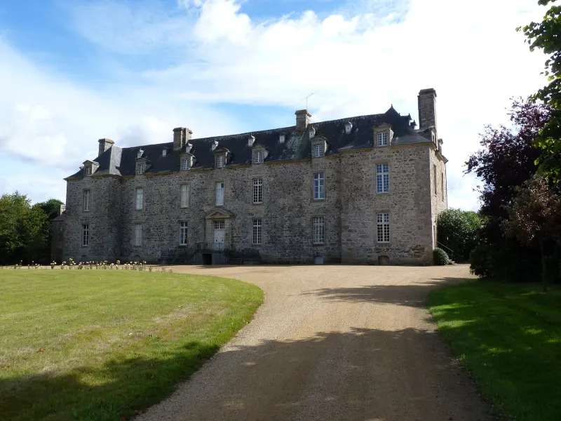
La Grand'Ville Castle
No reviews yet
Have you flown here? Share your experience with other pilots.
+ Write the first reviewHistory
milieu 17e siècle ; 1ère moitié 19e siècle Le château de la Grand Ville a été construit vers 1650 à la suite du démantèlement du château fort de Kérimer par le chevalier du Breil de Rays. Il passa ensuite dans la famille Chrétien de Tréveneuc à la suite d'un mariage, puis au comte de Kergariou, qui épousa Mélanie de Tréveneuc. Il est constitué d'un grand corps de logis rectangulaire et de deux petits corps latéraux symétriques est et ouest formant une légère avancée, ainsi que d'un corps latéral de plan presque carré articulé à l'angle sud-est du corps latéral est.
Map and restricted areas
Open in the main mapRestricted zones
Nearby aerodromes
Open aerodromes within 25 km of the spot, heliports included, with their distance and direction from the spot. Near an aerodrome, drone flying is prohibited or height-limited: check the UAS zones map.
| Aerodrome | Type | Distance | Elevation |
|---|---|---|---|
| Saint-Brieuc-Armor Airport | Airport | 11 km SE | 138 m |
| Base ULM de Kerfot | Aerodrome | 16 km N | 99 m |
| Centre Hospitalier Heliport | Heliport | 21 km SE | 108 m |
Aviation weather (METAR and TAF)
LFRT – Saint-Brieuc-Armor Airport VFR
METAR
METAR LFRT 171400Z AUTO 23021G31KT 9999 BKN032/// BKN039/// OVC090/// ///TCU 15/09 Q0987
- Wind
- 230°, 39 km/h, gusts 57 km/h
- Visibility
- 10 km or more
- Clouds
- Broken (5-7/8) at 3,200 ft (980 m) ; Broken (5-7/8) at 3,900 ft (1190 m) ; Overcast (8/8) at 9,000 ft (2740 m)
- Temperature
- 15 °C, dew point 9 °C
- QNH
- 987 hPa
- Flight category
- VFR: ceiling > 3,000 ft and visibility > 5 mi
TAF
Weather and Kp index
Sunrise and sunset
| Day | Dawn | Sunrise | Golden hour | Sunset | Dusk | Day length |
|---|---|---|---|---|---|---|
| Tue 17 Nov | 07:49 | 08:23 | 08:23–09:13 · 16:41–17:31 | 17:31 | 18:05 | 9 h 07 |
| Wed 18 Nov | 07:50 | 08:25 | 08:25–09:15 · 16:40–17:30 | 17:30 | 18:04 | 9 h 04 |
| Thu 19 Nov | 07:52 | 08:26 | 08:26–09:16 · 16:38–17:28 | 17:28 | 18:03 | 9 h 02 |
| Fri 20 Nov | 07:53 | 08:28 | 08:28–09:18 · 16:37–17:27 | 17:27 | 18:02 | 8 h 59 |
| Sat 21 Nov | 07:54 | 08:29 | 08:29–09:20 · 16:36–17:26 | 17:26 | 18:01 | 8 h 57 |
| Sun 22 Nov | 07:56 | 08:31 | 08:31–09:21 · 16:35–17:26 | 17:26 | 18:01 | 8 h 54 |
| Mon 23 Nov | 07:57 | 08:32 | 08:32–09:23 · 16:34–17:25 | 17:25 | 18:00 | 8 h 52 |


Reviews (0)
Log in to review this spot. Log in · Create a free account
No reviews yet. Share yours!