

Castle
No reviews yet
Have you flown here? Share your experience with other pilots.
+ Write the first reviewHistory
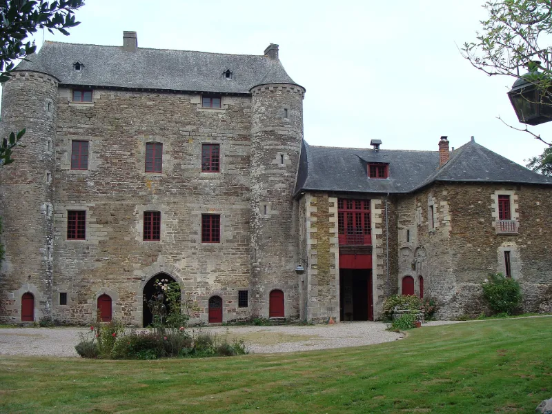
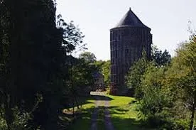
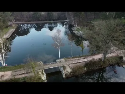
13e siècle ; 1ère moitié 15e siècle ; 18e siècle ; 2e moitié 19e siècle Le château de Montauban est un exemple, que l'on peut estimer unique en Bretagne, de l'évolution d'un site défensif important au cours du Moyen Age. Le premier château fut construit par la famille de Montfort, à une date inconnue, entre le 10e et le 12e siècle, époque où se diffuse le type de la motte castrale : celle de Montauban est encore reconnaissable de nos jours. Elle était vraisemblablement surmontée d'un donjon de bois, mais nous ne possédons aucune indication sur la disposition des lieux, remaniés ultérieurement pour l'installation des défenses avancées du château ; nous savons qu'Olivier de Montauban s'y est installé dès 1152. La motte fut sans doute abandonnée dès le 13e siècle au profit d'un autre château, construit à l'emplacement du château actuel. Le nouveau château, en pierre, a été construit sur un plan hexagonal, en tirant parti de la défense naturelle fournie par l'étang à l'ouest, et en complétant la défense à l'est par un important système de défenses avancées : douves, cavaliers, entrées successives. De cet édifice du 13e siècle subsistent l'actuel donjon, très modifié depuis, et vraisemblablement la tour des Anglais. L'ensemble fut complété en 1430 par l'imposant châtelet encore existant. Ce système de défense, en partie basé sur l'importance de l'étang, devint caduque avec le développement de l'artillerie au 15e siècle, et Charles VIII ne rencontra guère de difficultés pour investir le château par son point faible en 1487. Le logis et sa tour de flanquement furent entièrement détruits, et le donjon partiellement. Le château perdit ensuite de son importance et ne fut que sommairement reconstruit.
Map and restricted areas
Open in the main mapRestricted zones
| Zone | Category | Limits | Conditions |
|---|---|---|---|
| Bretagne | Zone réglementée | 244 m above ground level → 549 m above ground level | Vols interdits sauf lorsque the official document of the zone l'autorise explicitement ou avec l'accord du gestionnaire de la zone lorsqu'il est désigné par the official document of the zone |
| Argoat | Zone réglementée | 3053 m above sea level → 6259 m above sea level | Vols interdits sauf lorsque the official document of the zone l'autorise explicitement ou avec l'accord du gestionnaire de la zone lorsqu'il est désigné par the official document of the zone |
| Zrt Plumaugat | ZRT | From about 3,800 m to about 4,100 m above sea level | SUP AIP 053/26 · Du jeudi 16 avril 2026 au mercredi 12 avril 2028 |
| Zrt Rennes High | ZRT | From about 6,250 m to about 6,550 m above sea level | SUP AIP 053/26 · Du jeudi 16 avril 2026 au mercredi 12 avril 2028 |
Nearby aerodromes
Open aerodromes within 25 km of the spot, heliports included, with their distance and direction from the spot. Near an aerodrome, drone flying is prohibited or height-limited: check the UAS zones map.
No known open aerodrome within 25 km.
Aviation weather (METAR and TAF)
LFRN – Rennes-Saint-Jacques Airport MVFR
METAR
METAR LFRN 171330Z AUTO 23022G35KT 9999 OVC028 16/11 Q0991 TEMPO 23025G45KT 1400 TSRAGS BKN008 BKN020CB
- Wind
- 230°, 41 km/h, gusts 65 km/h
- Visibility
- 10 km or more
- Clouds
- Overcast (8/8) at 2,800 ft (850 m)
- Temperature
- 16 °C, dew point 11 °C
- QNH
- 991 hPa
- Flight category
- MVFR: ceiling 1,000–3,000 ft or visibility 3–5 mi
TAF
TAF LFRN 171100Z 1712/1812 23017G30KT 9999 BKN020 TEMPO 1712/1719 23020G35KT 3000 SHRA BKN012 SCT020CB SCT025TCU PROB40 TEMPO 1714/1718 23025G45KT 1400 TSRAGS BKN008 BKN020CB PROB40 TEMPO 1719/1812 3000 SHRA BKN012 BKN020TCU SCT025CB PROB30 TEMPO 1800/1806 1400 TSRA
| Period (local time) | Change | Wind | Visibility | Weather | Clouds |
|---|---|---|---|---|---|
| 17/11 13:00 → 18/11 13:00 | Initial conditions | 230°, 31 km/h, gusts 56 km/h | 10 km or more | Broken (5-7/8) at 2,000 ft (610 m) | |
| 17/11 13:00 → 17/11 20:00 | Temporarily | 230°, 37 km/h, gusts 65 km/h | 3.0 km | Showers of rain | Broken (5-7/8) at 1,200 ft (370 m) ; Scattered (3-4/8) at 2,000 ft (610 m) (cumulonimbus) ; Scattered (3-4/8) at 2,500 ft (760 m) (towering cumulus) |
| 17/11 15:00 → 17/11 19:00 | Temporarily, probability 40% | 230°, 46 km/h, gusts 83 km/h | 1.4 km | Thunderstorm rain ; thunderstorm small hail | Broken (5-7/8) at 800 ft (240 m) ; Broken (5-7/8) at 2,000 ft (610 m) (cumulonimbus) |
| 17/11 20:00 → 18/11 13:00 | Temporarily, probability 40% | 3.0 km | Showers of rain | Broken (5-7/8) at 1,200 ft (370 m) ; Broken (5-7/8) at 2,000 ft (610 m) (towering cumulus) ; Scattered (3-4/8) at 2,500 ft (760 m) (cumulonimbus) | |
| 18/11 01:00 → 18/11 07:00 | Temporarily, probability 30% | 1.4 km | Thunderstorm rain |
Weather and Kp index
| Day | Weather | Temp. min. / max. | Wind | Rain | Max Kp |
|---|---|---|---|---|---|
| Tue 17 Nov | Rain | 11° / 15° | 40 km/h SW | 3.8 mm | 5 |
| Wed 18 Nov | Fair | 10° / 14° | 30 km/h S | 3.5 mm | 5 |
| Thu 19 Nov | Cloudy | 9° / 13° | 31 km/h SW | – | 3 |
| Fri 20 Nov | Partly cloudy | 9° / 13° | 27 km/h W | 0.4 mm | 3 |
| Sat 21 Nov | Cloudy | 6° / 12° | 19 km/h SE | 1.3 mm | – |
| Sun 22 Nov | Light rain | 9° / 12° | 26 km/h W | 9.4 mm | – |
| Mon 23 Nov | Fair | 6° / 13° | 15 km/h S | 0.4 mm | – |
Hour by hour: Tuesday 17 November
| Time | Weather | Temp. | Wind | Rain | Clouds | Kp |
|---|---|---|---|---|---|---|
| 15:00 | Rain | 15° | 40 km/h SW | 0.4 mm | 100 % | 4 |
| 16:00 | Heavy rain | 13° | 35 km/h SW | 2.3 mm | 100 % | 4 |
| 17:00 | Rain | 11° | 29 km/h SW | 0.9 mm | 100 % | 4 |
| 18:00 | Light rain | 12° | 31 km/h SW | 0.2 mm | 98 % | 4 |
| 19:00 | Fair | 12° | 28 km/h W | – | 16 % | 5 |
| 20:00 | Fair | 11° | 25 km/h W | – | 20 % | 5 |
| 21:00 | Fair | 11° | 24 km/h SW | – | 36 % | 5 |
| 22:00 | Fair | 11° | 24 km/h SW | – | 19 % | 5 |
Hour by hour: Wednesday 18 November
| Time | Weather | Temp. | Wind | Rain | Clouds | Kp |
|---|---|---|---|---|---|---|
| 06:00 | Partly cloudy | 10° | 25 km/h SW | – | 65 % | 4 |
| 07:00 | Partly cloudy | 10° | 25 km/h SW | – | 48 % | 4 |
| 08:00 | Partly cloudy | 10° | 24 km/h SW | – | 42 % | 4 |
| 09:00 | Partly cloudy | 10° | 25 km/h SW | – | 48 % | 4 |
| 10:00 | Fair | 11° | 26 km/h SW | – | 27 % | 4 |
| 11:00 | Fair | 12° | 27 km/h SW | – | 17 % | 4 |
| 12:00 | Fair | 13° | 27 km/h SW | – | 23 % | 4 |
| 13:00 | Fair | 14° | 27 km/h SW | – | 16 % | 3 |
| 14:00 | Fair | 14° | 29 km/h SW | – | 23 % | 3 |
| 15:00 | Partly cloudy | 14° | 27 km/h SW | – | 49 % | 3 |
| 16:00 | Cloudy | 14° | 24 km/h SW | – | 100 % | 3 |
| 17:00 | Heavy rain | 13° | 24 km/h SW | 1.2 mm | 98 % | 3 |
| 18:00 | Rain | 11° | 27 km/h SW | 0.5 mm | 100 % | 3 |
| 19:00 | Rain | 11° | 26 km/h S | 0.9 mm | 100 % | 2 |
| 20:00 | Light rain | 11° | 30 km/h S | 0.2 mm | 94 % | 2 |
| 21:00 | Partly cloudy | 11° | 30 km/h SW | – | 64 % | 2 |
| 22:00 | Showers | 11° | 27 km/h SW | 0.7 mm | 84 % | 2 |
Sunrise and sunset
| Day | Dawn | Sunrise | Golden hour | Sunset | Dusk | Day length |
|---|---|---|---|---|---|---|
| Tue 17 Nov | 07:44 | 08:18 | 08:18–09:07 · 16:39–17:28 | 17:28 | 18:02 | 9 h 09 |
| Wed 18 Nov | 07:46 | 08:20 | 08:20–09:09 · 16:38–17:27 | 17:27 | 18:01 | 9 h 07 |
| Thu 19 Nov | 07:47 | 08:21 | 08:21–09:11 · 16:36–17:26 | 17:26 | 18:00 | 9 h 04 |
| Fri 20 Nov | 07:48 | 08:23 | 08:23–09:12 · 16:35–17:25 | 17:25 | 17:59 | 9 h 02 |
| Sat 21 Nov | 07:50 | 08:24 | 08:24–09:14 · 16:34–17:24 | 17:24 | 17:59 | 8 h 59 |
| Sun 22 Nov | 07:51 | 08:26 | 08:26–09:16 · 16:33–17:23 | 17:23 | 17:58 | 8 h 57 |
| Mon 23 Nov | 07:52 | 08:27 | 08:27–09:17 · 16:32–17:22 | 17:22 | 17:57 | 8 h 55 |

Reviews (0)
Log in to review this spot. Log in · Create a free account
No reviews yet. Share yours!