

Roches Castle
No reviews yet
Have you flown here? Share your experience with other pilots.
+ Write the first reviewHistory
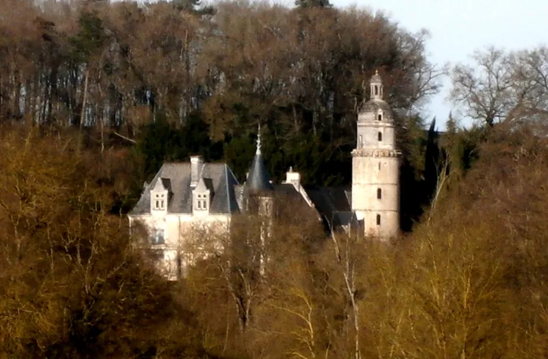
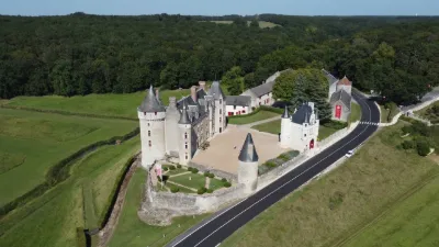
14e siècle ; 15e siècle ; 16e siècle Ancien fief relevant du château de Loches. En 1449, Jean du Puy, propriétaire, obtint l'autorisation de fortifier le château. En 1488, il fut acquis par Adam Fumée, premier médecin de Charles VII et de Louis XI. Très restauré au 19e siècle, l'édifice est flanqué à l'est d'une haute tour circulaire en petit appareil, datant du 14e siècle, denier vestige de l'habitation fortifiée primitive. Elle a été ornée, au 16e siècle, de bandeaux moulurés séparant chacun des quatre étages. La porte présente un plein cintre retombant sur des pilastres, dominé par un fronton triangulaire reposant sur une autre rangée de pilastres. La tour comporte un vaste escalier à vis sur trois étages, le quatrième étant composé d'une pièce à feu ayant sans doute servi de salle de veille. Le dernier étage, rajouté au 16e siècle, est légèrement en retrait des corbeaux des anciens mâchicoulis et est couvert en dôme à imbrications d'écailles couronné d'un lanterneau. Au sud, épaulée par un commun, se trouve une tour carrée qui servait de pigeonnier, percée de 1600 boulins carrés creusés dans le parement.
Map and restricted areas
Open in the main mapRestricted zones
Nearby aerodromes
Open aerodromes within 25 km of the spot, heliports included, with their distance and direction from the spot. Near an aerodrome, drone flying is prohibited or height-limited: check the UAS zones map.
| Aerodrome | Type | Distance | Elevation |
|---|---|---|---|
| Amboise Dierre Airport | Aerodrome | 17 km NW | 55 m |
| Tours Le Louroux Airport | Aerodrome | 25 km W | 126 m |
Aviation weather (METAR and TAF)
No METAR station within 50 km.
Weather and Kp index
Sunrise and sunset
| Day | Dawn | Sunrise | Golden hour | Sunset | Dusk | Day length |
|---|---|---|---|---|---|---|
| Tue 17 Nov | 07:29 | 08:03 | 08:03–08:50 · 16:31–17:19 | 17:19 | 17:52 | 9 h 16 |
| Wed 18 Nov | 07:31 | 08:04 | 08:04–08:52 · 16:30–17:18 | 17:18 | 17:51 | 9 h 13 |
| Thu 19 Nov | 07:32 | 08:06 | 08:06–08:54 · 16:29–17:17 | 17:17 | 17:50 | 9 h 11 |
| Fri 20 Nov | 07:33 | 08:07 | 08:07–08:55 · 16:28–17:16 | 17:16 | 17:50 | 9 h 08 |
| Sat 21 Nov | 07:35 | 08:08 | 08:08–08:57 · 16:27–17:15 | 17:15 | 17:49 | 9 h 06 |
| Sun 22 Nov | 07:36 | 08:10 | 08:10–08:59 · 16:25–17:14 | 17:14 | 17:48 | 9 h 04 |
| Mon 23 Nov | 07:37 | 08:11 | 08:11–09:00 · 16:24–17:13 | 17:13 | 17:47 | 9 h 02 |


Reviews (0)
Log in to review this spot. Log in · Create a free account
No reviews yet. Share yours!