

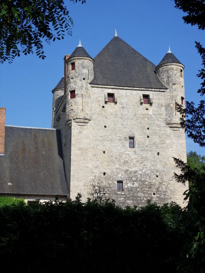
Old Chambord Castle
No reviews yet
Have you flown here? Share your experience with other pilots.
+ Write the first reviewHistory
2e moitié 14e siècle ; 16e siècle ; 19e siècle Construction de la fin du 14e siècle (vers 1370-1390) , hormis le pavillon de la cuisine et l'escalier à vis du 19e siècle. Les canonnières ainsi que le logis ont été remaniés au 15e siècle. Le grand toit qui recouvre les créneaux du logis date sans doute du 17e siècle. Celui du donjon a été remanié au 19e. De nombreuses fenêtres ont été ouvertes au 16e siècle. L'entrée actuelle au sud dans l'enceinte a remplacé, au 19e siècle, l'ancienne entrée bouchée à l'ouest. Le lieu de Chambord est cité dès 1276. Chambord paraît être une forteresse conservée de la guerre de Cent ans, et constitue un bon exemple d'architecture civile fortifiée dans le Bourbonnais au 13e et 14e siècle.
Map and restricted areas
Open in the main mapRestricted zones
| Zone | Category | Limits | Conditions |
|---|---|---|---|
| Lapalisse | Zone réglementée | 2138 m above sea level → 4583 m above sea level | Vols interdits sauf lorsque the official document of the zone l'autorise explicitement ou avec l'accord du gestionnaire de la zone lorsqu'il est désigné par the official document of the zone |
Nearby aerodromes
Open aerodromes within 25 km of the spot, heliports included, with their distance and direction from the spot. Near an aerodrome, drone flying is prohibited or height-limited: check the UAS zones map.
| Aerodrome | Type | Distance | Elevation |
|---|---|---|---|
| Lapalisse - Périgny Airfield | Aerodrome | 12 km S | 317 m |
| Aérodrome de Moulins - Montbeugny | Aerodrome | 22 km NW | 279 m |
| Verneuil en Bourbonnais | Aerodrome | 23 km W | 264 m |
| Vichy-Charmeil Airport | Airport | 25 km SW | 249 m |
Aviation weather (METAR and TAF)
LFLV – Vichy-Charmeil Airport VFR
METAR
METAR LFLV 171400Z AUTO 21007KT 140V280 9999 SCT048 SCT056 OVC210 18/10 Q0999
- Wind
- 210°, 13 km/h
- Visibility
- 10 km or more
- Clouds
- Scattered (3-4/8) at 4,800 ft (1460 m) ; Scattered (3-4/8) at 5,600 ft (1710 m) ; Overcast (8/8) at 21,000 ft (6400 m)
- Temperature
- 18 °C, dew point 10 °C
- QNH
- 999 hPa
- Flight category
- VFR: ceiling > 3,000 ft and visibility > 5 mi
TAF
Weather and Kp index
Sunrise and sunset
| Day | Dawn | Sunrise | Golden hour | Sunset | Dusk | Day length |
|---|---|---|---|---|---|---|
| Tue 17 Nov | 07:17 | 07:50 | 07:50–08:37 · 16:25–17:11 | 17:11 | 17:44 | 9 h 21 |
| Wed 18 Nov | 07:19 | 07:51 | 07:51–08:38 · 16:24–17:10 | 17:10 | 17:43 | 9 h 18 |
| Thu 19 Nov | 07:20 | 07:53 | 07:53–08:40 · 16:22–17:09 | 17:09 | 17:42 | 9 h 16 |
| Fri 20 Nov | 07:21 | 07:54 | 07:54–08:41 · 16:21–17:09 | 17:09 | 17:42 | 9 h 14 |
| Sat 21 Nov | 07:22 | 07:56 | 07:56–08:43 · 16:20–17:08 | 17:08 | 17:41 | 9 h 12 |
| Sun 22 Nov | 07:24 | 07:57 | 07:57–08:44 · 16:19–17:07 | 17:07 | 17:40 | 9 h 09 |
| Mon 23 Nov | 07:25 | 07:58 | 07:58–08:46 · 16:18–17:06 | 17:06 | 17:39 | 9 h 07 |
Reviews (0)
Log in to review this spot. Log in · Create a free account
No reviews yet. Share yours!