

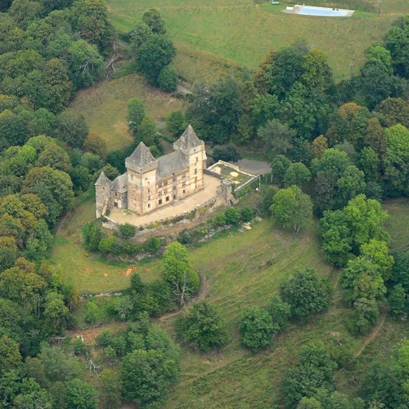
Messilhac Castle
No reviews yet
Have you flown here? Share your experience with other pilots.
+ Write the first reviewHistory
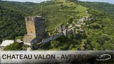
13e siècle ; 14e siècle ; 16e siècle Le château s'élève sur une plateforme allongée. Des communs s'y adossent du côté nord et il est entouré d'une enceinte à contours irréguliers dont le relief est obtenu par la taille du rocher. Le château est un long bâtiment terminé par deux grosses tours carrées dominant la partie centrale. A leur sommet court un chemin de ronde couvert, avec mâchicoulis et échauguettes d'angles. La même disposition défensive existe au sommet de la façade. Les deux tours sont probablement plus anciennes : le château dans son ensemble fut transformé au 16e siècle. Les baies à meneaux, la porte principale, l'escalier avec ses voûtes à liernes et tiercerons, les cheminées, les couronnements indiquent la période de transition, mais la sculpture, la composition de la porte que cantonnent des colonnes fusiformes appartiennent à la Renaissance. Le corps de logis central, construit en 1531, comporte trois étages avec quatre pièces chacun, ayant conservé leurs plafonds à la française et leurs cheminées monumentales. Des traces de constructions anciennes, au nord et dans le jardin, prouvent que l'édifice était plus important que ce qu'il est actuellement. Le pont-levis devait se trouver à l'est. Sous les tours de défense des remparts existent encore les oubliettes avec leurs trappes. Ce château est un exemple parfaitement conservé et non restauré d'une demeure seigneuriale du 13e siècle modifiée au 16e.
Map and restricted areas
Open in the main mapRestricted zones
| Zone | Category | Limits | Conditions |
|---|---|---|---|
| Zrt Echo Low | ZRT | From the ground up to about 4,100 m above sea level | SUP AIP 219/26 · Du mardi 20 octobre au jeudi 22 octobre 2026 |
| Zrt Fox South Inf | ZRT | FL 195 / FL 315 | SUP AIP 219/26 · Du mardi 20 octobre au jeudi 22 octobre 2026 |
| Zrt Fox South Sup | ZRT | FL 315 / UNL | SUP AIP 219/26 · Du mardi 20 octobre au jeudi 22 octobre 2026 |
Nearby aerodromes
Open aerodromes within 25 km of the spot, heliports included, with their distance and direction from the spot. Near an aerodrome, drone flying is prohibited or height-limited: check the UAS zones map.
| Aerodrome | Type | Distance | Elevation |
|---|---|---|---|
| Aurillac Airport | Airport | 17 km W | 639 m |
Aviation weather (METAR and TAF)
LFLW – Aurillac Airport VFR
METAR
METAR LFLW 171400Z AUTO 20006KT 160V240 9999 ////// 12/10 Q1005
- Wind
- 200°, 11 km/h
- Visibility
- 10 km or more
- Clouds
- –
- Temperature
- 12 °C, dew point 10 °C
- QNH
- 1005 hPa
- Flight category
- VFR: ceiling > 3,000 ft and visibility > 5 mi
TAF
TAF LFLW 170500Z 1706/1715 20012KT 4000 RA OVC006 TEMPO 1706/1708 13005KT 9999 NSW BKN030 TEMPO 1708/1714 2000 OVC002 TEMPO 1714/1715 27015G25KT 9999 NSW BKN020
| Period (local time) | Change | Wind | Visibility | Weather | Clouds |
|---|---|---|---|---|---|
| 17/11 07:00 → 17/11 16:00 | Initial conditions | 200°, 22 km/h | 4.0 km | Rain | Overcast (8/8) at 600 ft (180 m) |
| 17/11 07:00 → 17/11 09:00 | Temporarily | 130°, 9 km/h | 10 km or more | No significant weather | Broken (5-7/8) at 3,000 ft (910 m) |
| 17/11 09:00 → 17/11 15:00 | Temporarily | 2.0 km | Overcast (8/8) at 200 ft (60 m) | ||
| 17/11 15:00 → 17/11 16:00 | Temporarily | 270°, 28 km/h, gusts 46 km/h | 10 km or more | No significant weather | Broken (5-7/8) at 2,000 ft (610 m) |
Weather and Kp index
Sunrise and sunset
| Day | Dawn | Sunrise | Golden hour | Sunset | Dusk | Day length |
|---|---|---|---|---|---|---|
| Tue 17 Nov | 07:18 | 07:49 | 07:49–08:34 · 16:34–17:19 | 17:19 | 17:51 | 9 h 29 |
| Wed 18 Nov | 07:19 | 07:51 | 07:51–08:36 · 16:33–17:18 | 17:18 | 17:50 | 9 h 27 |
| Thu 19 Nov | 07:20 | 07:52 | 07:52–08:37 · 16:32–17:18 | 17:18 | 17:50 | 9 h 25 |
| Fri 20 Nov | 07:21 | 07:53 | 07:53–08:39 · 16:31–17:17 | 17:17 | 17:49 | 9 h 23 |
| Sat 21 Nov | 07:23 | 07:55 | 07:55–08:40 · 16:30–17:16 | 17:16 | 17:48 | 9 h 21 |
| Sun 22 Nov | 07:24 | 07:56 | 07:56–08:42 · 16:29–17:15 | 17:15 | 17:47 | 9 h 19 |
| Mon 23 Nov | 07:25 | 07:57 | 07:57–08:43 · 16:28–17:14 | 17:14 | 17:47 | 9 h 17 |
Reviews (0)
Log in to review this spot. Log in · Create a free account
No reviews yet. Share yours!