

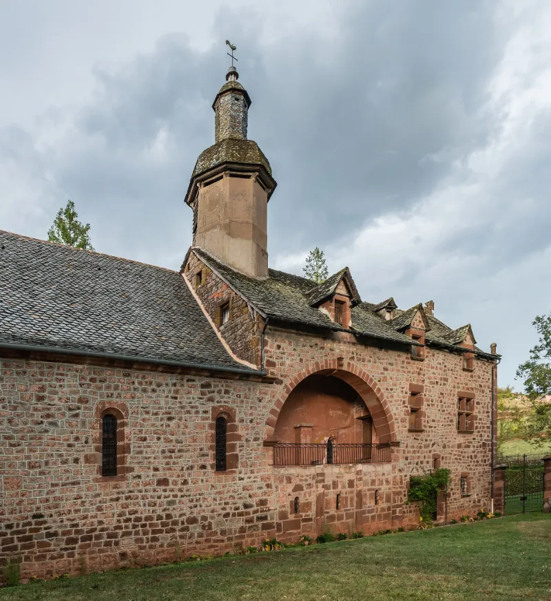
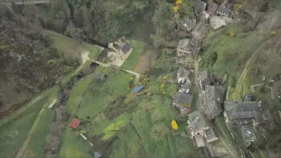
Notre-Dame de Foncourrieu Chapel and Adjoining Prior's Residence
No reviews yet
Have you flown here? Share your experience with other pilots.
+ Write the first reviewHistory
12e siècle ; 14e siècle ; 17e siècle Edifice de pélerinage, composé d'un choeur roman (ancienne chapelle transformée) prolongé par une nef du 14e siècle. Le logis du prieur, bâti vers 1650, y est relié par une tribune. De la fin du 17e et du début du 18e siècle datent les décors peints de la voûte de la nef, du choeur et de la chambre du prieur. Les voûtes lambrissées de bois ont été peintes en 1703 par un moine de Conques. Les voûtes du choeur comportent un décor de 1680, composé de quatre cartouches en l'honneur de la Vierge. Le logement du prieur, quant à lui, est orné d'un mosaïque de panneaux peints à figures géométriques et à fonds alternés, datant du 17e siècle. Le lieu de pélerinage est délimité par un enclos avec son portail et sa grille en fer forgé. Un chemin de pélerinage, marqué de losanges, est inclus dans l'enclos. Cet ancien prieuré était placé sous la dépendance de l'abbaye de Conques.
Map and restricted areas
Open in the main mapRestricted zones
| Zone | Category | Limits | Conditions |
|---|---|---|---|
| Ctr Rodez |
Zone de contrôle civile | 50 m above ground level → 1219 m above sea level | Flights above 50 metres are forbidden without the prior agreement of air traffic control |
Nearby aerodromes
Open aerodromes within 25 km of the spot, heliports included, with their distance and direction from the spot. Near an aerodrome, drone flying is prohibited or height-limited: check the UAS zones map.
| Aerodrome | Type | Distance | Elevation |
|---|---|---|---|
| Rodez-Marcillac Airport | Airport | 8.3 km S | 582 m |
| Centre Hospitalier Heliport | Heliport | 15 km SE | 595 m |
Aviation weather (METAR and TAF)
LFCR – Rodez-Marcillac Airport IFR
METAR
METAR LFCR 171400Z AUTO 24006KT 9999 OVC009/// ///CB 12/11 Q1005 TEMPO BKN011
- Wind
- 240°, 11 km/h
- Visibility
- 10 km or more
- Clouds
- Overcast (8/8) at 900 ft (270 m)
- Temperature
- 12 °C, dew point 11 °C
- QNH
- 1005 hPa
- Flight category
- IFR: ceiling 500–1,000 ft or visibility 1–3 mi
TAF
TAF AMD LFCR 171416Z 1714/1812 23010KT 9999 BKN018 TEMPO 1714/1717 -RA BKN009 TEMPO 1720/1803 3000 -RADZ BKN005 BKN011 TEMPO 1803/1808 3000 RA BKN006 TEMPO 1803/1806 27015G28KT TEMPO 1808/1811 BKN008 TEMPO 1811/1812 26015G28KT 4000 SHRA BKN017TCU
| Period (local time) | Change | Wind | Visibility | Weather | Clouds |
|---|---|---|---|---|---|
| 17/11 15:00 → 18/11 13:00 | Initial conditions | 230°, 19 km/h | 10 km or more | Broken (5-7/8) at 1,800 ft (550 m) | |
| 17/11 15:00 → 17/11 18:00 | Temporarily | Rain light | Broken (5-7/8) at 900 ft (270 m) | ||
| 17/11 21:00 → 18/11 04:00 | Temporarily | 3.0 km | Rain light ; drizzle light | Broken (5-7/8) at 500 ft (150 m) ; Broken (5-7/8) at 1,100 ft (340 m) | |
| 18/11 04:00 → 18/11 09:00 | Temporarily | 3.0 km | Rain | Broken (5-7/8) at 600 ft (180 m) | |
| 18/11 04:00 → 18/11 07:00 | Temporarily | 270°, 28 km/h, gusts 52 km/h | |||
| 18/11 09:00 → 18/11 12:00 | Temporarily | Broken (5-7/8) at 800 ft (240 m) | |||
| 18/11 12:00 → 18/11 13:00 | Temporarily | 260°, 28 km/h, gusts 52 km/h | 4.0 km | Showers of rain | Broken (5-7/8) at 1,700 ft (520 m) (towering cumulus) |
Weather and Kp index
Sunrise and sunset
| Day | Dawn | Sunrise | Golden hour | Sunset | Dusk | Day length |
|---|---|---|---|---|---|---|
| Tue 17 Nov | 07:18 | 07:49 | 07:49–08:34 · 16:37–17:21 | 17:21 | 17:53 | 9 h 32 |
| Wed 18 Nov | 07:19 | 07:50 | 07:50–08:35 · 16:36–17:20 | 17:20 | 17:52 | 9 h 29 |
| Thu 19 Nov | 07:20 | 07:52 | 07:52–08:37 · 16:35–17:19 | 17:19 | 17:51 | 9 h 27 |
| Fri 20 Nov | 07:21 | 07:53 | 07:53–08:38 · 16:34–17:19 | 17:19 | 17:50 | 9 h 25 |
| Sat 21 Nov | 07:22 | 07:54 | 07:54–08:39 · 16:33–17:18 | 17:18 | 17:50 | 9 h 23 |
| Sun 22 Nov | 07:24 | 07:56 | 07:56–08:41 · 16:32–17:17 | 17:17 | 17:49 | 9 h 21 |
| Mon 23 Nov | 07:25 | 07:57 | 07:57–08:42 · 16:31–17:16 | 17:16 | 17:48 | 9 h 19 |
Reviews (0)
Log in to review this spot. Log in · Create a free account
No reviews yet. Share yours!