

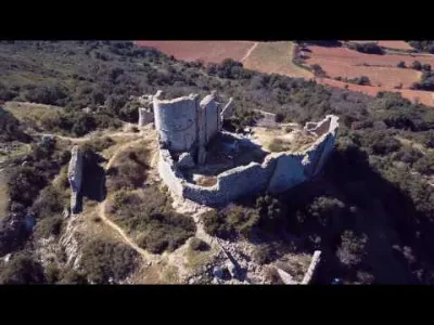
Saint-Martin-du-Cardonnet Chapel
No reviews yet
Have you flown here? Share your experience with other pilots.
+ Write the first reviewHistory
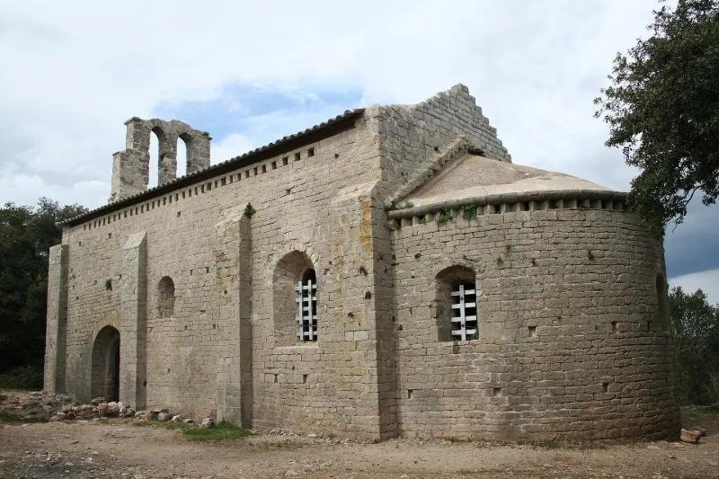
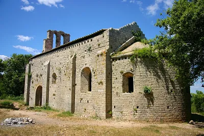
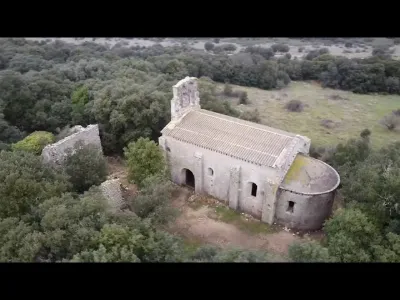
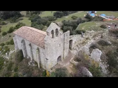
12e siècle Le castellum est cité en 1036. Le fief aurait appartenu, au 9e siècle, à l'abbaye d'Aniane. Il passe aux vicomtes de Béziers à la fin du 10e siècle. En 1114, la seigneurie est aux mains des Guilhem de Montpellier. Saint-Martin-du-Cardonnet faisait partie d'un prieuré dont les vestiges se trouvent autour de la chapelle. Celle-ci desservait les environs, habitat dispersé de mas isolés sur le plateau. La construction semble dater du 12e siècle. Au 16e siècle, le lieu subit un assaut huguenot. La chapelle s'élève dans un enclos occupé par les ruines du prieuré. Le plan rectangulaire est terminé par une abside semi-circulaire. La nef unique est couverte d'un berceau plein cintre. Ses trois travées sont séparées par deux arcs doubleaux retombant, par l'intermédiaire d'impostes chanfreinées, sur d'épais pilastres saillants rectangulaires. Une banquette de pierre est ménagée à l'intérieur, à la base des murs, tout autour de la chapelle. Surélevé d'un degré mais en retrait et plus bas, le choeur est voûté d'un cul de four. Il est séparé de la nef par un arc diaphragme plein cintre à double rouleau. Dans l'épaisseur du mur ouest, un renfoncement correspondait peut-être à une grande porte murée, à linteau en mitre. Le portail d'entrée est au sud. Le clocher-mur établi sur la façade occidentale est plus tardif. Il est percé de deux longues arcades en arc brisé.
Map and restricted areas
Open in the main mapRestricted zones
| Zone | Category | Limits | Conditions |
|---|---|---|---|
| Istres | Zone réglementée | 1529 m above sea level → 6259 m above sea level | Vols interdits sauf lorsque the official document of the zone l'autorise explicitement ou avec l'accord du gestionnaire de la zone lorsqu'il est désigné par the official document of the zone |
| Istres | Zone réglementée | 5491 m above sea level → 30766 m above sea level | Vols interdits sauf lorsque the official document of the zone l'autorise explicitement ou avec l'accord du gestionnaire de la zone lorsqu'il est désigné par the official document of the zone |
| Istres | Zone réglementée | 5491 m above sea level → 30766 m above sea level | Vols interdits sauf lorsque the official document of the zone l'autorise explicitement ou avec l'accord du gestionnaire de la zone lorsqu'il est désigné par the official document of the zone |
| Istres | Zone réglementée | 5491 m above sea level → 30766 m above sea level | Vols interdits sauf lorsque the official document of the zone l'autorise explicitement ou avec l'accord du gestionnaire de la zone lorsqu'il est désigné par the official document of the zone |
| Istres | Zone réglementée | 5491 m above sea level → 30766 m above sea level | Vols interdits sauf lorsque the official document of the zone l'autorise explicitement ou avec l'accord du gestionnaire de la zone lorsqu'il est désigné par the official document of the zone |
Nearby aerodromes
Open aerodromes within 25 km of the spot, heliports included, with their distance and direction from the spot. Near an aerodrome, drone flying is prohibited or height-limited: check the UAS zones map.
| Aerodrome | Type | Distance | Elevation |
|---|---|---|---|
| Montpellier Chr Heliport | Heliport | 18 km E | 46 m |
| Le Corum Heliport | Heliport | 20 km E | 54 m |
Aviation weather (METAR and TAF)
LFMT – Montpellier-Méditerranée Airport VFR
METAR
METAR LFMT 171400Z AUTO 25009KT 9999 FEW071/// SCT150/// ///TCU 15/13 Q1004 TEMPO
- Wind
- 250°, 17 km/h
- Visibility
- 10 km or more
- Clouds
- Few (1-2/8) at 7,100 ft (2160 m) ; Scattered (3-4/8) at 15,000 ft (4570 m)
- Temperature
- 15 °C, dew point 13 °C
- QNH
- 1004 hPa
- Flight category
- VFR: ceiling > 3,000 ft and visibility > 5 mi
TAF
TAF LFMT 170800Z 1709/1809 01008KT 9999 BKN016 BECMG 1710/1712 CAVOK TEMPO 1712/1718 -SHRA FEW050TCU BECMG 1713/1715 21010KT
| Period (local time) | Change | Wind | Visibility | Weather | Clouds |
|---|---|---|---|---|---|
| 17/11 10:00 → 17/11 11:00 | Initial conditions | 010°, 15 km/h | 10 km or more | Broken (5-7/8) at 1,600 ft (490 m) | |
| 17/11 11:00 → 17/11 14:00 | Becoming | 010°, 15 km/h | 10 km or more | No significant weather | No significant cloud |
| 17/11 13:00 → 17/11 19:00 | Temporarily | Showers of rain light | Few (1-2/8) at 5,000 ft (1520 m) (towering cumulus) | ||
| 17/11 14:00 → 18/11 10:00 | Becoming | 210°, 19 km/h | 10 km or more | No significant weather | No significant cloud |
Weather and Kp index
Sunrise and sunset
| Day | Dawn | Sunrise | Golden hour | Sunset | Dusk | Day length |
|---|---|---|---|---|---|---|
| Tue 17 Nov | 07:11 | 07:42 | 07:42–08:25 · 16:35–17:19 | 17:19 | 17:50 | 9 h 37 |
| Wed 18 Nov | 07:12 | 07:43 | 07:43–08:27 · 16:34–17:18 | 17:18 | 17:49 | 9 h 34 |
| Thu 19 Nov | 07:13 | 07:44 | 07:44–08:28 · 16:33–17:17 | 17:17 | 17:48 | 9 h 32 |
| Fri 20 Nov | 07:14 | 07:46 | 07:46–08:30 · 16:32–17:16 | 17:16 | 17:48 | 9 h 30 |
| Sat 21 Nov | 07:16 | 07:47 | 07:47–08:31 · 16:31–17:16 | 17:16 | 17:47 | 9 h 28 |
| Sun 22 Nov | 07:17 | 07:48 | 07:48–08:32 · 16:31–17:15 | 17:15 | 17:46 | 9 h 26 |
| Mon 23 Nov | 07:18 | 07:49 | 07:49–08:34 · 16:30–17:14 | 17:14 | 17:46 | 9 h 24 |
Reviews (0)
Log in to review this spot. Log in · Create a free account
No reviews yet. Share yours!