

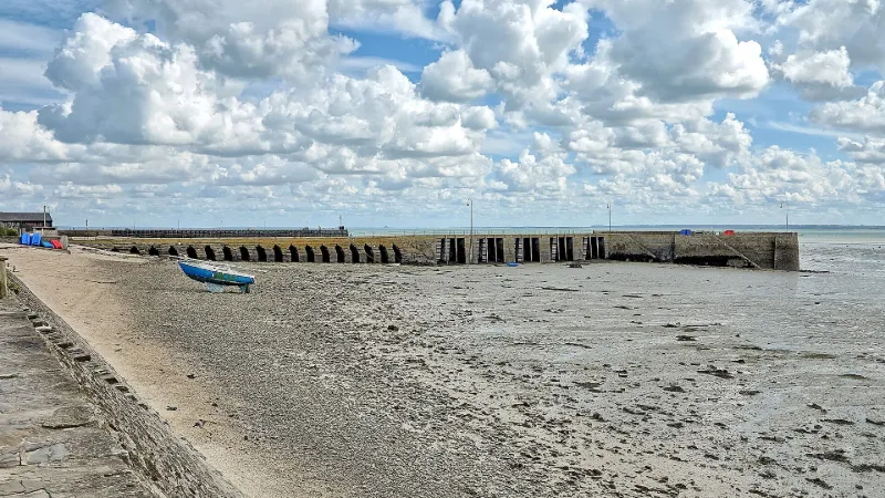
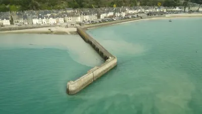
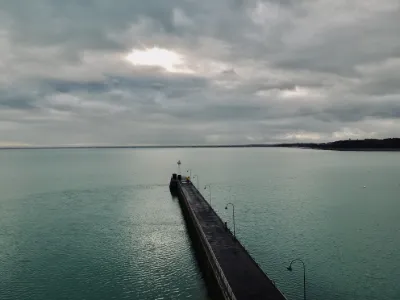
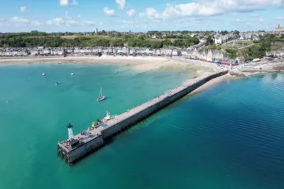
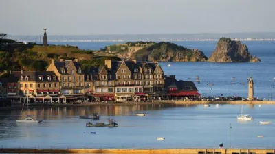
Jetty known as Cale de l'Epi
No reviews yet
Have you flown here? Share your experience with other pilots.
+ Write the first reviewHistory
2e quart 19e siècle La construction de la jetée de l'Epi est liée au développement du port de la Houle depuis la construction de la première digue en 1773. Les pêcheurs demandant la création d'une cale de débarquement dans la partie ouest de la Houle, la jetée fut réalisée en 1838 par les Ponts et Chaussées. Ce quai d'embarquement réalisé en pierres sèches avait 50 m de long sur 4 de large ; il était percé de 19 arches séparées par des gradins ayant pour fonction de faciliter l'accostage des embarcations. Ces arches à l'origine ouvertes ont été partiellement cimentées et l'ouvrage a été prolongé en 1886 par une structure coudée, partie pierre et partie béton.
Map and restricted areas
Open in the main mapRestricted zones
Nearby aerodromes
Open aerodromes within 25 km of the spot, heliports included, with their distance and direction from the spot. Near an aerodrome, drone flying is prohibited or height-limited: check the UAS zones map.
| Aerodrome | Type | Distance | Elevation |
|---|---|---|---|
| Centre Hospitalier Heliport | Heliport | 12 km W | 8 m |
| Dinard-Pleurtuit-Saint-Malo Airport | Airport | 19 km SW | 67 m |
| Chausey Heliport | Heliport | 23 km N | 21 m |
Aviation weather (METAR and TAF)
LFRD – Dinard-Pleurtuit-Saint-Malo Airport MVFR
METAR
METAR LFRD 171400Z AUTO 23021G36KT 9999 OVC030 OVC036 16/11 Q0988 TEMPO 1400 TSRAGS BKN008 BKN020CB
- Wind
- 230°, 39 km/h, gusts 67 km/h
- Visibility
- 10 km or more
- Clouds
- Overcast (8/8) at 3,000 ft (910 m) ; Overcast (8/8) at 3,600 ft (1100 m)
- Temperature
- 16 °C, dew point 11 °C
- QNH
- 988 hPa
- Flight category
- MVFR: ceiling 1,000–3,000 ft or visibility 3–5 mi
TAF
TAF LFRD 171100Z 1712/1812 25020G30KT 9999 BKN020 TEMPO 1712/1812 3000 SHRA BKN012 SCT020CB SCT025TCU PROB40 TEMPO 1712/1716 23025G45KT 1400 TSRAGS BKN008 BKN020CB PROB30 TEMPO 1800/1806 1400 TSRA
| Period (local time) | Change | Wind | Visibility | Weather | Clouds |
|---|---|---|---|---|---|
| 17/11 13:00 → 18/11 13:00 | Initial conditions | 250°, 37 km/h, gusts 56 km/h | 10 km or more | Broken (5-7/8) at 2,000 ft (610 m) | |
| 17/11 13:00 → 18/11 13:00 | Temporarily | 3.0 km | Showers of rain | Broken (5-7/8) at 1,200 ft (370 m) ; Scattered (3-4/8) at 2,000 ft (610 m) (cumulonimbus) ; Scattered (3-4/8) at 2,500 ft (760 m) (towering cumulus) | |
| 17/11 13:00 → 17/11 17:00 | Temporarily, probability 40% | 230°, 46 km/h, gusts 83 km/h | 1.4 km | Thunderstorm rain ; thunderstorm small hail | Broken (5-7/8) at 800 ft (240 m) ; Broken (5-7/8) at 2,000 ft (610 m) (cumulonimbus) |
| 18/11 01:00 → 18/11 07:00 | Temporarily, probability 30% | 1.4 km | Thunderstorm rain |
Weather and Kp index
Sunrise and sunset
| Day | Dawn | Sunrise | Golden hour | Sunset | Dusk | Day length |
|---|---|---|---|---|---|---|
| Tue 17 Nov | 07:44 | 08:19 | 08:19–09:09 · 16:36–17:26 | 17:26 | 18:00 | 9 h 06 |
| Wed 18 Nov | 07:46 | 08:20 | 08:20–09:10 · 16:35–17:25 | 17:25 | 17:59 | 9 h 04 |
| Thu 19 Nov | 07:47 | 08:22 | 08:22–09:12 · 16:33–17:24 | 17:24 | 17:58 | 9 h 01 |
| Fri 20 Nov | 07:49 | 08:23 | 08:23–09:14 · 16:32–17:23 | 17:23 | 17:57 | 8 h 59 |
| Sat 21 Nov | 07:50 | 08:25 | 08:25–09:16 · 16:31–17:22 | 17:22 | 17:57 | 8 h 56 |
| Sun 22 Nov | 07:51 | 08:26 | 08:26–09:17 · 16:30–17:21 | 17:21 | 17:56 | 8 h 54 |
| Mon 23 Nov | 07:53 | 08:28 | 08:28–09:19 · 16:29–17:20 | 17:20 | 17:55 | 8 h 51 |
Reviews (0)
Log in to review this spot. Log in · Create a free account
No reviews yet. Share yours!