

Suspension Bridge and Former Toll Pavilions
No reviews yet
Have you flown here? Share your experience with other pilots.
+ Write the first reviewHistory
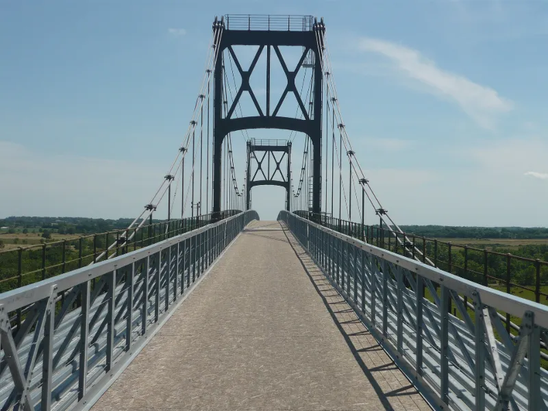
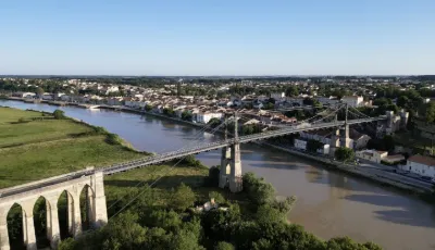
19e siècle ; 2e quart 20e siècle Proche de l'estuaire de la Charente, le lieu est soumis à de fortes marées et à des crues. Il semble avoir été retenu dès le 13e siècle pour le franchissement de la rivière par des ponts. Des bacs furent ensuite utilisés sur cet axe qu'est la route royale Bordeaux/Saint-Malo. En 1831, le projet de pont suspendu dressé par Louis Dor répondit le mieux à la nécessité de laisser passer les bâteaux d'un tirant d'eau de 20 mètres. Il pouvait s'appuyer d'un côté de la rive sur une falaise et, de l'autre, retomber dans un marais. Le pont fut inauguré le 21 avril 1842. La culée de pierre de 407 mètres se compose de 51 arcades ogivales. Le tablier était différent et finira par se briser sous les charges en 1883. L'ingénieur Arnodin est alors chargé de la reconstruction de la partie suspendue du pont. La nouvelle version est inaugurée en 1885. Le nouveau tablier se compose d'un châssis en fer et conserve un placage en bois. Un garde-corps en fer forgé surmonte la structure. En 1934, suite à l'alourdissement des véhicules circulant sur le pont, de nouveaux travaux de consolidation sont réalisés. L'accroissement du trafic après la Seconde guerre mondiale oblige à interdire l'accès du pont aux véhicules.
Map and restricted areas
Open in the main mapRestricted zones
| Zone | Category | Limits | Conditions |
|---|---|---|---|
| Tma la Rochelle |
Région de contrôle terminal | 610 m above sea level → 914 m above sea level · 610 m above sea level → 914 m above sea level · 610 m above sea level → 3821 m above sea level · 610 m above sea level → 3821 m above sea level · 914 m above sea level → 3821 m above sea level | Drone flights inside this zone are forbidden without the prior agreement of air traffic control |
| Cognac | Zone réglementée | 914 m above sea level → 1219 m above sea level | Vols interdits sauf lorsque the official document of the zone l'autorise explicitement ou avec l'accord du gestionnaire de la zone lorsqu'il est désigné par the official document of the zone |
| Cognac | Zone réglementée | 1219 m above sea level → 2297 m above sea level | Vols interdits sauf lorsque the official document of the zone l'autorise explicitement ou avec l'accord du gestionnaire de la zone lorsqu'il est désigné par the official document of the zone |
| Cognac | Zone réglementée | 1529 m above sea level → 6259 m above sea level | Vols interdits sauf lorsque the official document of the zone l'autorise explicitement ou avec l'accord du gestionnaire de la zone lorsqu'il est désigné par the official document of the zone |
| Bordeaux | Zone réglementée | 5491 m above sea level → 30766 m above sea level | Vols interdits sauf lorsque the official document of the zone l'autorise explicitement ou avec l'accord du gestionnaire de la zone lorsqu'il est désigné par the official document of the zone |
| Zena Gascogne | Zone dangereuse | 5491 m above sea level → 30766 m above sea level | Vols interdits sauf lorsque the official document of the zone l'autorise explicitement ou avec l'accord du gestionnaire de la zone lorsqu'il est désigné par the official document of the zone |
| Zena Gascogne Restreinte | Zone dangereuse | 5491 m above sea level → 30766 m above sea level | Vols interdits sauf lorsque the official document of the zone l'autorise explicitement ou avec l'accord du gestionnaire de la zone lorsqu'il est désigné par the official document of the zone |
Nearby aerodromes
Open aerodromes within 25 km of the spot, heliports included, with their distance and direction from the spot. Near an aerodrome, drone flying is prohibited or height-limited: check the UAS zones map.
| Aerodrome | Type | Distance | Elevation |
|---|---|---|---|
| Rochefort-Saint-Agnant (BA 721) Airport | Airport | 9.5 km SW | 18 m |
| Aérodrome de Marennes - Le Bournet | Aerodrome | 20 km SW | 5 m |
Aviation weather (METAR and TAF)
LFBH – La Rochelle-Île de Ré Airport MVFR
METAR
METAR LFBH 171330Z AUTO 21014KT 9000 BKN021 BKN030 OVC036 16/14 Q0999 TEMPO 4500 -SHRA SCT025TCU BECMG 22015G25KT
- Wind
- 210°, 26 km/h
- Visibility
- 9 km
- Clouds
- Broken (5-7/8) at 2,100 ft (640 m) ; Broken (5-7/8) at 3,000 ft (910 m) ; Overcast (8/8) at 3,600 ft (1100 m)
- Temperature
- 16 °C, dew point 14 °C
- QNH
- 999 hPa
- Flight category
- MVFR: ceiling 1,000–3,000 ft or visibility 3–5 mi
TAF
TAF LFBH 171100Z 1712/1812 21014KT 9999 BKN030 OVC200 BECMG 1712/1715 22015G25KT PROB30 TEMPO 1712/1716 4500 -SHRA SCT025TCU BECMG 1717/1720 25020G35KT 4500 -RA BKN020TCU TEMPO 1719/1721 24030G45KT 2500 TSRA BKN014 BKN020CB BECMG 1720/1722 26015G25KT 9999 NSW SCT020 BKN040 TEMPO 1804/1812 25018G30KT 4500 -SHRA SCT035CB PROB40 TEMPO 1806/1812 2500 -TSRA BKN020CB
| Period (local time) | Change | Wind | Visibility | Weather | Clouds |
|---|---|---|---|---|---|
| 17/11 13:00 → 18/11 13:00 | Initial conditions | 210°, 26 km/h | 10 km or more | Broken (5-7/8) at 3,000 ft (910 m) ; Overcast (8/8) at 20,000 ft (6100 m) | |
| 17/11 13:00 → 17/11 18:00 | Becoming | 220°, 28 km/h, gusts 46 km/h | 10 km or more | Broken (5-7/8) at 3,000 ft (910 m) ; Overcast (8/8) at 20,000 ft (6100 m) | |
| 17/11 13:00 → 17/11 17:00 | Temporarily, probability 30% | 4.5 km | Showers of rain light | Scattered (3-4/8) at 2,500 ft (760 m) (towering cumulus) | |
| 17/11 18:00 → 17/11 21:00 | Becoming | 250°, 37 km/h, gusts 65 km/h | 4.5 km | Rain light | Broken (5-7/8) at 2,000 ft (610 m) (towering cumulus) |
| 17/11 20:00 → 17/11 22:00 | Temporarily | 240°, 56 km/h, gusts 83 km/h | 2.5 km | Thunderstorm rain | Broken (5-7/8) at 1,400 ft (430 m) ; Broken (5-7/8) at 2,000 ft (610 m) (cumulonimbus) |
| 17/11 21:00 → 18/11 13:00 | Becoming | 260°, 28 km/h, gusts 46 km/h | 10 km or more | No significant weather | Scattered (3-4/8) at 2,000 ft (610 m) ; Broken (5-7/8) at 4,000 ft (1220 m) |
| 18/11 05:00 → 18/11 13:00 | Temporarily | 250°, 33 km/h, gusts 56 km/h | 4.5 km | Showers of rain light | Scattered (3-4/8) at 3,500 ft (1070 m) (cumulonimbus) |
| 18/11 07:00 → 18/11 13:00 | Temporarily, probability 40% | 2.5 km | Thunderstorm rain light | Broken (5-7/8) at 2,000 ft (610 m) (cumulonimbus) |
Weather and Kp index
| Day | Weather | Temp. min. / max. | Wind | Rain | Max Kp |
|---|---|---|---|---|---|
| Tue 17 Nov | Showers | 14° / 17° | 42 km/h W | 6.3 mm | 5 |
| Wed 18 Nov | Partly cloudy | 12° / 15° | 36 km/h SW | 15 mm | 5 |
| Thu 19 Nov | Showers | 11° / 13° | 42 km/h W | 13 mm | 3 |
| Fri 20 Nov | Showers | 11° / 14° | 33 km/h W | 8.3 mm | 3 |
| Sat 21 Nov | Cloudy | 9° / 14° | 18 km/h SE | 5.0 mm | – |
| Sun 22 Nov | Showers | 12° / 15° | 32 km/h W | 7.4 mm | – |
| Mon 23 Nov | Cloudy | 9° / 14° | 13 km/h SW | 0.4 mm | – |
Hour by hour: Tuesday 17 November
| Time | Weather | Temp. | Wind | Rain | Clouds | Kp |
|---|---|---|---|---|---|---|
| 15:00 | Showers | 17° | 31 km/h SW | 0.3 mm | 14 % | 4 |
| 16:00 | Fair | 16° | 35 km/h SW | – | 36 % | 4 |
| 17:00 | Light rain | 16° | 36 km/h SW | 0.2 mm | 97 % | 4 |
| 18:00 | Cloudy | 16° | 38 km/h SW | – | 100 % | 4 |
| 19:00 | Rain | 16° | 40 km/h W | 0.5 mm | 99 % | 5 |
| 20:00 | Rain | 15° | 40 km/h W | 0.7 mm | 100 % | 5 |
| 21:00 | Heavy rain | 14° | 42 km/h W | 1.9 mm | 100 % | 5 |
| 22:00 | Heavy rain | 14° | 34 km/h W | 1.5 mm | 100 % | 5 |
Hour by hour: Wednesday 18 November
| Time | Weather | Temp. | Wind | Rain | Clouds | Kp |
|---|---|---|---|---|---|---|
| 06:00 | Showers | 13° | 35 km/h W | 0.8 mm | 41 % | 4 |
| 07:00 | Showers | 13° | 36 km/h W | 0.4 mm | 65 % | 4 |
| 08:00 | Showers | 13° | 35 km/h W | 0.7 mm | 64 % | 4 |
| 09:00 | Showers | 12° | 28 km/h W | 0.2 mm | 37 % | 4 |
| 10:00 | Showers | 14° | 31 km/h W | 0.2 mm | 66 % | 4 |
| 11:00 | Light rain | 14° | 26 km/h SW | 0.2 mm | 94 % | 4 |
| 12:00 | Partly cloudy | 14° | 29 km/h SW | – | 81 % | 4 |
| 13:00 | Partly cloudy | 14° | 27 km/h SW | – | 77 % | 3 |
| 14:00 | Partly cloudy | 15° | 31 km/h SW | – | 86 % | 3 |
| 15:00 | Partly cloudy | 15° | 27 km/h SW | – | 95 % | 3 |
| 16:00 | Light rain | 15° | 27 km/h SW | 0.2 mm | 94 % | 3 |
| 17:00 | Rain | 14° | 23 km/h SW | 0.6 mm | 99 % | 3 |
| 18:00 | Light rain | 13° | 27 km/h SW | 0.4 mm | 100 % | 3 |
| 19:00 | Rain | 14° | 26 km/h SW | 0.9 mm | 100 % | 2 |
| 20:00 | Heavy rain | 13° | 25 km/h S | 1.2 mm | 100 % | 2 |
| 21:00 | Heavy rain | 13° | 24 km/h S | 2.6 mm | 100 % | 2 |
| 22:00 | Heavy rain | 13° | 24 km/h S | 4.2 mm | 100 % | 2 |
Sunrise and sunset
| Day | Dawn | Sunrise | Golden hour | Sunset | Dusk | Day length |
|---|---|---|---|---|---|---|
| Tue 17 Nov | 07:34 | 08:07 | 08:07–08:53 · 16:44–17:30 | 17:30 | 18:03 | 9 h 23 |
| Wed 18 Nov | 07:35 | 08:08 | 08:08–08:54 · 16:43–17:29 | 17:29 | 18:02 | 9 h 21 |
| Thu 19 Nov | 07:37 | 08:09 | 08:09–08:56 · 16:42–17:29 | 17:29 | 18:01 | 9 h 19 |
| Fri 20 Nov | 07:38 | 08:11 | 08:11–08:57 · 16:41–17:28 | 17:28 | 18:00 | 9 h 16 |
| Sat 21 Nov | 07:39 | 08:12 | 08:12–08:59 · 16:40–17:27 | 17:27 | 18:00 | 9 h 14 |
| Sun 22 Nov | 07:40 | 08:13 | 08:13–09:00 · 16:39–17:26 | 17:26 | 17:59 | 9 h 12 |
| Mon 23 Nov | 07:42 | 08:15 | 08:15–09:02 · 16:38–17:25 | 17:25 | 17:58 | 9 h 10 |



Reviews (0)
Log in to review this spot. Log in · Create a free account
No reviews yet. Share yours!