

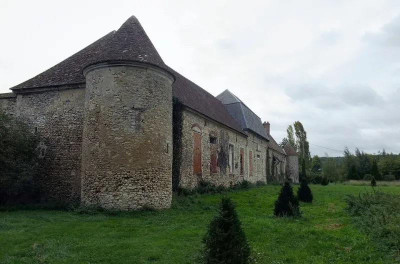
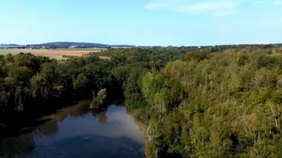
Manor known as Vaux Farm
No reviews yet
Have you flown here? Share your experience with other pilots.
+ Write the first reviewHistory
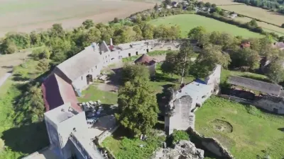
4e quart 12e siècle ; limite 16e siècle 17e siècle ; 18e siècle En 1186, Richard de Vals, chevalier du roi de France, fortifie son petit château situé sur la ligne de défense de l'Epte. L'église Saint-Laurent relève alors de l'archevêque de Rouen. Après les désordres dus à la guerre de Cent Ans et aux pillages de la Ligue, le domaine est relevé à la fin du 16e siècle ou au début du siècle suivant. Un nouveau logis et un parc sont réalisés au 18e siècle pour les Mainneville. Le manoir comprend un ensemble de bâtiments organisés autour d'une cour fermée, dont chaque angle est ponctué d'une tour ronde : la chapelle du 12e siècle, le logis et les dépendances du 17e siècle appuyés à l'enceinte. Du parc subsistent le réseau hydraulique et l'emprise.
Map and restricted areas
Open in the main mapRestricted zones
| Zone | Category | Limits | Conditions |
|---|---|---|---|
| Paris 4 | Zone réglementée | 1067 m above sea level → 1372 m above sea level | Vols interdits sauf lorsque the official document of the zone l'autorise explicitement ou avec l'accord du gestionnaire de la zone lorsqu'il est désigné par the official document of the zone |
| Mantes | Zone réglementée | 1067 m above sea level → 1372 m above sea level | Vols interdits sauf lorsque the official document of the zone l'autorise explicitement ou avec l'accord du gestionnaire de la zone lorsqu'il est désigné par the official document of the zone |
| Mantes | Zone réglementée | 1067 m above sea level → 1372 m above sea level | Vols interdits sauf lorsque the official document of the zone l'autorise explicitement ou avec l'accord du gestionnaire de la zone lorsqu'il est désigné par the official document of the zone |
| Paris 5 | Zone réglementée | 1372 m above sea level → 2297 m above sea level | Vols interdits sauf lorsque the official document of the zone l'autorise explicitement ou avec l'accord du gestionnaire de la zone lorsqu'il est désigné par the official document of the zone |
| Paris 7 | Zone réglementée | 1529 m above sea level → 2907 m above sea level | Vols interdits sauf lorsque the official document of the zone l'autorise explicitement ou avec l'accord du gestionnaire de la zone lorsqu'il est désigné par the official document of the zone |
| Paris 9 | Zone réglementée | 2138 m above sea level → 3821 m above sea level | Vols interdits sauf lorsque the official document of the zone l'autorise explicitement ou avec l'accord du gestionnaire de la zone lorsqu'il est désigné par the official document of the zone |
| Paris 11 | Zone réglementée | 3053 m above sea level → 6259 m above sea level | Vols interdits sauf lorsque the official document of the zone l'autorise explicitement ou avec l'accord du gestionnaire de la zone lorsqu'il est désigné par the official document of the zone |
Nearby aerodromes
Open aerodromes within 25 km of the spot, heliports included, with their distance and direction from the spot. Near an aerodrome, drone flying is prohibited or height-limited: check the UAS zones map.
| Aerodrome | Type | Distance | Elevation |
|---|---|---|---|
| Base ULM Les Noyers | Aerodrome | 7.5 km W | 100 m |
| Base ULM de Flavacourt | Aerodrome | 9.8 km N | 139 m |
| Étrépagny Airfield | Aerodrome | 9.9 km NW | 94 m |
| Base Paramoteurs d' Avernes | Aerodrome | 20 km SE | 139 m |
| Mantes Chérence Airfield | Aerodrome | 22 km S | 156 m |
Aviation weather (METAR and TAF)
LFPT – Aérodrome de Pontoise - Cormeilles en Vexin VFR
METAR
METAR LFPT 171330Z AUTO 24016KT 210V270 CAVOK 15/09 Q0990
- Wind
- 240°, 30 km/h
- Visibility
- 10 km or more
- Clouds
- –
- Temperature
- 15 °C, dew point 9 °C
- QNH
- 990 hPa
- Flight category
- VFR: ceiling > 3,000 ft and visibility > 5 mi
TAF
Weather and Kp index
| Day | Weather | Temp. min. / max. | Wind | Rain | Max Kp |
|---|---|---|---|---|---|
| Tue 17 Nov | Heavy rain | 10° / 12° | 32 km/h SW | 5.0 mm | 5 |
| Wed 18 Nov | Showers | 10° / 13° | 33 km/h W | 5.1 mm | 5 |
| Thu 19 Nov | Cloudy | 8° / 12° | 32 km/h SW | 6.4 mm | 3 |
| Fri 20 Nov | Showers | 9° / 12° | 28 km/h SW | 3.1 mm | 3 |
| Sat 21 Nov | Fair | 7° / 10° | 25 km/h W | 0.4 mm | – |
| Sun 22 Nov | Cloudy | 5° / 7° | 17 km/h E | 8.2 mm | – |
| Mon 23 Nov | Fair | 6° / 10° | 19 km/h W | 1.4 mm | – |
Hour by hour: Tuesday 17 November
| Time | Weather | Temp. | Wind | Rain | Clouds | Kp |
|---|---|---|---|---|---|---|
| 15:00 | Heavy rain | 12° | 27 km/h SW | 1.3 mm | 100 % | 4 |
| 16:00 | Rain | 12° | 27 km/h SW | 0.6 mm | 100 % | 4 |
| 17:00 | Rain | 11° | 32 km/h SW | 0.9 mm | 99 % | 4 |
| 18:00 | Rain | 11° | 31 km/h SW | 0.8 mm | 100 % | 4 |
| 19:00 | Rain | 11° | 30 km/h SW | 0.8 mm | 100 % | 5 |
| 20:00 | Rain | 11° | 29 km/h SW | 0.5 mm | 93 % | 5 |
| 21:00 | Light rain | 10° | 27 km/h SW | 0.1 mm | 100 % | 5 |
| 22:00 | Partly cloudy | 10° | 27 km/h SW | – | 72 % | 5 |
Hour by hour: Wednesday 18 November
| Time | Weather | Temp. | Wind | Rain | Clouds | Kp |
|---|---|---|---|---|---|---|
| 06:00 | Partly cloudy | 10° | 24 km/h SW | – | 84 % | 4 |
| 07:00 | Partly cloudy | 10° | 24 km/h SW | – | 80 % | 4 |
| 08:00 | Partly cloudy | 10° | 24 km/h SW | – | 78 % | 4 |
| 09:00 | Partly cloudy | 10° | 23 km/h SW | – | 73 % | 4 |
| 10:00 | Partly cloudy | 11° | 25 km/h SW | – | 63 % | 4 |
| 11:00 | Partly cloudy | 12° | 27 km/h SW | – | 39 % | 4 |
| 12:00 | Showers | 12° | 32 km/h SW | 0.1 mm | 44 % | 4 |
| 13:00 | Showers | 13° | 33 km/h W | 0.1 mm | 46 % | 3 |
| 14:00 | Showers | 13° | 29 km/h W | 0.2 mm | 60 % | 3 |
| 15:00 | Clear sky | 13° | 24 km/h SW | – | 12 % | 3 |
| 16:00 | Clear sky | 13° | 22 km/h SW | – | 8 % | 3 |
| 17:00 | Fair | 12° | 21 km/h SW | – | 30 % | 3 |
| 18:00 | Partly cloudy | 11° | 18 km/h SW | – | 82 % | 3 |
| 19:00 | Cloudy | 10° | 19 km/h SW | – | 91 % | 2 |
| 20:00 | Light rain | 10° | 19 km/h SW | 0.1 mm | 92 % | 2 |
| 21:00 | Heavy rain | 10° | 21 km/h S | 2.3 mm | 100 % | 2 |
| 22:00 | Rain | 10° | 21 km/h S | 0.8 mm | 100 % | 2 |
Sunrise and sunset
| Day | Dawn | Sunrise | Golden hour | Sunset | Dusk | Day length |
|---|---|---|---|---|---|---|
| Tue 17 Nov | 07:31 | 08:06 | 08:06–08:57 · 16:19–17:09 | 17:09 | 17:44 | 9 h 02 |
| Wed 18 Nov | 07:33 | 08:08 | 08:08–08:59 · 16:17–17:08 | 17:08 | 17:43 | 9 h 00 |
| Thu 19 Nov | 07:34 | 08:10 | 08:10–09:01 · 16:16–17:07 | 17:07 | 17:42 | 8 h 57 |
| Fri 20 Nov | 07:36 | 08:11 | 08:11–09:02 · 16:15–17:06 | 17:06 | 17:41 | 8 h 55 |
| Sat 21 Nov | 07:37 | 08:13 | 08:13–09:04 · 16:13–17:05 | 17:05 | 17:41 | 8 h 52 |
| Sun 22 Nov | 07:38 | 08:14 | 08:14–09:06 · 16:12–17:04 | 17:04 | 17:40 | 8 h 50 |
| Mon 23 Nov | 07:40 | 08:16 | 08:16–09:08 · 16:11–17:03 | 17:03 | 17:39 | 8 h 47 |
Reviews (0)
Log in to review this spot. Log in · Create a free account
No reviews yet. Share yours!