

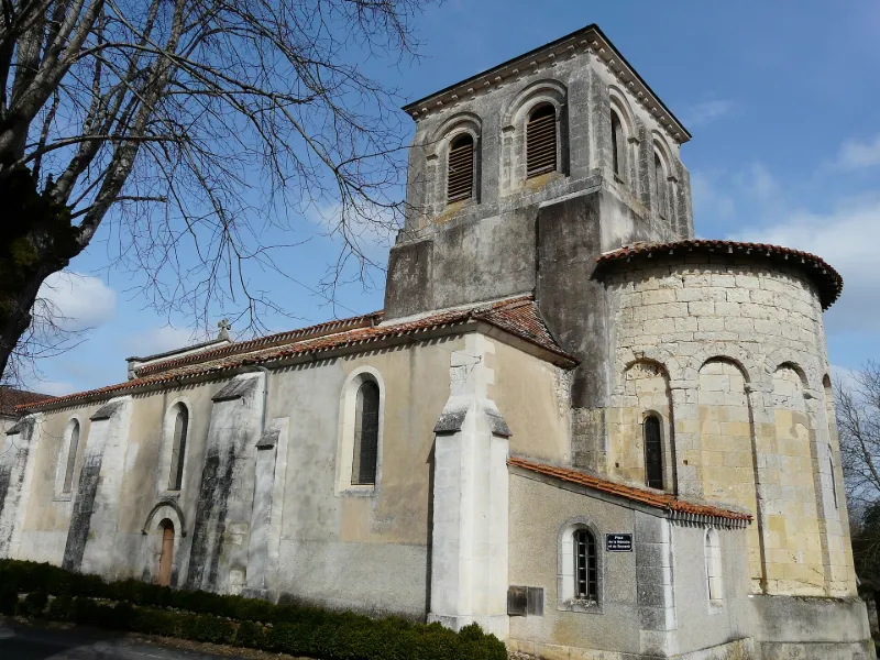
Saint-Pierre-ès-Liens Church
No reviews yet
Have you flown here? Share your experience with other pilots.
+ Write the first reviewHistory
12e siècle De l'église romane restent le sanctuaire à abside semi-circulaire et le carré sous coupole. Celle-ci repose sur de grands arcs formerets simples, retombant sur de massifs piliers, et des doubleaux à rouleaux retombant sur des colonnes engagées. Chapiteaux sculptés. Sanctuaire voûté en cul de four à cinq arcs aveugles plein cintre, retombant sur quatre colonnettes accostées, posées sur stylobate. A l'extérieur, l'abside est renforcée par une arcature de sept arcs plein cintre. Clocher carré sur coupole dont la partie supérieure est moderne.
Map and restricted areas
Open in the main mapRestricted zones
Nearby aerodromes
Open aerodromes within 25 km of the spot, heliports included, with their distance and direction from the spot. Near an aerodrome, drone flying is prohibited or height-limited: check the UAS zones map.
| Aerodrome | Type | Distance | Elevation |
|---|---|---|---|
| Centre Hospitalier Heliport | Heliport | 13 km NE | 153 m |
| Périgueux-Bassillac Airport | Airport | 19 km E | 100 m |
Aviation weather (METAR and TAF)
LFBX – Périgueux-Bassillac Airport VFR
METAR
METAR LFBX 171400Z AUTO 22005KT 180V250 9999 SCT032 BKN039 OVC110 17/13 Q1002
- Wind
- 220°, 9 km/h
- Visibility
- 10 km or more
- Clouds
- Scattered (3-4/8) at 3,200 ft (980 m) ; Broken (5-7/8) at 3,900 ft (1190 m) ; Overcast (8/8) at 11,000 ft (3350 m)
- Temperature
- 17 °C, dew point 13 °C
- QNH
- 1002 hPa
- Flight category
- VFR: ceiling > 3,000 ft and visibility > 5 mi
TAF
Weather and Kp index
Sunrise and sunset
| Day | Dawn | Sunrise | Golden hour | Sunset | Dusk | Day length |
|---|---|---|---|---|---|---|
| Tue 17 Nov | 07:26 | 07:58 | 07:58–08:44 · 16:42–17:27 | 17:27 | 17:59 | 9 h 28 |
| Wed 18 Nov | 07:28 | 08:00 | 08:00–08:45 · 16:41–17:26 | 17:26 | 17:58 | 9 h 26 |
| Thu 19 Nov | 07:29 | 08:01 | 08:01–08:47 · 16:39–17:25 | 17:25 | 17:57 | 9 h 23 |
| Fri 20 Nov | 07:30 | 08:02 | 08:02–08:48 · 16:38–17:24 | 17:24 | 17:56 | 9 h 21 |
| Sat 21 Nov | 07:31 | 08:04 | 08:04–08:50 · 16:37–17:23 | 17:23 | 17:56 | 9 h 19 |
| Sun 22 Nov | 07:33 | 08:05 | 08:05–08:51 · 16:36–17:23 | 17:23 | 17:55 | 9 h 17 |
| Mon 23 Nov | 07:34 | 08:06 | 08:06–08:53 · 16:36–17:22 | 17:22 | 17:54 | 9 h 15 |

Reviews (0)
Log in to review this spot. Log in · Create a free account
No reviews yet. Share yours!