

San-Quilico Church
No reviews yet
Have you flown here? Share your experience with other pilots.
+ Write the first reviewHistory
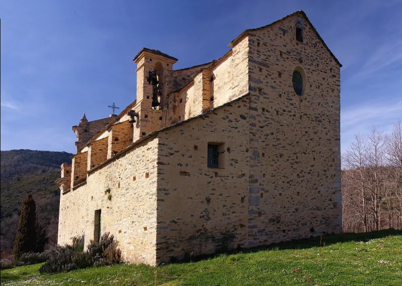
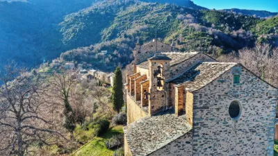
11e siècle ; 18e siècle Elevée probablement au 11e siècle sur l'emplacement d'un sanctuaire préroman du 8e siècle, l'église a été agrandie et transformée au 18e siècle. L'édifice, de style roman pisan à l'origine, a subi de grandes transformations de style baroque au moment de son agrandissement. Presque toute la façade principale primitive existe encore, en dalles de schiste gris. Au centre s'ouvre une porte flanquée de piédroits monolithes. Un linteau décoré de motifs sculptés en relief plat, est surmonté d'un tympan monolithe encadré d'un arc en plein cintre. Le deuxième niveau, de style baroque comme le reste de l'église, est séparé du fronton et du premier niveau par des corniches. Au sommet du fronton se distingue une figure humaine gravée dans un losange. La façade sud supporte le campanile. La porte provient de la première construction et a été remontée en disposant les éléments primitifs. L'intérieur présente une nef avec huit chapelles latérales et décoré de style baroque.
Map and restricted areas
Open in the main mapRestricted zones
| Zone | Category | Limits | Conditions |
|---|---|---|---|
| Zena Med | Zone dangereuse | 5491 m above sea level → 9003 m above sea level | Vols interdits sauf lorsque the official document of the zone l'autorise explicitement ou avec l'accord du gestionnaire de la zone lorsqu'il est désigné par the official document of the zone |
Nearby aerodromes
Open aerodromes within 25 km of the spot, heliports included, with their distance and direction from the spot. Near an aerodrome, drone flying is prohibited or height-limited: check the UAS zones map.
| Aerodrome | Type | Distance | Elevation |
|---|---|---|---|
| Bastia-Poretta Airport | Airport | 16 km NE | 8 m |
| Aérodrome de Corte | Aerodrome | 22 km SW | 345 m |
Aviation weather (METAR and TAF)
LFKB – Bastia-Poretta Airport VFR
METAR
METAR LFKB 171330Z AUTO 12004KT 090V150 9999 FEW076 SCT100 20/15 Q1005 TEMPO 21015G30KT
- Wind
- 120°, 7 km/h
- Visibility
- 10 km or more
- Clouds
- Few (1-2/8) at 7,600 ft (2320 m) ; Scattered (3-4/8) at 10,000 ft (3050 m)
- Temperature
- 20 °C, dew point 15 °C
- QNH
- 1005 hPa
- Flight category
- VFR: ceiling > 3,000 ft and visibility > 5 mi
TAF
TAF LFKB 170800Z 1709/1809 VRB02KT CAVOK TX21/1713Z TN13/1709Z BECMG 1711/1713 24014KT TEMPO 1714/1806 21015G30KT PROB40 TEMPO 1720/1722 33015G30KT
| Period (local time) | Change | Wind | Visibility | Weather | Clouds |
|---|---|---|---|---|---|
| 17/11 10:00 → 17/11 12:00 | Initial conditions | Variable, 4 km/h | 10 km or more | No significant cloud | |
| 17/11 12:00 → 18/11 10:00 | Becoming | 240°, 26 km/h | 10 km or more | No significant cloud | |
| 17/11 15:00 → 18/11 07:00 | Temporarily | 210°, 28 km/h, gusts 56 km/h | |||
| 17/11 21:00 → 17/11 23:00 | Temporarily, probability 40% | 330°, 28 km/h, gusts 56 km/h |
Weather and Kp index
Sunrise and sunset
| Day | Dawn | Sunrise | Golden hour | Sunset | Dusk | Day length |
|---|---|---|---|---|---|---|
| Tue 17 Nov | 06:46 | 07:16 | 07:16–07:59 · 16:17–16:59 | 16:59 | 17:29 | 9 h 43 |
| Wed 18 Nov | 06:47 | 07:17 | 07:17–08:00 · 16:16–16:58 | 16:58 | 17:29 | 9 h 41 |
| Thu 19 Nov | 06:48 | 07:18 | 07:18–08:01 · 16:15–16:57 | 16:57 | 17:28 | 9 h 39 |
| Fri 20 Nov | 06:49 | 07:20 | 07:20–08:03 · 16:14–16:57 | 16:57 | 17:27 | 9 h 37 |
| Sat 21 Nov | 06:50 | 07:21 | 07:21–08:04 · 16:13–16:56 | 16:56 | 17:27 | 9 h 35 |
| Sun 22 Nov | 06:51 | 07:22 | 07:22–08:05 · 16:12–16:55 | 16:55 | 17:26 | 9 h 33 |
| Mon 23 Nov | 06:53 | 07:23 | 07:23–08:07 · 16:11–16:55 | 16:55 | 17:25 | 9 h 31 |

Reviews (0)
Log in to review this spot. Log in · Create a free account
No reviews yet. Share yours!