

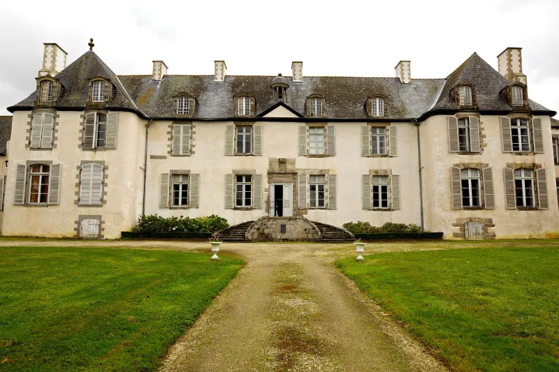
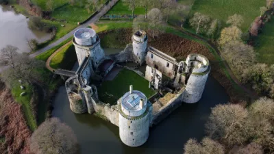
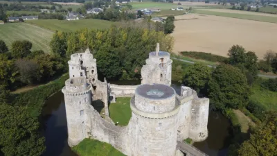
La Moglais Castle
No reviews yet
Have you flown here? Share your experience with other pilots.
+ Write the first reviewHistory
18e siècle ; 1ère moitié 19e siècle Le domaine de la Moglais comprend un château achevé vers 1734 environné de communs et d'un parc à la française. Sous la Restauration, le château et le parc sont réaménagés, ce dernier conservant de cette époque plusieurs bâtiments décorés de façades à l'Italienne, parmi lesquels une orangerie et un petit théâtre ou salle des fêtes. La partie du logis ayant échappé à l'incendie de 1941 a conservé sa distribution et un décor de grande qualité datant du début du 19ème siècle. Deux chambres, au premier étage, sont ornées de papiers peints panoramique ainsi qu'une chambre située au premier étage de l'aile sud.
Map and restricted areas
Open in the main mapRestricted zones
| Zone | Category | Limits | Conditions |
|---|---|---|---|
| Argoat | Zone réglementée | 3053 m above sea level → 6259 m above sea level | Vols interdits sauf lorsque the official document of the zone l'autorise explicitement ou avec l'accord du gestionnaire de la zone lorsqu'il est désigné par the official document of the zone |
Nearby aerodromes
Open aerodromes within 25 km of the spot, heliports included, with their distance and direction from the spot. Near an aerodrome, drone flying is prohibited or height-limited: check the UAS zones map.
| Aerodrome | Type | Distance | Elevation |
|---|---|---|---|
| Centre Hospitalier Heliport | Heliport | 20 km W | 108 m |
Aviation weather (METAR and TAF)
LFRT – Saint-Brieuc-Armor Airport VFR
METAR
METAR LFRT 171330Z AUTO 23023G36KT 9999 BKN031 BKN043 15/10 Q0987
- Wind
- 230°, 43 km/h, gusts 67 km/h
- Visibility
- 10 km or more
- Clouds
- Broken (5-7/8) at 3,100 ft (940 m) ; Broken (5-7/8) at 4,300 ft (1310 m)
- Temperature
- 15 °C, dew point 10 °C
- QNH
- 987 hPa
- Flight category
- VFR: ceiling > 3,000 ft and visibility > 5 mi
TAF
Weather and Kp index
| Day | Weather | Temp. min. / max. | Wind | Rain | Max Kp |
|---|---|---|---|---|---|
| Tue 17 Nov | Heavy rain | 11° / 13° | 42 km/h SW | 3.5 mm | 5 |
| Wed 18 Nov | Fair | 10° / 14° | 34 km/h S | 5.1 mm | 5 |
| Thu 19 Nov | Cloudy | 9° / 13° | 34 km/h SW | 0.4 mm | 3 |
| Fri 20 Nov | Cloudy | 10° / 13° | 32 km/h SW | 0.4 mm | 3 |
| Sat 21 Nov | Cloudy | 8° / 13° | 21 km/h SE | 1.1 mm | – |
| Sun 22 Nov | Light rain | 9° / 12° | 27 km/h W | 12 mm | – |
| Mon 23 Nov | Clear sky | 6° / 13° | 17 km/h S | 0.3 mm | – |
Hour by hour: Tuesday 17 November
| Time | Weather | Temp. | Wind | Rain | Clouds | Kp |
|---|---|---|---|---|---|---|
| 15:00 | Heavy rain | 13° | 42 km/h SW | 2.3 mm | 100 % | 4 |
| 16:00 | Heavy rain | 12° | 37 km/h SW | 1.2 mm | 100 % | 4 |
| 17:00 | Partly cloudy | 12° | 32 km/h SW | – | 79 % | 4 |
| 18:00 | Partly cloudy | 12° | 33 km/h W | – | 41 % | 4 |
| 19:00 | Fair | 12° | 32 km/h W | – | 23 % | 5 |
| 20:00 | Fair | 11° | 31 km/h W | – | 26 % | 5 |
| 21:00 | Fair | 11° | 30 km/h SW | – | 22 % | 5 |
| 22:00 | Partly cloudy | 11° | 32 km/h SW | – | 54 % | 5 |
Hour by hour: Wednesday 18 November
| Time | Weather | Temp. | Wind | Rain | Clouds | Kp |
|---|---|---|---|---|---|---|
| 06:00 | Partly cloudy | 10° | 31 km/h SW | – | 55 % | 4 |
| 07:00 | Partly cloudy | 10° | 30 km/h SW | – | 59 % | 4 |
| 08:00 | Partly cloudy | 10° | 27 km/h SW | – | 44 % | 4 |
| 09:00 | Partly cloudy | 10° | 27 km/h SW | – | 48 % | 4 |
| 10:00 | Fair | 12° | 28 km/h SW | – | 26 % | 4 |
| 11:00 | Fair | 12° | 25 km/h SW | – | 23 % | 4 |
| 12:00 | Fair | 13° | 26 km/h SW | – | 13 % | 4 |
| 13:00 | Fair | 14° | 28 km/h SW | – | 20 % | 3 |
| 14:00 | Fair | 14° | 28 km/h SW | – | 29 % | 3 |
| 15:00 | Partly cloudy | 14° | 29 km/h SW | – | 84 % | 3 |
| 16:00 | Cloudy | 14° | 27 km/h SW | – | 99 % | 3 |
| 17:00 | Heavy rain | 13° | 29 km/h SW | 1.9 mm | 100 % | 3 |
| 18:00 | Rain | 11° | 29 km/h SW | 0.9 mm | 100 % | 3 |
| 19:00 | Showers | 11° | 29 km/h S | 2.0 mm | 85 % | 2 |
| 20:00 | Partly cloudy | 11° | 34 km/h S | – | 52 % | 2 |
| 21:00 | Showers | 11° | 32 km/h SW | 0.1 mm | 47 % | 2 |
| 22:00 | Showers | 11° | 31 km/h SW | 0.2 mm | 78 % | 2 |
Sunrise and sunset
| Day | Dawn | Sunrise | Golden hour | Sunset | Dusk | Day length |
|---|---|---|---|---|---|---|
| Tue 17 Nov | 07:46 | 08:21 | 08:21–09:10 · 16:40–17:29 | 17:29 | 18:03 | 9 h 08 |
| Wed 18 Nov | 07:48 | 08:22 | 08:22–09:12 · 16:38–17:28 | 17:28 | 18:02 | 9 h 05 |
| Thu 19 Nov | 07:49 | 08:24 | 08:24–09:14 · 16:37–17:27 | 17:27 | 18:01 | 9 h 03 |
| Fri 20 Nov | 07:51 | 08:25 | 08:25–09:15 · 16:36–17:26 | 17:26 | 18:00 | 9 h 00 |
| Sat 21 Nov | 07:52 | 08:27 | 08:27–09:17 · 16:35–17:25 | 17:25 | 18:00 | 8 h 58 |
| Sun 22 Nov | 07:53 | 08:28 | 08:28–09:19 · 16:33–17:24 | 17:24 | 17:59 | 8 h 55 |
| Mon 23 Nov | 07:55 | 08:30 | 08:30–09:20 · 16:32–17:23 | 17:23 | 17:58 | 8 h 53 |

Reviews (0)
Log in to review this spot. Log in · Create a free account
No reviews yet. Share yours!