

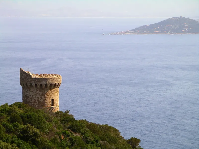
Capo-di-Muro or Capu-di-Muru Tower
No reviews yet
Have you flown here? Share your experience with other pilots.
+ Write the first reviewHistory
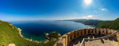
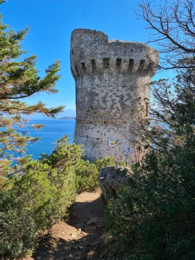
16e siècle ; 17e siècle Construite entre 1580 et 1617, la tour faisait partie de la juridiction d'Ajaccio et relevait de la Camera. Elle était gardée par un chef et deux soldats. A la fin du 17e siècle, elle est privatisée. En 1857, elle est affectée aux phares et balises. C'est une tour ronde couverte d'une terrasse ceinte de mâchicoulis. Elle présente un appareil en gros moellons de granit. La porte d'accès se situe à l'étage. Elle relèverait de la typologie classique des tours du littoral si elle ne se distinguait par l'aménagement complet de son étage : grande niche, puits de citerne, cheminée et four. L'escalier d'accès à la terrasse prend son départ au-dessus du grand ébrasement dans lequel s'inscrit la baie unique. Sur la terrasse, la plateforme qui couvrait l'abri de l'escalier a disparu.
Map and restricted areas
Open in the main mapRestricted zones
| Zone | Category | Limits | Conditions |
|---|---|---|---|
| Ctr Ajaccio |
Zone de contrôle civile | 50 m above ground level → 610 m above ground level · 50 m above ground level → 762 m above sea level | Flights above 50 metres are forbidden without the prior agreement of air traffic control |
| Zena Med | Zone dangereuse | 5491 m above sea level → 9003 m above sea level | Vols interdits sauf lorsque the official document of the zone l'autorise explicitement ou avec l'accord du gestionnaire de la zone lorsqu'il est désigné par the official document of the zone |
Nearby aerodromes
Open aerodromes within 25 km of the spot, heliports included, with their distance and direction from the spot. Near an aerodrome, drone flying is prohibited or height-limited: check the UAS zones map.
| Aerodrome | Type | Distance | Elevation |
|---|---|---|---|
| Propriano Airport | Aerodrome | 20 km SE | 4 m |
| Ajaccio-Napoléon Bonaparte Airport | Airport | 22 km NE | 5 m |
Aviation weather (METAR and TAF)
LFKJ – Ajaccio-Napoléon Bonaparte Airport VFR
METAR
METAR LFKJ 171330Z AUTO 22010KT 9000 SCT023/// BKN031/// BKN038/// ///TCU 20/18 Q1009 NOSIG
- Wind
- 220°, 19 km/h
- Visibility
- 9 km
- Clouds
- Scattered (3-4/8) at 2,300 ft (700 m) ; Broken (5-7/8) at 3,100 ft (940 m) ; Broken (5-7/8) at 3,800 ft (1160 m)
- Temperature
- 20 °C, dew point 18 °C
- QNH
- 1009 hPa
- Flight category
- VFR: ceiling > 3,000 ft and visibility > 5 mi
TAF
TAF LFKJ 170800Z 1709/1809 VRB05KT 9999 BKN020 BECMG 1709/1710 22014KT TEMPO 1709/1724 -SHRA SCT020TCU BECMG 1722/1724 VRB02KT
| Period (local time) | Change | Wind | Visibility | Weather | Clouds |
|---|---|---|---|---|---|
| 17/11 10:00 → 18/11 10:00 | Initial conditions | Variable, 9 km/h | 10 km or more | Broken (5-7/8) at 2,000 ft (610 m) | |
| 17/11 10:00 → 17/11 23:00 | Becoming | 220°, 26 km/h | 10 km or more | Broken (5-7/8) at 2,000 ft (610 m) | |
| 17/11 10:00 → 18/11 01:00 | Temporarily | Showers of rain light | Scattered (3-4/8) at 2,000 ft (610 m) (towering cumulus) | ||
| 17/11 23:00 → 18/11 10:00 | Becoming | Variable, 4 km/h | 10 km or more | Broken (5-7/8) at 2,000 ft (610 m) |
Weather and Kp index
Sunrise and sunset
| Day | Dawn | Sunrise | Golden hour | Sunset | Dusk | Day length |
|---|---|---|---|---|---|---|
| Tue 17 Nov | 06:47 | 07:17 | 07:17–07:59 · 16:22–17:04 | 17:04 | 17:33 | 9 h 46 |
| Wed 18 Nov | 06:48 | 07:18 | 07:18–08:00 · 16:21–17:03 | 17:03 | 17:33 | 9 h 44 |
| Thu 19 Nov | 06:49 | 07:19 | 07:19–08:02 · 16:20–17:02 | 17:02 | 17:32 | 9 h 42 |
| Fri 20 Nov | 06:50 | 07:21 | 07:21–08:03 · 16:19–17:01 | 17:01 | 17:31 | 9 h 40 |
| Sat 21 Nov | 06:52 | 07:22 | 07:22–08:04 · 16:18–17:01 | 17:01 | 17:31 | 9 h 38 |
| Sun 22 Nov | 06:53 | 07:23 | 07:23–08:05 · 16:17–17:00 | 17:00 | 17:30 | 9 h 37 |
| Mon 23 Nov | 06:54 | 07:24 | 07:24–08:07 · 16:17–16:59 | 16:59 | 17:30 | 9 h 35 |

Reviews (0)
Log in to review this spot. Log in · Create a free account
No reviews yet. Share yours!