

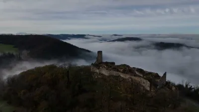
Caborde on Planoise Hill, at Les Equeugniers
No reviews yet
Have you flown here? Share your experience with other pilots.
+ Write the first reviewHistory
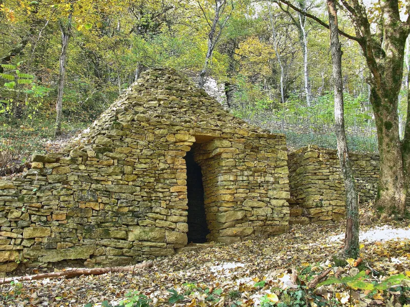
A Besançon, la culture de la vigne a eu une grande importance dès le Moyen Age. Elle a investi les versants des collines où subsistent des murets de soutènement et quelques cabanes en pierre sèche, les cabordes. Ces dernières figurent sur le plan cadastral de 1834. La caborde qui subsiste sur le versant sud-est de la colline de Planoise est de plan circulaire, comme c'est généralement le cas, mais elle intègre le muret de soutènement d'une vigne dans sa face antérieure. Elle se trouve en partie enterrée dans la parcelle supérieure. Elle est couverte d'une coupole en tas-de-charge en forme de clocher débordant le mur. A l'intérieur, le mur s'incurve à partir du sol.
Map and restricted areas
Open in the main mapRestricted zones
| Zone | Category | Limits | Conditions |
|---|---|---|---|
| (mirage 2000 Ne) | Zone réglementée | 457 m above ground level → 1524 m above ground level | Vols interdits sauf lorsque the official document of the zone l'autorise explicitement ou avec l'accord du gestionnaire de la zone lorsqu'il est désigné par the official document of the zone |
| Mirage 2000 Ne | Zone réglementée | 1524 m above ground level → 3821 m above sea level | Vols interdits sauf lorsque the official document of the zone l'autorise explicitement ou avec l'accord du gestionnaire de la zone lorsqu'il est désigné par the official document of the zone |
| Zrt Treveri | ZRT | From about 14,950 m to about 16,750 m above sea level | SUP AIP 233/24 · Du 16 janvier 2025 au 13 janvier 2027 |
Nearby aerodromes
Open aerodromes within 25 km of the spot, heliports included, with their distance and direction from the spot. Near an aerodrome, drone flying is prohibited or height-limited: check the UAS zones map.
| Aerodrome | Type | Distance | Elevation |
|---|---|---|---|
| Hôpital Jean Minjoz Heliport | Heliport | 2.7 km NW | 285 m |
| Aérodrome de Besançon-La Vèze | Aerodrome | 7.4 km E | 387 m |
| Besançon–Thise Airfield | Aerodrome | 11 km NE | 246 m |
Aviation weather (METAR and TAF)
LFGJ – Dole-Tavaux Airport VFR
METAR
METAR LFGJ 171330Z AUTO 20017KT 9999 FEW025 BKN063 16/12 Q0999 TEMPO 21020G35KT SCT020TCU
- Wind
- 200°, 31 km/h
- Visibility
- 10 km or more
- Clouds
- Few (1-2/8) at 2,500 ft (760 m) ; Broken (5-7/8) at 6,300 ft (1920 m)
- Temperature
- 16 °C, dew point 12 °C
- QNH
- 999 hPa
- Flight category
- VFR: ceiling > 3,000 ft and visibility > 5 mi
TAF
TAF LFGJ 171100Z 1712/1721 21015G25KT 9999 OVC025 TEMPO 1712/1715 21020G35KT PROB40 TEMPO 1712/1721 -SHRA SCT020TCU
| Period (local time) | Change | Wind | Visibility | Weather | Clouds |
|---|---|---|---|---|---|
| 17/11 13:00 → 17/11 22:00 | Initial conditions | 210°, 28 km/h, gusts 46 km/h | 10 km or more | Overcast (8/8) at 2,500 ft (760 m) | |
| 17/11 13:00 → 17/11 16:00 | Temporarily | 210°, 37 km/h, gusts 65 km/h | |||
| 17/11 13:00 → 17/11 22:00 | Temporarily, probability 40% | Showers of rain light | Scattered (3-4/8) at 2,000 ft (610 m) (towering cumulus) |
Weather and Kp index
Sunrise and sunset
| Day | Dawn | Sunrise | Golden hour | Sunset | Dusk | Day length |
|---|---|---|---|---|---|---|
| Tue 17 Nov | 07:10 | 07:43 | 07:43–08:31 · 16:11–16:59 | 16:59 | 17:32 | 9 h 16 |
| Wed 18 Nov | 07:11 | 07:44 | 07:44–08:32 · 16:10–16:58 | 16:58 | 17:32 | 9 h 13 |
| Thu 19 Nov | 07:12 | 07:46 | 07:46–08:34 · 16:09–16:57 | 16:57 | 17:31 | 9 h 11 |
| Fri 20 Nov | 07:14 | 07:47 | 07:47–08:35 · 16:08–16:56 | 16:56 | 17:30 | 9 h 08 |
| Sat 21 Nov | 07:15 | 07:49 | 07:49–08:37 · 16:07–16:55 | 16:55 | 17:29 | 9 h 06 |
| Sun 22 Nov | 07:16 | 07:50 | 07:50–08:39 · 16:06–16:54 | 16:54 | 17:28 | 9 h 04 |
| Mon 23 Nov | 07:17 | 07:51 | 07:51–08:40 · 16:05–16:54 | 16:54 | 17:27 | 9 h 02 |
Reviews (0)
Log in to review this spot. Log in · Create a free account
No reviews yet. Share yours!