

Penhoat Castle
No reviews yet
Have you flown here? Share your experience with other pilots.
+ Write the first reviewHistory
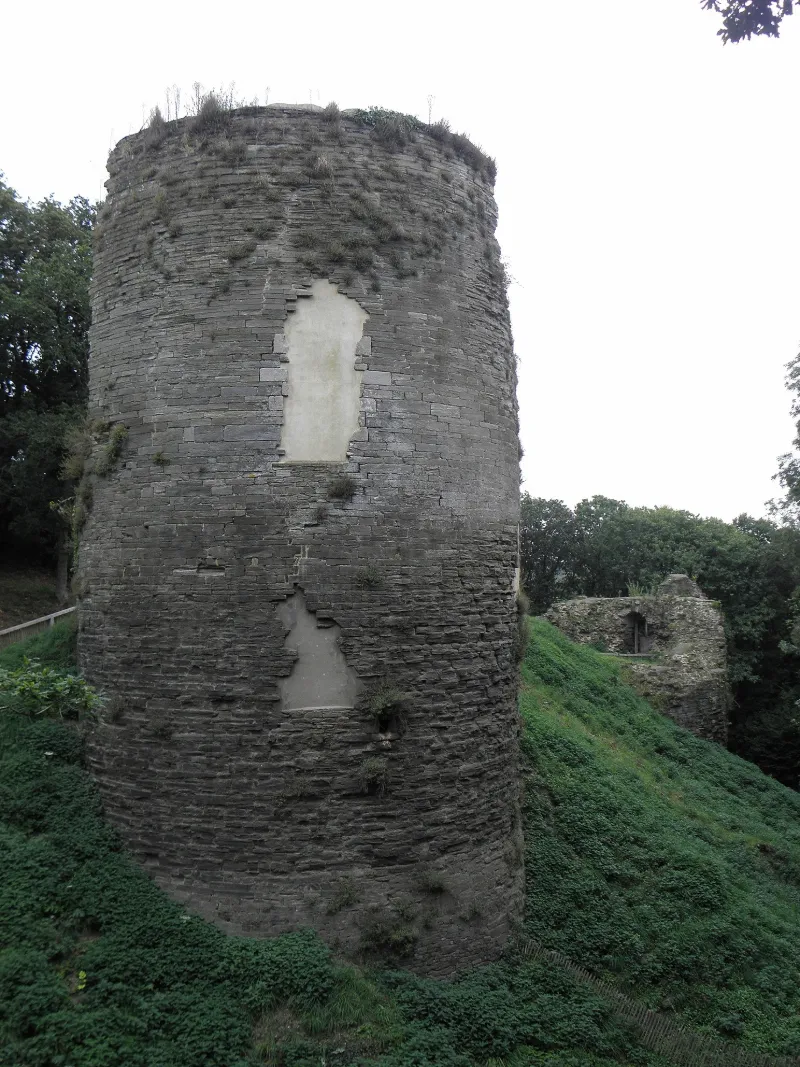
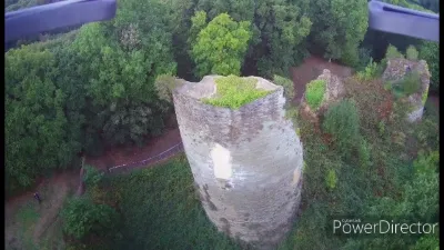
13e siècle ; 15e siècle La forteresse aurait été construite au 13e siècle par Guillaume, sire de Penhoat, à son retour de croisade. Ses dispositions ont évolué en fonction des progrès de l'artillerie et les vestiges subsistant semblent dater du 15e siècle. Suite aux destructions dues aux guerres de la Ligue, ne subsistent que deux tronçons des tours cylindriques sud et nord, construites en moellons de schiste, ainsi qu'un pan de la courtine Est. La tour sud était surmontée d'un châtelet. Une courtine, dont le tracé reste visible, devait relier les deux tours, et celles-ci au donjon. Au sud devait se trouver une enceinte rectangulaire défendue par un second fossé.
Map and restricted areas
Open in the main mapRestricted zones
| Zone | Category | Limits | Conditions |
|---|---|---|---|
| Tma Iroise |
Région de contrôle terminal | 457 m above sea level → 6259 m above sea level · 762 m above sea level → 3821 m above sea level · 762 m above sea level → 6259 m above sea level · 1372 m above sea level → 6259 m above sea level · 3053 m above sea level → 6259 m above sea level | Drone flights inside this zone are forbidden without the prior agreement of air traffic control |
Nearby aerodromes
Open aerodromes within 25 km of the spot, heliports included, with their distance and direction from the spot. Near an aerodrome, drone flying is prohibited or height-limited: check the UAS zones map.
| Aerodrome | Type | Distance | Elevation |
|---|---|---|---|
| Morlaix-Ploujean Airport | Airport | 8.5 km E | 83 m |
| Landivisiau Air Base | Airport | 18 km W | 106 m |
Aviation weather (METAR and TAF)
LFRU – Morlaix-Ploujean Airport MVFR
METAR
METAR LFRU 171330Z AUTO 24028G44KT 6000 -RA BKN028/// BKN039/// BKN046/// ///CB 14/10 Q0987
- Wind
- 240°, 52 km/h, gusts 81 km/h
- Visibility
- 6 km
- Weather
- Rain light
- Clouds
- Broken (5-7/8) at 2,800 ft (850 m) ; Broken (5-7/8) at 3,900 ft (1190 m) ; Broken (5-7/8) at 4,600 ft (1400 m)
- Temperature
- 14 °C, dew point 10 °C
- QNH
- 987 hPa
- Flight category
- MVFR: ceiling 1,000–3,000 ft or visibility 3–5 mi
TAF
Weather and Kp index
| Day | Weather | Temp. min. / max. | Wind | Rain | Max Kp |
|---|---|---|---|---|---|
| Tue 17 Nov | Rain | 10° / 12° | 42 km/h SW | 2.0 mm | 5 |
| Wed 18 Nov | Showers | 9° / 14° | 38 km/h SW | 7.8 mm | 5 |
| Thu 19 Nov | Light rain | 9° / 12° | 37 km/h W | 4.7 mm | 3 |
| Fri 20 Nov | Light rain | 9° / 13° | 44 km/h SW | 2.4 mm | 3 |
| Sat 21 Nov | Fair | 9° / 13° | 24 km/h SE | 5.3 mm | – |
| Sun 22 Nov | Light rain | 9° / 12° | 29 km/h SE | 11 mm | – |
| Mon 23 Nov | Fair | 8° / 14° | 20 km/h S | 3.5 mm | – |
Hour by hour: Tuesday 17 November
| Time | Weather | Temp. | Wind | Rain | Clouds | Kp |
|---|---|---|---|---|---|---|
| 15:00 | Rain | 12° | 42 km/h SW | 0.5 mm | 100 % | 4 |
| 16:00 | Partly cloudy | 12° | 36 km/h SW | – | 48 % | 4 |
| 17:00 | Partly cloudy | 12° | 36 km/h SW | – | 56 % | 4 |
| 18:00 | Fair | 12° | 35 km/h SW | – | 27 % | 4 |
| 19:00 | Fair | 12° | 34 km/h SW | – | 35 % | 5 |
| 20:00 | Showers | 12° | 33 km/h SW | 0.1 mm | 36 % | 5 |
| 21:00 | Rain | 12° | 39 km/h SW | 0.8 mm | 89 % | 5 |
| 22:00 | Showers | 10° | 34 km/h SW | 0.3 mm | 84 % | 5 |
Hour by hour: Wednesday 18 November
| Time | Weather | Temp. | Wind | Rain | Clouds | Kp |
|---|---|---|---|---|---|---|
| 06:00 | Partly cloudy | 10° | 31 km/h SW | – | 66 % | 4 |
| 07:00 | Showers | 10° | 28 km/h SW | 0.4 mm | 57 % | 4 |
| 08:00 | Showers | 9° | 31 km/h SW | 0.3 mm | 82 % | 4 |
| 09:00 | Partly cloudy | 10° | 29 km/h SW | – | 46 % | 4 |
| 10:00 | Partly cloudy | 11° | 34 km/h SW | – | 45 % | 4 |
| 11:00 | Fair | 12° | 31 km/h SW | – | 26 % | 4 |
| 12:00 | Fair | 13° | 29 km/h SW | – | 16 % | 4 |
| 13:00 | Showers | 14° | 28 km/h SW | 0.2 mm | 12 % | 3 |
| 14:00 | Light rain | 13° | 33 km/h SW | 0.1 mm | 93 % | 3 |
| 15:00 | Cloudy | 14° | 32 km/h SW | – | 97 % | 3 |
| 16:00 | Heavy rain | 13° | 31 km/h SW | 1.2 mm | 100 % | 3 |
| 17:00 | Heavy rain | 11° | 31 km/h SW | 1.4 mm | 98 % | 3 |
| 18:00 | Rain | 11° | 32 km/h S | 1.0 mm | 100 % | 3 |
| 19:00 | Light rain | 11° | 28 km/h SW | 0.3 mm | 99 % | 2 |
| 20:00 | Rain | 11° | 33 km/h SW | 0.8 mm | 94 % | 2 |
| 21:00 | Light rain | 10° | 29 km/h SW | 0.1 mm | 93 % | 2 |
| 22:00 | Partly cloudy | 9° | 27 km/h SW | – | 44 % | 2 |
Sunrise and sunset
| Day | Dawn | Sunrise | Golden hour | Sunset | Dusk | Day length |
|---|---|---|---|---|---|---|
| Tue 17 Nov | 07:53 | 08:27 | 08:27–09:16 · 16:45–17:34 | 17:34 | 18:09 | 9 h 07 |
| Wed 18 Nov | 07:54 | 08:28 | 08:28–09:18 · 16:43–17:33 | 17:33 | 18:08 | 9 h 04 |
| Thu 19 Nov | 07:55 | 08:30 | 08:30–09:20 · 16:42–17:32 | 17:32 | 18:07 | 9 h 02 |
| Fri 20 Nov | 07:57 | 08:31 | 08:31–09:22 · 16:41–17:31 | 17:31 | 18:06 | 8 h 59 |
| Sat 21 Nov | 07:58 | 08:33 | 08:33–09:23 · 16:40–17:30 | 17:30 | 18:05 | 8 h 57 |
| Sun 22 Nov | 07:59 | 08:34 | 08:34–09:25 · 16:39–17:29 | 17:29 | 18:04 | 8 h 54 |
| Mon 23 Nov | 08:01 | 08:36 | 08:36–09:27 · 16:37–17:28 | 17:28 | 18:03 | 8 h 52 |
Reviews (0)
Log in to review this spot. Log in · Create a free account
No reviews yet. Share yours!