

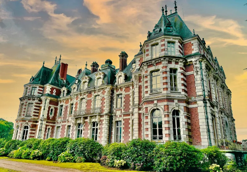
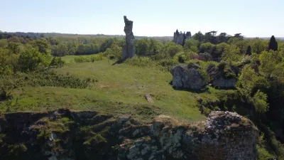
Jumellière Castle
No reviews yet
Have you flown here? Share your experience with other pilots.
+ Write the first reviewHistory
Cette propriété, dessinée sous le Second Empire pour Armand-Urbain, comte de Maillé, comprend un édifice élevé par l’architecte Henri Parent, entre 1858 et 1862, et agrandi par une extension vers 1874. Le domaine fut également complété par des dépendances (écuries, serres, cascade de rocailles, château d’eau, maison du jardinier, potager). Enfin, un parc paysager fut aménagé en 1867.
Map and restricted areas
Open in the main mapRestricted zones
Nearby aerodromes
Open aerodromes within 25 km of the spot, heliports included, with their distance and direction from the spot. Near an aerodrome, drone flying is prohibited or height-limited: check the UAS zones map.
| Aerodrome | Type | Distance | Elevation |
|---|---|---|---|
| Saint Sigismond ULM | Aerodrome | 23 km NW | 76 m |
| Cholet Le Pontreau Airport | Airport | 24 km SW | 135 m |
Aviation weather (METAR and TAF)
LFJR – Angers-Loire Airport VFR
METAR
METAR LFJR 171400Z AUTO 23017KT 9999 BKN031 BKN037 OVC170 16/11 Q0994
- Wind
- 230°, 31 km/h
- Visibility
- 10 km or more
- Clouds
- Broken (5-7/8) at 3,100 ft (940 m) ; Broken (5-7/8) at 3,700 ft (1130 m) ; Overcast (8/8) at 17,000 ft (5180 m)
- Temperature
- 16 °C, dew point 11 °C
- QNH
- 994 hPa
- Flight category
- VFR: ceiling > 3,000 ft and visibility > 5 mi
TAF
Weather and Kp index
Sunrise and sunset
| Day | Dawn | Sunrise | Golden hour | Sunset | Dusk | Day length |
|---|---|---|---|---|---|---|
| Tue 17 Nov | 07:37 | 08:10 | 08:10–08:58 · 16:38–17:26 | 17:26 | 17:59 | 9 h 15 |
| Wed 18 Nov | 07:38 | 08:11 | 08:11–08:59 · 16:37–17:25 | 17:25 | 17:58 | 9 h 13 |
| Thu 19 Nov | 07:39 | 08:13 | 08:13–09:01 · 16:36–17:24 | 17:24 | 17:57 | 9 h 10 |
| Fri 20 Nov | 07:41 | 08:14 | 08:14–09:03 · 16:34–17:23 | 17:23 | 17:57 | 9 h 08 |
| Sat 21 Nov | 07:42 | 08:16 | 08:16–09:04 · 16:33–17:22 | 17:22 | 17:56 | 9 h 06 |
| Sun 22 Nov | 07:43 | 08:17 | 08:17–09:06 · 16:32–17:21 | 17:21 | 17:55 | 9 h 03 |
| Mon 23 Nov | 07:44 | 08:19 | 08:19–09:08 · 16:31–17:20 | 17:20 | 17:54 | 9 h 01 |
Reviews (0)
Log in to review this spot. Log in · Create a free account
No reviews yet. Share yours!