

Ville Der Castle
No reviews yet
Have you flown here? Share your experience with other pilots.
+ Write the first reviewHistory
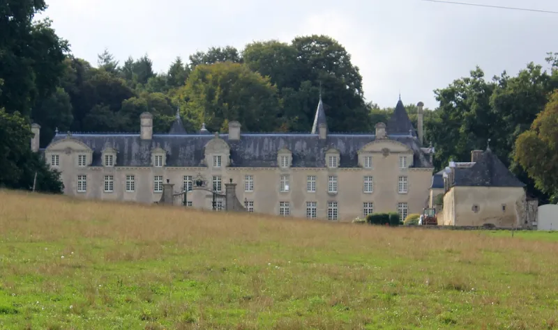
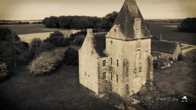
La seigneurie est attestée au 16e siècle. A l'origine, le domaine se composait d'une grande maison avec, de chaque côté, des dépendances. L'entrée était limitée par deux piliers en granit sur un pont surmontant les douves. A l'intérieur, les pièces étaient établies en enfilade. Ce manoir correspondait aux reprises des 17-18e siècles d'un logis fortifié du 15e siècle dont subsiste la tour octogonale et un escalier à vis intérieur. La construction des communs date de 1775. Entre 1896 et 1900, l'ensemble est transformé en un domaine de style classique. L'élévation antérieure est complètement recomposée. Une aile nord est ajoutée. Un pavillon saillant rectangulaire est ajouté à l'élévation postérieure ouest, auquel est accolé dans l'angle intérieur nord une tourelle de latrines. Une galerie fermée relie l'aile nord et la tourelle d'escalier du 15e siècle. Deux pavillons sont construits au nord et au sud, reliés à l'édifice par une porte qui ferme la cour et dans le prolongement desquels s'établissent les deux ailes de communs recomposés. Création d'un jardin à la française dans la cour d'honneur. Le décor intérieur comprend lambris, plafond peint, cheminée monumentale... Le remaniement de ce domaine illustre un type de restauration visant à monumentaliser un édifice existant par un agrandissement symétrique et une composition générale s'inspirant de l'architecture du 17e siècle.
Map and restricted areas
Open in the main mapRestricted zones
| Zone | Category | Limits | Conditions |
|---|---|---|---|
| Loudeac | Zone réglementée | 1372 m above sea level → 3821 m above sea level | Vols interdits sauf lorsque the official document of the zone l'autorise explicitement ou avec l'accord du gestionnaire de la zone lorsqu'il est désigné par the official document of the zone |
| Loudeac | Zone réglementée | 3053 m above sea level → 6259 m above sea level | Vols interdits sauf lorsque the official document of the zone l'autorise explicitement ou avec l'accord du gestionnaire de la zone lorsqu'il est désigné par the official document of the zone |
| Argoat | Zone réglementée | 3053 m above sea level → 6259 m above sea level | Vols interdits sauf lorsque the official document of the zone l'autorise explicitement ou avec l'accord du gestionnaire de la zone lorsqu'il est désigné par the official document of the zone |
Nearby aerodromes
Open aerodromes within 25 km of the spot, heliports included, with their distance and direction from the spot. Near an aerodrome, drone flying is prohibited or height-limited: check the UAS zones map.
| Aerodrome | Type | Distance | Elevation |
|---|---|---|---|
| Ploërmel Loyat Airfield | Aerodrome | 16 km NE | 72 m |
| Coëtquidan Air Base | Aerodrome | 22 km NE | 130 m |
| Vannes-Meucon Airport | Airport | 25 km SW | 136 m |
Aviation weather (METAR and TAF)
LFRV – Vannes-Meucon Airport MVFR
METAR
METAR LFRV 171400Z AUTO 23017G30KT 190V270 8000 BKN014 OVC100 15/12 Q0991
- Wind
- 230°, 31 km/h, gusts 56 km/h
- Visibility
- 8 km
- Clouds
- Broken (5-7/8) at 1,400 ft (430 m) ; Overcast (8/8) at 10,000 ft (3050 m)
- Temperature
- 15 °C, dew point 12 °C
- QNH
- 991 hPa
- Flight category
- MVFR: ceiling 1,000–3,000 ft or visibility 3–5 mi
TAF
Weather and Kp index
Sunrise and sunset
| Day | Dawn | Sunrise | Golden hour | Sunset | Dusk | Day length |
|---|---|---|---|---|---|---|
| Tue 17 Nov | 07:45 | 08:19 | 08:19–09:07 · 16:42–17:31 | 17:31 | 18:05 | 9 h 12 |
| Wed 18 Nov | 07:46 | 08:20 | 08:20–09:09 · 16:41–17:30 | 17:30 | 18:04 | 9 h 09 |
| Thu 19 Nov | 07:48 | 08:22 | 08:22–09:11 · 16:40–17:29 | 17:29 | 18:03 | 9 h 07 |
| Fri 20 Nov | 07:49 | 08:23 | 08:23–09:12 · 16:39–17:28 | 17:28 | 18:02 | 9 h 04 |
| Sat 21 Nov | 07:50 | 08:25 | 08:25–09:14 · 16:37–17:27 | 17:27 | 18:01 | 9 h 02 |
| Sun 22 Nov | 07:52 | 08:26 | 08:26–09:16 · 16:36–17:26 | 17:26 | 18:00 | 8 h 59 |
| Mon 23 Nov | 07:53 | 08:27 | 08:27–09:17 · 16:35–17:25 | 17:25 | 18:00 | 8 h 57 |
Reviews (0)
Log in to review this spot. Log in · Create a free account
No reviews yet. Share yours!