

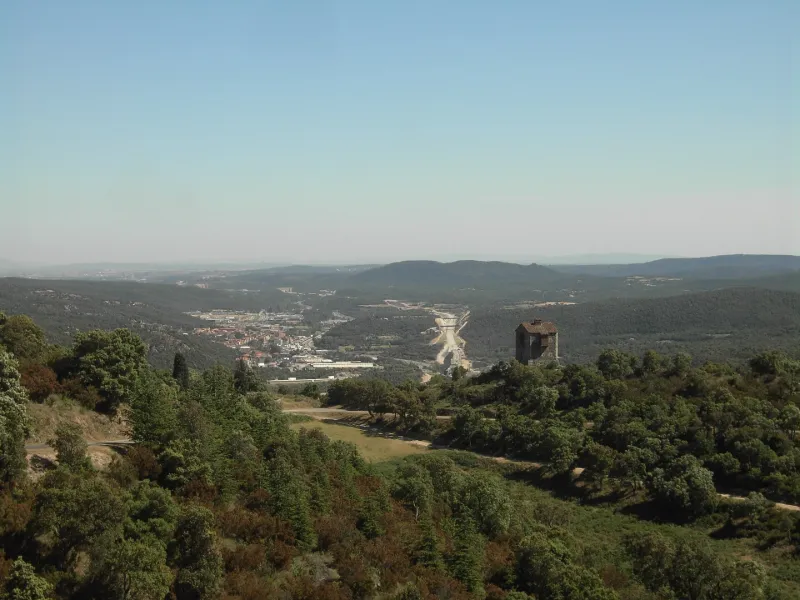
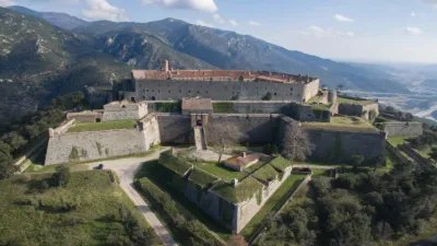
Panissars Archaeological Site, located at the Panissars Pass
No reviews yet
Have you flown here? Share your experience with other pilots.
+ Write the first reviewHistory
La voie domitienne, créée à partir de 118 av. J-C, est conservée en totalité dans sa largeur. Cette voie est une artère principale : une partie de milliaire romain dont l'inscription pourrait correspondre à Constantin y a été mise au jour. Les fondations du trophée de Pompée ont été aménagées pour recevoir un grand appareil de blocs de grès d'origine maritime. Dans l'angle nord-est, ces tranchées ont été installées en « gradins », technique héritée des Grecs et utilisée par les Romains jusqu'à l'époque d'Auguste. Ce trophée est le premier exemple de ce type de construction monumentale célébrant la suprématie de Rome sur le monde méditerranéen et européen. Concernant les ruines médiévales du prieuré Sainte-Marie, l'église se composait d'une nef en plan barlong, d'une abside surélevée, d'une crypte et d'une avant-nef. Elle fut consacrée en 1011 et devînt prieuré à la fin du 11ème siècle
Map and restricted areas
Open in the main mapRestricted zones
Nearby aerodromes
Open aerodromes within 25 km of the spot, heliports included, with their distance and direction from the spot. Near an aerodrome, drone flying is prohibited or height-limited: check the UAS zones map.
| Aerodrome | Type | Distance | Elevation |
|---|---|---|---|
| Base ULM Saint Génis | Aerodrome | 11 km NE | 46 m |
| Torre-Blanc Llauro | Aerodrome | 15 km NW | 460 m |
| Aeródromo de Ordis | Aerodrome | 25 km S | 680 m |
| Centre Medical du Cap Peyrefite Heliport | Heliport | 25 km E | 15 m |
Aviation weather (METAR and TAF)
LFMP – Perpignan-Rivesaltes (Llabanère) Airport VFR
METAR
METAR LFMP 171400Z AUTO 12005KT 090V150 CAVOK 16/13 Q1005 NOSIG
- Wind
- 120°, 9 km/h
- Visibility
- 10 km or more
- Clouds
- –
- Temperature
- 16 °C, dew point 13 °C
- QNH
- 1005 hPa
- Flight category
- VFR: ceiling > 3,000 ft and visibility > 5 mi
TAF
TAF LFMP 170800Z 1709/1809 VRB02KT 9999 BKN008 BECMG 1710/1712 CAVOK BECMG 1806/1808 28012KT
| Period (local time) | Change | Wind | Visibility | Weather | Clouds |
|---|---|---|---|---|---|
| 17/11 10:00 → 17/11 11:00 | Initial conditions | Variable, 4 km/h | 10 km or more | Broken (5-7/8) at 800 ft (240 m) | |
| 17/11 11:00 → 18/11 07:00 | Becoming | Variable, 4 km/h | 10 km or more | No significant weather | No significant cloud |
| 18/11 07:00 → 18/11 10:00 | Becoming | 280°, 22 km/h | 10 km or more | No significant weather | No significant cloud |
Weather and Kp index
| Day | Weather | Temp. min. / max. | Wind | Rain | Max Kp |
|---|---|---|---|---|---|
| Tue 17 Nov | Cloudy | 12° / 18° | 13 km/h W | – | 5 |
| Wed 18 Nov | Cloudy | 11° / 18° | 20 km/h N | – | 5 |
| Thu 19 Nov | Clear sky | 9° / 18° | 39 km/h NW | 0.7 mm | 3 |
| Fri 20 Nov | Partly cloudy | 9° / 17° | 6 km/h NW | – | 3 |
| Sat 21 Nov | Cloudy | 11° / 17° | 7 km/h SE | – | – |
| Sun 22 Nov | Cloudy | 10° / 16° | 19 km/h NW | – | – |
| Mon 23 Nov | Partly cloudy | 8° / 14° | 6 km/h E | 0.6 mm | – |
Hour by hour: Tuesday 17 November
| Time | Weather | Temp. | Wind | Rain | Clouds | Kp |
|---|---|---|---|---|---|---|
| 15:00 | Cloudy | 18° | 7 km/h SE | – | 100 % | 4 |
| 16:00 | Cloudy | 17° | 8 km/h SE | – | 100 % | 4 |
| 17:00 | Cloudy | 15° | 11 km/h S | – | 98 % | 4 |
| 18:00 | Cloudy | 14° | 8 km/h S | – | 98 % | 4 |
| 19:00 | Cloudy | 13° | 12 km/h W | – | 90 % | 5 |
| 20:00 | Partly cloudy | 12° | 13 km/h W | – | 77 % | 5 |
| 21:00 | Cloudy | 12° | 12 km/h W | – | 90 % | 5 |
| 22:00 | Partly cloudy | 12° | 9 km/h NW | – | 84 % | 5 |
Hour by hour: Wednesday 18 November
| Time | Weather | Temp. | Wind | Rain | Clouds | Kp |
|---|---|---|---|---|---|---|
| 06:00 | Fair | 11° | 5 km/h SW | – | 37 % | 4 |
| 07:00 | Fair | 11° | 6 km/h SW | – | 13 % | 4 |
| 08:00 | Fair | 11° | 9 km/h W | – | 34 % | 4 |
| 09:00 | Partly cloudy | 14° | 11 km/h N | – | 71 % | 4 |
| 10:00 | Partly cloudy | 15° | 15 km/h N | – | 70 % | 4 |
| 11:00 | Partly cloudy | 15° | 20 km/h N | – | 42 % | 4 |
| 12:00 | Partly cloudy | 17° | 20 km/h NW | – | 54 % | 4 |
| 13:00 | Cloudy | 18° | 14 km/h S | – | 100 % | 3 |
| 14:00 | Cloudy | 18° | 10 km/h SE | – | 98 % | 3 |
| 15:00 | Cloudy | 18° | 8 km/h SE | – | 100 % | 3 |
| 16:00 | Cloudy | 17° | 8 km/h S | – | 100 % | 3 |
| 17:00 | Cloudy | 16° | 9 km/h S | – | 100 % | 3 |
| 18:00 | Cloudy | 15° | 9 km/h S | – | 100 % | 3 |
| 19:00 | Cloudy | 15° | 10 km/h S | – | 99 % | 2 |
| 20:00 | Partly cloudy | 14° | 9 km/h S | – | 81 % | 2 |
| 21:00 | Partly cloudy | 13° | 12 km/h S | – | 59 % | 2 |
| 22:00 | Partly cloudy | 12° | 13 km/h S | – | 77 % | 2 |
Sunrise and sunset
| Day | Dawn | Sunrise | Golden hour | Sunset | Dusk | Day length |
|---|---|---|---|---|---|---|
| Tue 17 Nov | 07:12 | 07:42 | 07:42–08:25 · 16:42–17:25 | 17:25 | 17:55 | 9 h 42 |
| Wed 18 Nov | 07:13 | 07:43 | 07:43–08:26 · 16:42–17:24 | 17:24 | 17:55 | 9 h 40 |
| Thu 19 Nov | 07:14 | 07:44 | 07:44–08:27 · 16:41–17:23 | 17:23 | 17:54 | 9 h 38 |
| Fri 20 Nov | 07:15 | 07:46 | 07:46–08:29 · 16:40–17:23 | 17:23 | 17:53 | 9 h 36 |
| Sat 21 Nov | 07:16 | 07:47 | 07:47–08:30 · 16:39–17:22 | 17:22 | 17:53 | 9 h 35 |
| Sun 22 Nov | 07:17 | 07:48 | 07:48–08:31 · 16:38–17:21 | 17:21 | 17:52 | 9 h 33 |
| Mon 23 Nov | 07:19 | 07:49 | 07:49–08:33 · 16:37–17:21 | 17:21 | 17:51 | 9 h 31 |

Reviews (0)
Log in to review this spot. Log in · Create a free account
No reviews yet. Share yours!