

Water
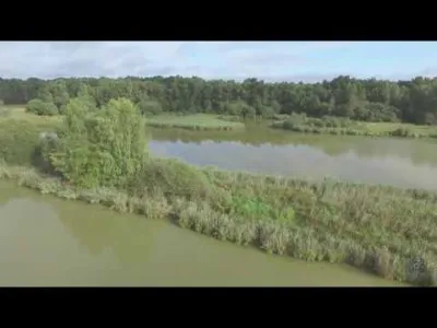
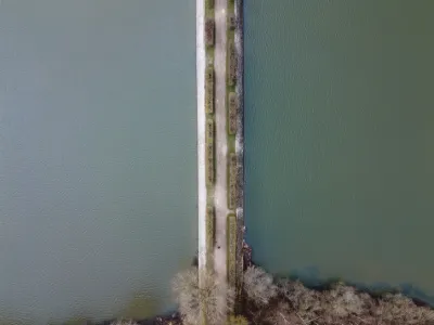
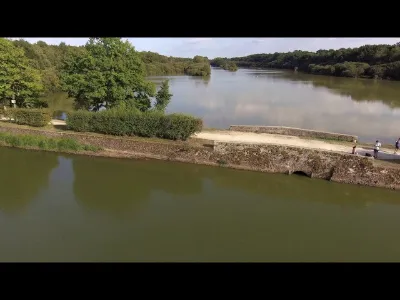
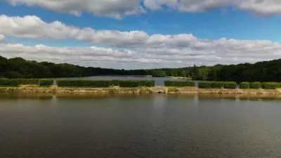
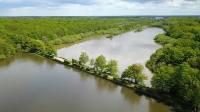
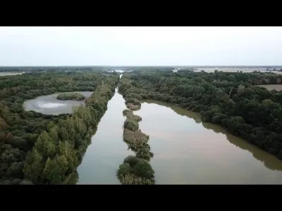
Etangs de Hollande
1 pilot review
“Agréable spot, mais il est difficile de garder à vue son drone car les arbres entourant le…” — Bim, 7 years ago
Read the reviews + Write my reviewDescription
Short flight on Saturday morning... Ponds of Holland - Etangs de Pourras, Les Bréviaires - DRONE
Map and restricted areas
Open in the main mapNearby aerodromes
Open aerodromes within 25 km of the spot, heliports included, with their distance and direction from the spot. Near an aerodrome, drone flying is prohibited or height-limited: check the UAS zones map.
| Aerodrome | Type | Distance | Elevation | Difference |
|---|---|---|---|---|
| Centre Hospitalier de Rambouillet | Heliport | 7.4 km S | 157 m | spot 14 m higher |
| Aérodrome de Beynes - Thiverval | Aerodrome | 15 km N | 113 m | spot 58 m higher |
| Chavenay Villepreux Airfield | Aerodrome | 18 km NE | 130 m | spot 41 m higher |
| Les Sangliers Heliport | Heliport | 19 km E | 158 m | spot 13 m higher |
| Toussus Le Noble Heliport | Heliport | 20 km E | 164 m | spot 7 m higher |
Aviation weather (METAR and TAF)
LFPN – Toussus-le-Noble Airport IFR
METAR
METAR LFPN 211100Z AUTO 17005KT 140V200 9999 OVC007 09/08 Q1018 BECMG BKN012
- Wind
- 170°, 9 km/h
- Visibility
- 10 km or more
- Clouds
- Overcast (8/8) at 700 ft (210 m)
- Temperature
- 9 °C, dew point 8 °C
- QNH
- 1018 hPa
- Flight category
- IFR: ceiling 500–1,000 ft or visibility 1–3 mi
TAF
TAF LFPN 211100Z 2112/2121 17005KT 9999 BKN012 PROB40 TEMPO 2112/2114 OVC008 BECMG 2114/2116 SCT020
| Period (local time) | Change | Wind | Visibility | Weather | Clouds |
|---|---|---|---|---|---|
| 21/11 13:00 → 21/11 15:00 | Initial conditions | 170°, 9 km/h | 10 km or more | Broken (5-7/8) at 1,200 ft (370 m) | |
| 21/11 13:00 → 21/11 15:00 | Temporarily, probability 40% | Overcast (8/8) at 800 ft (240 m) | |||
| 21/11 15:00 → 21/11 22:00 | Becoming | 170°, 9 km/h | 10 km or more | Scattered (3-4/8) at 2,000 ft (610 m) |
Weather and Kp index
| Day | Weather | Temp. min. / max. | Wind | Rain | Max Kp |
|---|---|---|---|---|---|
| Sat 21 Nov | Cloudy | 7° / 10° | 14 km/h E | – | 2 |
| Sun 22 Nov | Heavy rain | 7° / 7° | 15 km/h E | 26 mm | 2 |
| Mon 23 Nov | Clear sky | 1° / 8° | 22 km/h NE | 2.7 mm | 4 |
| Tue 24 Nov | Cloudy | -1° / 4° | 16 km/h E | – | 2 |
| Wed 25 Nov | Light rain | 1° / 4° | 16 km/h E | 3.1 mm | – |
| Thu 26 Nov | Clear sky | -3° / 1° | 14 km/h NE | – | – |
| Fri 27 Nov | Clear sky | -4° / 1° | 11 km/h E | – | – |
Hour by hour: Saturday 21 November
| Time | Weather | Temp. | Wind | Rain | Clouds | Kp |
|---|---|---|---|---|---|---|
| 12:00 | Cloudy | 9° | 7 km/h S | – | 100 % | 2 |
| 13:00 | Cloudy | 9° | 9 km/h S | – | 100 % | 1 |
| 14:00 | Cloudy | 10° | 8 km/h S | – | 100 % | 1 |
| 15:00 | Cloudy | 10° | 10 km/h SE | – | 100 % | 1 |
| 16:00 | Cloudy | 10° | 10 km/h SE | – | 100 % | 2 |
| 17:00 | Cloudy | 9° | 9 km/h SE | – | 100 % | 2 |
| 18:00 | Cloudy | 9° | 8 km/h SE | – | 100 % | 2 |
| 19:00 | Cloudy | 8° | 10 km/h E | – | 100 % | 2 |
| 20:00 | Cloudy | 8° | 10 km/h E | – | 100 % | 2 |
| 21:00 | Partly cloudy | 7° | 12 km/h E | – | 100 % | 2 |
| 22:00 | Cloudy | 7° | 14 km/h E | – | 100 % | 2 |
Hour by hour: Sunday 22 November
| Time | Weather | Temp. | Wind | Rain | Clouds | Kp |
|---|---|---|---|---|---|---|
| 06:00 | Rain | 7° | 15 km/h E | 0.6 mm | 100 % | 2 |
| 07:00 | Rain | 7° | 14 km/h E | 1.0 mm | 100 % | 2 |
| 08:00 | Heavy rain | 7° | 14 km/h E | 1.1 mm | 100 % | 2 |
| 09:00 | Rain | 7° | 14 km/h E | 1.0 mm | 100 % | 2 |
| 10:00 | Heavy rain | 7° | 13 km/h E | 1.4 mm | 100 % | 2 |
| 11:00 | Heavy rain | 7° | 12 km/h E | 1.7 mm | 100 % | 2 |
| 12:00 | Heavy rain | 7° | 11 km/h E | 1.2 mm | 100 % | 2 |
| 13:00 | Heavy rain | 7° | 10 km/h E | 1.2 mm | 100 % | 2 |
| 14:00 | Heavy rain | 7° | 10 km/h E | 1.1 mm | 100 % | 2 |
| 15:00 | Heavy rain | 7° | 8 km/h NE | 1.1 mm | 100 % | 2 |
| 16:00 | Rain | 7° | 8 km/h NE | 0.8 mm | 100 % | 2 |
| 17:00 | Heavy rain | 7° | 5 km/h N | 1.3 mm | 100 % | 2 |
| 18:00 | Heavy rain | 7° | 3 km/h E | 1.5 mm | 100 % | 2 |
| 19:00 | Heavy rain | 7° | 8 km/h E | 1.8 mm | 100 % | 2 |
| 20:00 | Heavy rain | 7° | 6 km/h E | 3.0 mm | 100 % | 2 |
| 21:00 | Heavy rain | 7° | 12 km/h SE | 2.6 mm | 100 % | 2 |
| 22:00 | Heavy rain | 7° | 15 km/h SE | 1.4 mm | 100 % | 2 |
Sunrise and sunset
| Day | Dawn | Sunrise | Golden hour | Sunset | Dusk | Day length |
|---|---|---|---|---|---|---|
| Sat 21 Nov | 07:35 | 08:10 | 08:10–09:01 · 16:16–17:07 | 17:07 | 17:42 | 8 h 56 |
| Sun 22 Nov | 07:37 | 08:12 | 08:12–09:03 · 16:15–17:06 | 17:06 | 17:41 | 8 h 53 |
| Mon 23 Nov | 07:38 | 08:13 | 08:13–09:04 · 16:14–17:05 | 17:05 | 17:40 | 8 h 51 |
| Tue 24 Nov | 07:39 | 08:15 | 08:15–09:06 · 16:13–17:04 | 17:04 | 17:39 | 8 h 49 |
| Wed 25 Nov | 07:41 | 08:16 | 08:16–09:08 · 16:12–17:03 | 17:03 | 17:39 | 8 h 47 |
| Thu 26 Nov | 07:42 | 08:17 | 08:17–09:09 · 16:11–17:02 | 17:02 | 17:38 | 8 h 44 |
| Fri 27 Nov | 07:43 | 08:19 | 08:19–09:11 · 16:10–17:02 | 17:02 | 17:37 | 8 h 42 |

Reviews
Log in to review this spot. Log in · Create a free account
Bim
Agréable spot, mais il est difficile de garder à vue son drone car les arbres entourant les étangs sont hauts. Ma contribution vidéo sur ce spot : https://youtu.be/TvYyQvJBJLE