

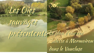
LAC DE MORMOIRON PLAN D'EAU DES SALETTES
No reviews yet
Have you flown here? Share your experience with other pilots.
+ Write the first reviewDescription
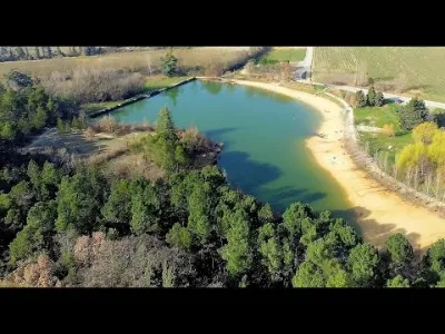
Artificial lake of more than 2 ha in the middle of vineyards and pines with a sandy beach. Swimming is supervised in July and August. The lake is open all year round for fishing (in summer, allowed until 10 am). Other activities on site are possible, such as volleyball, football, tennis, basketball, petanque, tree climbing, mountain biking, but also a children's playground. It is also the starting point for beautiful walks to do with the family. The lake also has a restaurant-grill-glacier, the Cahute, which organizes theme evenings all summer long and offers a beautiful space for refreshment and relaxation.
Map and restricted areas
Open in the main mapNearby aerodromes
Open aerodromes within 25 km of the spot, heliports included, with their distance and direction from the spot. Near an aerodrome, drone flying is prohibited or height-limited: check the UAS zones map.
| Aerodrome | Type | Distance | Elevation | Difference |
|---|---|---|---|---|
| Aérodrome de Carpentras | Aerodrome | 10 km SW | 120 m | spot 120 m higher |
| Centre De Secours Heliport | Heliport | 14 km W | 87 m | spot 153 m higher |
| Hôtel La Coquillade Heliport | Heliport | 23 km SE | 249 m | spot 9 m lower |
Aviation weather (METAR and TAF)
LFMO – Orange-Caritat (BA 115) Air Base VFR
METAR
METAR LFMO 211000Z AUTO VRB03KT CAVOK 12/09 Q1020 NOSIG
- Wind
- Variable, 6 km/h
- Visibility
- 10 km or more
- Clouds
- –
- Temperature
- 12 °C, dew point 9 °C
- QNH
- 1020 hPa
- Flight category
- VFR: ceiling > 3,000 ft and visibility > 5 mi
TAF
TAF LFMO 210800Z 2109/2209 32003KT CAVOK TX16/2115Z TN12/2201Z TEMPO 2121/2209 4000 RA BECMG 2201/2203 13015G25KT
| Period (local time) | Change | Wind | Visibility | Weather | Clouds |
|---|---|---|---|---|---|
| 21/11 10:00 → 22/11 02:00 | Initial conditions | 320°, 6 km/h | 10 km or more | No significant cloud | |
| 21/11 22:00 → 22/11 10:00 | Temporarily | 4.0 km | Rain | ||
| 22/11 02:00 → 22/11 10:00 | Becoming | 130°, 28 km/h, gusts 46 km/h | 10 km or more | No significant cloud |
Weather and Kp index
Sunrise and sunset
| Day | Dawn | Sunrise | Golden hour | Sunset | Dusk | Day length |
|---|---|---|---|---|---|---|
| Sat 21 Nov | 07:11 | 07:42 | 07:42–08:27 · 16:23–17:08 | 17:08 | 17:40 | 9 h 25 |
| Sun 22 Nov | 07:12 | 07:43 | 07:43–08:28 · 16:22–17:07 | 17:07 | 17:39 | 9 h 23 |
| Mon 23 Nov | 07:13 | 07:45 | 07:45–08:30 · 16:22–17:07 | 17:07 | 17:38 | 9 h 22 |
| Tue 24 Nov | 07:14 | 07:46 | 07:46–08:31 · 16:21–17:06 | 17:06 | 17:38 | 9 h 20 |
| Wed 25 Nov | 07:15 | 07:47 | 07:47–08:32 · 16:20–17:05 | 17:05 | 17:37 | 9 h 18 |
| Thu 26 Nov | 07:16 | 07:48 | 07:48–08:34 · 16:19–17:05 | 17:05 | 17:37 | 9 h 16 |
| Fri 27 Nov | 07:17 | 07:49 | 07:49–08:35 · 16:19–17:04 | 17:04 | 17:36 | 9 h 14 |
Reviews
Log in to review this spot. Log in · Create a free account
No reviews yet. Share yours!