

Mauzun Castle
No reviews yet
Have you flown here? Share your experience with other pilots.
+ Write the first reviewDescription
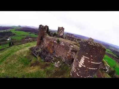
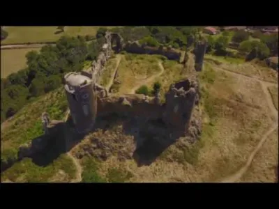
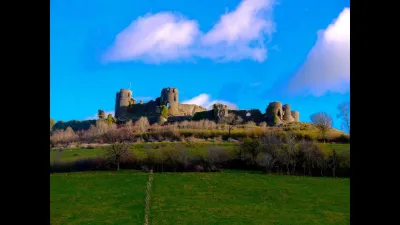
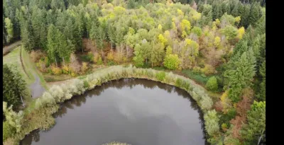
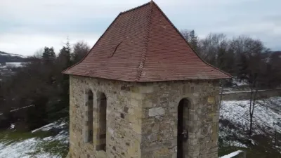
Small aerial visit of the castle of Mauzun located in the Puy-de-Dôme. A ghost town perched in a mountain amphitheatre, Mauzun Castle stands with its striking silhouette of gigantic ruins on the steps of the Livradois. Visible from afar, the fortress crowns the mound of an old volcano of Auvergne from which it draws its black stone. The castle, at the heart of the defensive system, is protected below by two successive enclosures. The castral complex, with 20 towers and 1600 m of curtain walls, covers an area of 5 hectares. Shots taken with a DJI Mavic Air and a racer drone, despite the wind.
Map and restricted areas
Open in the main mapNearby aerodromes
Open aerodromes within 25 km of the spot, heliports included, with their distance and direction from the spot. Near an aerodrome, drone flying is prohibited or height-limited: check the UAS zones map.
| Aerodrome | Type | Distance | Elevation | Difference |
|---|---|---|---|---|
| Clermont-Ferrand Auvergne Airport | Airport | 22 km NW | 332 m | spot 304 m higher |
| Aérodrome d'Issoire-Le Broc | Aerodrome | 25 km SW | 378 m | spot 258 m higher |
Aviation weather (METAR and TAF)
LFLC – Clermont-Ferrand Auvergne Airport VFR
METAR
METAR LFLC 210630Z AUTO 05003KT 340V080 9999 SCT042 OVC049 09/06 Q1020 NOSIG
- Wind
- 050°, 6 km/h
- Visibility
- 10 km or more
- Clouds
- Scattered (3-4/8) at 4,200 ft (1280 m) ; Overcast (8/8) at 4,900 ft (1490 m)
- Temperature
- 9 °C, dew point 6 °C
- QNH
- 1020 hPa
- Flight category
- VFR: ceiling > 3,000 ft and visibility > 5 mi
TAF
TAF LFLC 210500Z 2106/2206 19005KT 9999 BKN030
| Period (local time) | Change | Wind | Visibility | Weather | Clouds |
|---|---|---|---|---|---|
| 21/11 07:00 → 22/11 07:00 | Initial conditions | 190°, 9 km/h | 10 km or more | Broken (5-7/8) at 3,000 ft (910 m) |
Weather and Kp index
Sunrise and sunset
| Day | Dawn | Sunrise | Golden hour | Sunset | Dusk | Day length |
|---|---|---|---|---|---|---|
| Sat 21 Nov | 07:21 | 07:54 | 07:54–08:41 · 16:24–17:10 | 17:10 | 17:43 | 9 h 16 |
| Sun 22 Nov | 07:23 | 07:55 | 07:55–08:42 · 16:23–17:09 | 17:09 | 17:42 | 9 h 14 |
| Mon 23 Nov | 07:24 | 07:57 | 07:57–08:44 · 16:22–17:09 | 17:09 | 17:42 | 9 h 12 |
| Tue 24 Nov | 07:25 | 07:58 | 07:58–08:45 · 16:21–17:08 | 17:08 | 17:41 | 9 h 09 |
| Wed 25 Nov | 07:26 | 07:59 | 07:59–08:47 · 16:20–17:07 | 17:07 | 17:40 | 9 h 08 |
| Thu 26 Nov | 07:27 | 08:01 | 08:01–08:48 · 16:19–17:07 | 17:07 | 17:40 | 9 h 06 |
| Fri 27 Nov | 07:29 | 08:02 | 08:02–08:49 · 16:18–17:06 | 17:06 | 17:39 | 9 h 04 |

Reviews
Log in to review this spot. Log in · Create a free account
No reviews yet. Share yours!