

Lake Alfed
No reviews yet
Have you flown here? Share your experience with other pilots.
+ Write the first reviewDescription
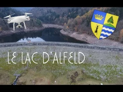
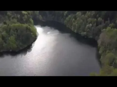
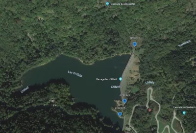
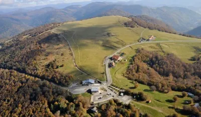
Drone Dji Phantom 4 FR Le Lac d'Alfeld (68), too bad for this grey weather that makes the video lose quality. The lake was currently draining, that's why the water level is low. Lake Alfeld is a dam lake in the Upper Rhine in the municipality of Sewen on the eastern slope of the Ballon d'Alsace. The reservoir has an area of about 10 hectares. The lake is due to glacial erosion and a dam was built by the Germans in 1883. The lake is a reserve of water in case of shortage for the rivers of the Doller Valley. The name "Alfeld" comes from the name of the pasture that used to be in the place of the present lake. Lake Alfeld occupies a basin carved out by an ancient glacier and bordered by an impressive moraine overlooking the Sewen Valley. You can reach it by car via the departmental road 466, 3 km from the village of Sewen in the direction of the Ballon d'Alsace, on foot in 1h30 from the church square of Sewen. Lake Alfeld is a place for fishing and walking. In summer, it welcomes many visitors but diving and swimming are at the risk of the divers.
Map and restricted areas
Open in the main mapNearby aerodromes
Open aerodromes within 25 km of the spot, heliports included, with their distance and direction from the spot. Near an aerodrome, drone flying is prohibited or height-limited: check the UAS zones map.
| Aerodrome | Type | Distance | Elevation | Difference |
|---|---|---|---|---|
| La Tête Des Champs Altiport | Aerodrome | 11 km N | 970 m | spot 367 m lower |
| Ramonchamp ULM | Aerodrome | 12 km NW | 577 m | spot 26 m higher |
| Belfort Chaux Airfield | Aerodrome | 13 km S | 417 m | spot 186 m higher |
Aviation weather (METAR and TAF)
LFSM – Montbéliard-Courcelles Airfield MVFR
METAR
METAR LFSM 211100Z AUTO 24003KT 200V300 9999 -RA BKN013/// OVC023/// OVC040/// ///TCU 09/08 Q1020 RERA
- Wind
- 240°, 6 km/h
- Visibility
- 10 km or more
- Weather
- Rain light
- Clouds
- Broken (5-7/8) at 1,300 ft (400 m) ; Overcast (8/8) at 2,300 ft (700 m) ; Overcast (8/8) at 4,000 ft (1220 m)
- Temperature
- 9 °C, dew point 8 °C
- QNH
- 1020 hPa
- Flight category
- MVFR: ceiling 1,000–3,000 ft or visibility 3–5 mi
TAF
Weather and Kp index
| Day | Weather | Temp. min. / max. | Wind | Rain | Max Kp |
|---|---|---|---|---|---|
| Sat 21 Nov | Cloudy | 1° / 6° | 15 km/h W | 0.1 mm | 2 |
| Sun 22 Nov | Sleet | 1° / 2° | 16 km/h E | 29 mm | 2 |
| Mon 23 Nov | Cloudy | -6° / 1° | 13 km/h NE | 0.9 mm | 4 |
| Tue 24 Nov | Partly cloudy | -6° / 1° | 12 km/h E | – | 2 |
| Wed 25 Nov | Cloudy | -3° / 2° | 10 km/h E | 0.9 mm | – |
| Thu 26 Nov | Cloudy | -4° / -2° | 7 km/h E | 1.6 mm | – |
| Fri 27 Nov | Cloudy | -3° / -1° | 11 km/h SW | 0.1 mm | – |
Hour by hour: Saturday 21 November
| Time | Weather | Temp. | Wind | Rain | Clouds | Kp |
|---|---|---|---|---|---|---|
| 12:00 | Cloudy | 4° | 13 km/h W | – | 97 % | 2 |
| 13:00 | Cloudy | 5° | 15 km/h W | – | 93 % | 1 |
| 14:00 | Light rain | 6° | 13 km/h W | 0.1 mm | 90 % | 1 |
| 15:00 | Partly cloudy | 6° | 12 km/h W | – | 70 % | 1 |
| 16:00 | Partly cloudy | 5° | 8 km/h W | – | 83 % | 2 |
| 17:00 | Fog | 3° | 3 km/h W | – | 60 % | 2 |
| 18:00 | Fog | 2° | 4 km/h NW | – | 94 % | 2 |
| 19:00 | Fog | 2° | 5 km/h N | – | 97 % | 2 |
| 20:00 | Fog | 1° | 5 km/h N | – | 96 % | 2 |
| 21:00 | Fog | 1° | 7 km/h NE | – | 99 % | 2 |
| 22:00 | Fog | 1° | 9 km/h NE | – | 100 % | 2 |
Hour by hour: Sunday 22 November
| Time | Weather | Temp. | Wind | Rain | Clouds | Kp |
|---|---|---|---|---|---|---|
| 06:00 | Light rain | 2° | 15 km/h E | 0.2 mm | 100 % | 2 |
| 07:00 | Rain | 2° | 15 km/h E | 0.7 mm | 100 % | 2 |
| 08:00 | Heavy rain | 2° | 15 km/h E | 1.3 mm | 100 % | 2 |
| 09:00 | Sleet | 2° | 15 km/h E | 1.6 mm | 100 % | 2 |
| 10:00 | Sleet | 2° | 15 km/h E | 2.1 mm | 100 % | 2 |
| 11:00 | Sleet | 2° | 16 km/h E | 2.4 mm | 100 % | 2 |
| 12:00 | Sleet | 1° | 16 km/h E | 2.3 mm | 100 % | 2 |
| 13:00 | Sleet | 1° | 16 km/h E | 2.6 mm | 100 % | 2 |
| 14:00 | Sleet | 1° | 14 km/h E | 2.6 mm | 100 % | 2 |
| 15:00 | Sleet | 1° | 14 km/h E | 2.7 mm | 100 % | 2 |
| 16:00 | Sleet | 1° | 12 km/h NE | 2.3 mm | 100 % | 2 |
| 17:00 | Sleet | 1° | 9 km/h NE | 2.0 mm | 100 % | 2 |
| 18:00 | Sleet | 1° | 8 km/h NE | 1.9 mm | 100 % | 2 |
| 19:00 | Sleet | 1° | 10 km/h S | 1.6 mm | 100 % | 2 |
| 20:00 | Sleet | 2° | 10 km/h SE | 1.2 mm | 100 % | 2 |
| 21:00 | Sleet | 1° | 12 km/h E | 0.7 mm | 100 % | 2 |
| 22:00 | Sleet | 1° | 8 km/h NE | 0.4 mm | 100 % | 2 |
Sunrise and sunset
| Day | Dawn | Sunrise | Golden hour | Sunset | Dusk | Day length |
|---|---|---|---|---|---|---|
| Sat 21 Nov | 07:13 | 07:47 | 07:47–08:36 · 16:00–16:50 | 16:50 | 17:24 | 9 h 02 |
| Sun 22 Nov | 07:14 | 07:48 | 07:48–08:38 · 15:59–16:49 | 16:49 | 17:23 | 9 h 00 |
| Mon 23 Nov | 07:15 | 07:50 | 07:50–08:40 · 15:58–16:48 | 16:48 | 17:22 | 8 h 58 |
| Tue 24 Nov | 07:17 | 07:51 | 07:51–08:41 · 15:57–16:47 | 16:47 | 17:22 | 8 h 55 |
| Wed 25 Nov | 07:18 | 07:53 | 07:53–08:43 · 15:56–16:46 | 16:46 | 17:21 | 8 h 53 |
| Thu 26 Nov | 07:19 | 07:54 | 07:54–08:44 · 15:55–16:46 | 16:46 | 17:20 | 8 h 51 |
| Fri 27 Nov | 07:20 | 07:55 | 07:55–08:46 · 15:54–16:45 | 16:45 | 17:20 | 8 h 49 |


Reviews
Log in to review this spot. Log in · Create a free account
No reviews yet. Share yours!