Skip to content
Water

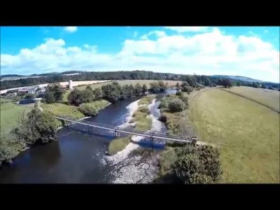
River Annan beside Hoddom Castle
United Kingdom

The video is only loaded from YouTube (youtube-nocookie.com) when you start it.

No reviews yet

Have you flown here? Share your experience with other pilots.

+ Write the first review

Description

River Annan beside Hoddom Castle

Aviation weather (METAR and TAF)

EGOM – RAF Spadeadam · 49 km E VFR

METAR

Observed 21/11 12:20 · 27 min ago

METAR EGOM 211220Z AUTO 09003KT 9999 NCD 05/02 Q1016

Wind
090°, 6 km/h
Visibility
10 km or more
Clouds
–
Temperature
5 °C, dew point 2 °C
QNH
1016 hPa
Flight category
VFR: ceiling > 3,000 ft and visibility > 5 mi

TAF

This station does not issue a TAF (or none is currently valid).

METAR and TAF from NOAA (Aviation Weather Center), for guidance only: they do not replace flight planning with official sources (SIA, Météo-France). Nearest station that issues a METAR, not necessarily the nearest aerodrome.

Plan the light

Weather and Kp index

Loading forecast…

Sunrise and sunset

Local times at the spot (UTC). The golden hour, the warm, low light sought after for photos and videos, runs from sunrise until the sun reaches 6° above the horizon, and in the evening from 6° until sunset.

Day Dawn Sunrise Golden hour Sunset Dusk Day length
Sat 21 Nov07:15 07:57 07:57–09:01 · 14:57–16:01 16:01 16:438 h 04
Sun 22 Nov07:17 07:59 07:59–09:04 · 14:55–16:00 16:00 16:428 h 00
Mon 23 Nov07:19 08:01 08:01–09:06 · 14:53–15:59 15:59 16:417 h 57
Tue 24 Nov07:20 08:03 08:03–09:08 · 14:51–15:57 15:57 16:407 h 54
Wed 25 Nov07:22 08:04 08:04–09:11 · 14:50–15:56 15:56 16:397 h 51
Thu 26 Nov07:23 08:06 08:06–09:13 · 14:48–15:55 15:55 16:387 h 48
Fri 27 Nov07:25 08:08 08:08–09:15 · 14:47–15:54 15:54 16:377 h 45

Nearby on Wikipedia

  • Eaglais Fheichein · 3.9 km away

    Ecclefechan, ou Eaglais Fheichein en gaélique écossais, est un village écossais dans le comté de Dùn Phrìs, dans le district de Dumfries and Galloway. (...)

  • Centrale nucléaire de Chapelcross · 6.9 km away

    La Centrale nucléaire de Chapelcross, qui s'est d'abord appelée « Chapelcross Processing Plant » (CXPP), nom de code CANDLE, était une installation nucléaire du type Magnox installée à côté de Annan, ville du comté de Dumfries et Galloway dans le sud-ouest de l'Écosse. (...)

  • Galabank · 7.0 km away

    Galabank est un stade de football construit en 1953 et situé à Annan. D'une capacité de places dont assises, il accueille depuis sa création les matches à domicile de l'Annan Athletic, club membre de la Scottish Professional Football League et, entre 2012 et 2014, ceux de Mid-Annandale, club de la (...)

  • Croix de Ruthwell · 7.7 km away

    La croix de Ruthwell est un monument d’« art insulaire » élevé par les Anglo-Saxons à Ruthwell, ville écossaise faisant alors partie du royaume de Northumbrie. L’érection du monument date vraisemblablement du : La plupart des autres datations la situe avant plutôt qu’après cette période. (...)

  • Championnat dÉcosse de football D4 2012-2013 · 7.8 km away

Articles found by GeoNames from the spot's position.

Nearby spots

Reviews

Log in to review this spot. Log in · Create a free account

No reviews yet. Share yours!

Connection to the site lost. Trying again…

The site is not responding. Trying again in seconds.

The site is no longer responding.

The site has been updated. Reloading the page…

This page has expired.

Resuming failed. Please reload the page.

The site is no longer responding.