

SWITZERLAND I Öschinensee I Bernese Oberland

No reviews yet
Have you flown here? Share your experience with other pilots.
+ Write the first reviewDescription
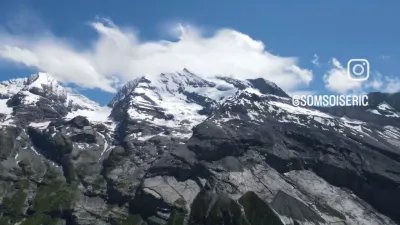
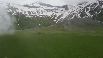
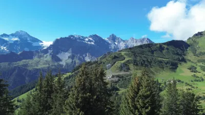
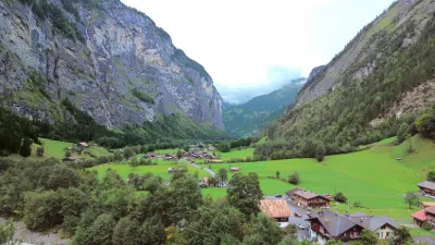
Der Oeschinensee liegt oberhalb von Kandersteg (Berner Oberland) in der Schweiz. Sein Wasserspiegel liegt durchschnittlich auf einer Höhe von 1'578 m. Der See ist bei normalem Wasserstand 56 m tief und hat eine Fläche von 1,1 km², womit er zu den grösseren Bergseen in der Schweiz gehört. Er entstand durch den Bergrutsch einer Flanke des Doldenhorns, der den Wasserabfluss blockierte.
Seit 2007 gehört der Oeschinensee zum erweiterten UNESCO-Weltnaturerbe Schweizer Alpen Jungfrau-Aletsch.
Oeschinen Lake (German: Oeschinensee) is a lake in the Bernese Oberland, Switzerland, 4 kilometres (2.5 mi) east of Kandersteg in the Oeschinen valley. At an elevation of 1,578 metres (5,177 ft), it has a surface area of 1.1147 square kilometres (0.4304 sq mi). Its maximum depth is 56 metres (184 ft).
The lake is fed through a series of mountain creeks and drains underground. The water then re-surfaces as the Oeschibach. Part of it is captured for electricity production and as water supply for Kandersteg.
In observations from 1931 to 1965, the elevation of the lake surface varied between 1,566.09 metres (5,138.1 ft) and 1,581.9 metres (5,190 ft). The average seasonal variation was 12.2 metres (40 ft) (September/April).
The lake is generally frozen during five months, from December to May.
Fish in the lake include Arctic char (Seesaibling), lake trout (Kanadische Seeforelle), rainbow trout (Regenbogenforelle). From January to March, ice fishing is popular.
A gondola lift from Kandersteg leads to Oeschinen, 20 minutes by foot from the lake.
Since 2007 the lake is part of the Jungfrau-Aletsch-Bietschhorn UNESCO World Heritage Site.
Enjoy the beautiful nature of Switzerland and give it a thumbs up if you enjoyed it. :-)))
Map and restricted areas
Open in the main mapAviation weather (METAR and TAF)
LSMM – Meiringen Airport ?
METAR
METAR LSMM 210650Z AUTO 09008KT 9999NDV -SHRA SCT013 BKN025 OVC056 04/03 Q1020 RMK
- Wind
- 090°, 15 km/h
- Visibility
- –
- Weather
- Showers of rain light
- Clouds
- Scattered (3-4/8) at 1,300 ft (400 m) ; Broken (5-7/8) at 2,500 ft (760 m) ; Overcast (8/8) at 5,600 ft (1710 m)
- Temperature
- 4 °C, dew point 3 °C
- QNH
- 1020 hPa
- Flight category
- Unknown category
TAF
Weather and Kp index
| Day | Weather | Temp. min. / max. | Wind | Rain | Max Kp |
|---|---|---|---|---|---|
| Sat 21 Nov | Clear sky | -10° / -0° | 7 km/h SE | – | 2 |
| Sun 22 Nov | Sleet | -4° / 2° | 11 km/h SW | 27 mm | 2 |
| Mon 23 Nov | Cloudy | -4° / -0° | 12 km/h NW | 25 mm | 4 |
| Tue 24 Nov | Partly cloudy | -16° / -2° | 4 km/h SE | – | 2 |
| Wed 25 Nov | Snow | -6° / -2° | 8 km/h SE | 2.6 mm | – |
| Thu 26 Nov | Cloudy | -8° / -1° | 6 km/h SE | 0.3 mm | – |
| Fri 27 Nov | Clear sky | -10° / -1° | 4 km/h SE | – | – |
Hour by hour: Saturday 21 November
| Time | Weather | Temp. | Wind | Rain | Clouds | Kp |
|---|---|---|---|---|---|---|
| 08:00 | Fog | -2° | 4 km/h S | – | 80 % | 2 |
| 09:00 | Fog | -1° | 4 km/h S | – | 75 % | 2 |
| 10:00 | Partly cloudy | -1° | 4 km/h SE | – | 59 % | 2 |
| 11:00 | Partly cloudy | -1° | 4 km/h SE | – | 38 % | 2 |
| 12:00 | Fair | -1° | 3 km/h SE | – | 20 % | 2 |
| 13:00 | Clear sky | -0° | 3 km/h SE | – | 10 % | 1 |
| 14:00 | Fair | -0° | 4 km/h SE | – | 13 % | 1 |
| 15:00 | Fair | -1° | 4 km/h E | – | 21 % | 1 |
| 16:00 | Fair | -4° | 5 km/h SE | – | 34 % | 2 |
| 17:00 | Fog | -8° | 6 km/h SE | – | 88 % | 2 |
| 18:00 | Fog | -10° | 7 km/h SE | – | 91 % | 2 |
| 19:00 | Fog | -10° | 7 km/h SE | – | 98 % | 2 |
| 20:00 | Cloudy | -8° | 6 km/h SE | – | 98 % | 2 |
| 21:00 | Cloudy | -6° | 5 km/h SE | – | 98 % | 2 |
| 22:00 | Partly cloudy | -4° | 5 km/h SE | – | 83 % | 2 |
Hour by hour: Sunday 22 November
| Time | Weather | Temp. | Wind | Rain | Clouds | Kp |
|---|---|---|---|---|---|---|
| 06:00 | Snow | -1° | 5 km/h SE | 0.8 mm | 100 % | 2 |
| 07:00 | Snow | -2° | 5 km/h SE | 1.2 mm | 100 % | 2 |
| 08:00 | Snow | -2° | 7 km/h SE | 1.3 mm | 100 % | 2 |
| 09:00 | Snow | -1° | 9 km/h SE | 1.1 mm | 100 % | 2 |
| 10:00 | Snow | -0° | 9 km/h SE | 1.5 mm | 100 % | 2 |
| 11:00 | Sleet | 0° | 8 km/h S | 1.6 mm | 100 % | 2 |
| 12:00 | Sleet | 1° | 8 km/h S | 1.4 mm | 100 % | 2 |
| 13:00 | Sleet | 2° | 8 km/h S | 1.2 mm | 100 % | 2 |
| 14:00 | Sleet | 2° | 7 km/h SW | 2.2 mm | 100 % | 2 |
| 15:00 | Sleet | 1° | 9 km/h SW | 2.0 mm | 100 % | 2 |
| 16:00 | Snow | 1° | 9 km/h SW | 1.4 mm | 100 % | 2 |
| 17:00 | Snow | 0° | 8 km/h SW | 0.9 mm | 100 % | 2 |
| 18:00 | Snow | 0° | 8 km/h W | 0.8 mm | 100 % | 2 |
| 19:00 | Snow | 0° | 9 km/h W | 1.4 mm | 100 % | 2 |
| 20:00 | Snow | 0° | 10 km/h SW | 1.4 mm | 100 % | 2 |
| 21:00 | Snow | -0° | 10 km/h SW | 1.9 mm | 100 % | 2 |
| 22:00 | Snow | -0° | 11 km/h SW | 1.9 mm | 100 % | 2 |
Sunrise and sunset
| Day | Dawn | Sunrise | Golden hour | Sunset | Dusk | Day length |
|---|---|---|---|---|---|---|
| Sat 21 Nov | 07:06 | 07:39 | 07:39–08:27 · 16:03–16:51 | 16:51 | 17:24 | 9 h 11 |
| Sun 22 Nov | 07:07 | 07:41 | 07:41–08:28 · 16:02–16:50 | 16:50 | 17:23 | 9 h 09 |
| Mon 23 Nov | 07:09 | 07:42 | 07:42–08:30 · 16:01–16:49 | 16:49 | 17:22 | 9 h 06 |
| Tue 24 Nov | 07:10 | 07:43 | 07:43–08:31 · 16:00–16:48 | 16:48 | 17:22 | 9 h 04 |
| Wed 25 Nov | 07:11 | 07:45 | 07:45–08:33 · 15:59–16:47 | 16:47 | 17:21 | 9 h 02 |
| Thu 26 Nov | 07:12 | 07:46 | 07:46–08:34 · 15:58–16:47 | 16:47 | 17:20 | 9 h 00 |
| Fri 27 Nov | 07:13 | 07:47 | 07:47–08:36 · 15:57–16:46 | 16:46 | 17:20 | 8 h 58 |

Reviews
Log in to review this spot. Log in · Create a free account
No reviews yet. Share yours!