Skip to content
Unusual

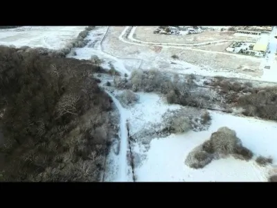
Snow at Brockholes and surrounding Farmland.
United Kingdom

The video is only loaded from YouTube (youtube-nocookie.com) when you start it.

No reviews yet

Have you flown here? Share your experience with other pilots.

+ Write the first review

Description

Check out those aggressive Sheep!

Aviation weather (METAR and TAF)

EGNH – Blackpool International Airport · 27 km W VFR

METAR

Observed 21/11 12:20 · 27 min ago

METAR EGNH 211220Z 12010KT CAVOK 07/03 Q1016

Wind
120°, 19 km/h
Visibility
10 km or more
Clouds
–
Temperature
7 °C, dew point 3 °C
QNH
1016 hPa
Flight category
VFR: ceiling > 3,000 ft and visibility > 5 mi

TAF

Issued 21/11 11:00 · valid from 21/11 12:00 to 21/11 19:00

TAF EGNH 211100Z 2112/2119 10008KT 9999 FEW025 PROB30 2112/2113 7000

Period (local time) Change Wind Visibility Weather Clouds
21/11 12:00 → 21/11 19:00 Initial conditions 100°, 15 km/h 10 km or more Few (1-2/8) at 2,500 ft (760 m)
21/11 12:00 → 21/11 13:00 probability 30% 7 km

Empty cell: no change forecast for that element.

METAR and TAF from NOAA (Aviation Weather Center), for guidance only: they do not replace flight planning with official sources (SIA, Météo-France). Nearest station that issues a METAR, not necessarily the nearest aerodrome.

Plan the light

Weather and Kp index

Loading forecast…

Sunrise and sunset

Local times at the spot (UTC). The golden hour, the warm, low light sought after for photos and videos, runs from sunrise until the sun reaches 6° above the horizon, and in the evening from 6° until sunset.

Day Dawn Sunrise Golden hour Sunset Dusk Day length
Sat 21 Nov07:08 07:48 07:48–08:49 · 15:04–16:04 16:04 16:458 h 15
Sun 22 Nov07:10 07:50 07:50–08:51 · 15:02–16:03 16:03 16:448 h 12
Mon 23 Nov07:11 07:52 07:52–08:54 · 15:00–16:02 16:02 16:428 h 10
Tue 24 Nov07:13 07:54 07:54–08:56 · 14:59–16:01 16:01 16:418 h 07
Wed 25 Nov07:14 07:55 07:55–08:58 · 14:57–16:00 16:00 16:418 h 04
Thu 26 Nov07:16 07:57 07:57–09:00 · 14:56–15:59 15:59 16:408 h 01
Fri 27 Nov07:17 07:59 07:59–09:02 · 14:54–15:58 15:58 16:397 h 58

Nearby on Wikipedia

  • Samlesbury · 2.6 km away

    Samlesbury est un village, et une paroisse civile, situé dans le borough de South Ribble dans le Lancashire en Angleterre. Samlesbury Hall, une résidence historique, se trouve dans ce village, tout comme le Samlesbury Aerodrome. En 2010, le village abrite aussi une brasserie détenue par AB InBev.

  • Trésor de Cuerdale · 2.9 km away

    Le trésor de Cuerdale est un trésor de l'âge des Vikings découvert en 1840 à Cuerdale, près de Preston, dans le Lancashire. Il comprend plus de en argent, parmi lesquels des pièces de monnaie, des bijoux, des fragments de métal et des lingots (...)

  • Cuerdale · 3.2 km away

    Cuerdale est un village et une paroisse civile du Lancashire, en Angleterre. Il est situé à quelques kilomètres au sud-est de la ville de Preston. Administrativement, il relève du district de South Ribble.

  • Preston North End Football Club · 4.0 km away

    Le Preston North End Football Club est un club de football professionnel anglais fondé en 1881 et basé à Preston dans le nord-ouest de l'Angleterre. Preston est un des clubs fondateurs du championnat anglais en 1888 et le premier champion d’Angleterre de l'histoire (...)

  • Deepdale · 4.0 km away

    Deepdale Stadium est un stade de football localisé à Preston. C'est l'enceinte du club de Preston North End FC. Tandis que de nombreuses équipes se sont déplacées d'un endroit à un autre dans leur histoire à court ou long terme, Preston North End FC est resté fidèle au terrain en PR1, devenant leur (...)

Articles found by GeoNames from the spot's position.

Nearby spots

Reviews

Log in to review this spot. Log in · Create a free account

No reviews yet. Share yours!

Connection to the site lost. Trying again…

The site is not responding. Trying again in seconds.

The site is no longer responding.

The site has been updated. Reloading the page…

This page has expired.

Resuming failed. Please reload the page.

The site is no longer responding.