

Montauban buzenol
No reviews yet
Have you flown here? Share your experience with other pilots.
+ Write the first reviewDescription
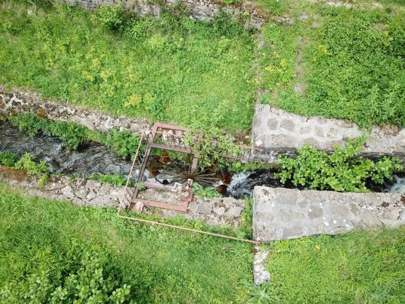
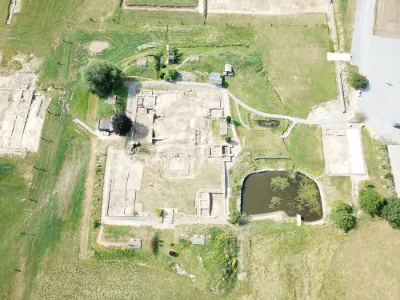
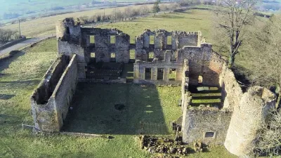
The prestigious site of Montauban in Buzenol, a major archaeological site in the Gaumas, classified as a "Major Heritage Site of Wallonia", bears witness to three successive periods of occupation of the site (Iron Age, Gallo-Roman period and Middle Ages) and preserves many traces that are still visible today.
This place of refuge, surrounded by Iron Age ramparts (La Tène -450 to -25), presents, at the southern tip of the rocky spur, the ruins of a dungeon from the early Middle Ages, a castle that legend attributes to the Four Sons of Aymon. It appears that the rampart of the centre also dates from the time of the dungeon. At present, the earthen levees, ditches, dam walls and the famous keep are still clearly visible to the walker. In 1958, in the rampart was discovered a beautiful set of a dozen carved stones, fragments of dismantled funerary monuments. Among these is the famous bas-relief of the Trevirian harvester, described by Pliny and Palladius. The lapidary museum, an annex of the Gaumais Museums, was built in 1960 to house all its exhibits. Built in 1960 by the architect Constantin Brodski, it remains an indisputable reference in terms of museum architecture integrated on the site. The Monument is classified, including the old forges, "Major Heritage of Wallonia" since 1959.
Map and restricted areas
Open in the main mapAviation weather (METAR and TAF)
ELLX – Luxembourg-Findel International Airport VFR
METAR
METAR ELLX 210650Z 00000KT CAVOK M00/M00 Q1018 NOSIG
- Wind
- Calm
- Visibility
- 10 km or more
- Clouds
- –
- Temperature
- 0 °C, dew point 0 °C
- QNH
- 1018 hPa
- Flight category
- VFR: ceiling > 3,000 ft and visibility > 5 mi
TAF
TAF ELLX 210500Z 2106/2212 20005KT 9999 FEW045
| Period (local time) | Change | Wind | Visibility | Weather | Clouds |
|---|---|---|---|---|---|
| 21/11 07:00 → 22/11 13:00 | Initial conditions | 200°, 9 km/h | 10 km or more | Few (1-2/8) at 4,500 ft (1370 m) |
Weather and Kp index
Sunrise and sunset
| Day | Dawn | Sunrise | Golden hour | Sunset | Dusk | Day length |
|---|---|---|---|---|---|---|
| Sat 21 Nov | 07:23 | 07:59 | 07:59–08:51 · 15:56–16:48 | 16:48 | 17:24 | 8 h 49 |
| Sun 22 Nov | 07:24 | 08:00 | 08:00–08:52 · 15:55–16:47 | 16:47 | 17:23 | 8 h 47 |
| Mon 23 Nov | 07:26 | 08:02 | 08:02–08:54 · 15:54–16:46 | 16:46 | 17:23 | 8 h 44 |
| Tue 24 Nov | 07:27 | 08:03 | 08:03–08:56 · 15:53–16:46 | 16:46 | 17:22 | 8 h 42 |
| Wed 25 Nov | 07:28 | 08:04 | 08:04–08:58 · 15:52–16:45 | 16:45 | 17:21 | 8 h 40 |
| Thu 26 Nov | 07:30 | 08:06 | 08:06–08:59 · 15:50–16:44 | 16:44 | 17:20 | 8 h 37 |
| Fri 27 Nov | 07:31 | 08:07 | 08:07–09:01 · 15:49–16:43 | 16:43 | 17:20 | 8 h 35 |


Reviews
Log in to review this spot. Log in · Create a free account
No reviews yet. Share yours!