

Nocfond

2 pilot reviews
“Salut Kawa. J’y suis ce WE. Le lieu s’appelle gite du petit nocfond. Voulez vous passer ?…” — kameo, 6 years ago
Read the reviews + Write my reviewDescription
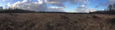
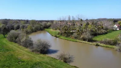
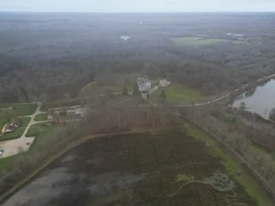
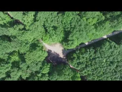
A bit peculiar but it's a gite and the boss lets the dronists fly in his forests and meadows. I flew with a Mavic and with my 5/6" freestyle drones there, the spot is beautiful and varied. On the other hand it is only accessible to the clients of the gite, but it is still a good plan.
The meadow is perfect for freestyle or racing, the more adventurous / experienced can go to the rest of the 57 hectares territory, but personally I preferred to do it in Mavic, just to not get stuck in one of the ponds, like a friend who left a babyhawk there. The natural and artificial elements (powerloop the FFS tractor garage!) make it a very varied spot, lost away from everyone, where no one is disturbed.
Map and restricted areas
Open in the main mapNearby aerodromes
Open aerodromes within 25 km of the spot, heliports included, with their distance and direction from the spot. Near an aerodrome, drone flying is prohibited or height-limited: check the UAS zones map.
| Aerodrome | Type | Distance | Elevation | Difference |
|---|---|---|---|---|
| Centre Hospitalier Heliport | Heliport | 12 km W | 89 m | spot 8 m higher |
| Romorantin Pruniers Airfield | Aerodrome | 15 km W | 88 m | spot 10 m higher |
| Vierzon Méreau Airfield | Aerodrome | 20 km SE | 131 m | spot 33 m lower |
Aviation weather (METAR and TAF)
LFYR – Romorantin Pruniers Airfield MVFR
METAR
METAR LFYR 211200Z AUTO 17004KT 130V210 9999 OVC016 12/09 Q1018
- Wind
- 170°, 7 km/h
- Visibility
- 10 km or more
- Clouds
- Overcast (8/8) at 1,600 ft (490 m)
- Temperature
- 12 °C, dew point 9 °C
- QNH
- 1018 hPa
- Flight category
- MVFR: ceiling 1,000–3,000 ft or visibility 3–5 mi
TAF
Weather and Kp index
Sunrise and sunset
| Day | Dawn | Sunrise | Golden hour | Sunset | Dusk | Day length |
|---|---|---|---|---|---|---|
| Sat 21 Nov | 07:32 | 08:05 | 08:05–08:54 · 16:23–17:11 | 17:11 | 17:45 | 9 h 05 |
| Sun 22 Nov | 07:33 | 08:07 | 08:07–08:56 · 16:22–17:10 | 17:10 | 17:44 | 9 h 03 |
| Mon 23 Nov | 07:34 | 08:08 | 08:08–08:57 · 16:20–17:10 | 17:10 | 17:44 | 9 h 01 |
| Tue 24 Nov | 07:35 | 08:09 | 08:09–08:59 · 16:19–17:09 | 17:09 | 17:43 | 8 h 59 |
| Wed 25 Nov | 07:37 | 08:11 | 08:11–09:00 · 16:19–17:08 | 17:08 | 17:42 | 8 h 57 |
| Thu 26 Nov | 07:38 | 08:12 | 08:12–09:02 · 16:18–17:07 | 17:07 | 17:42 | 8 h 55 |
| Fri 27 Nov | 07:39 | 08:13 | 08:13–09:03 · 16:17–17:07 | 17:07 | 17:41 | 8 h 53 |


Reviews
Log in to review this spot. Log in · Create a free account
kameo
Salut Kawa. J’y suis ce WE. Le lieu s’appelle gite du petit nocfond. Voulez vous passer ? Je pars ce soir par contre. On a un discord nommé le flight club avec les autres pilotes. On est une soixantaine de freestylers. https://discord.gg/3bYeUbg
kawa18
Salut Kameo, Je ne suis pas loin et ce serait peut être sympa d'échanger sur nos passions et peut être voler ensemble. Cordialement Didier