

The 3 mills of Calvisson
1 pilot review
“Merci pour le spot il est génial ;)” — Alex74, 7 years ago
Read the reviews + Write my reviewDescription
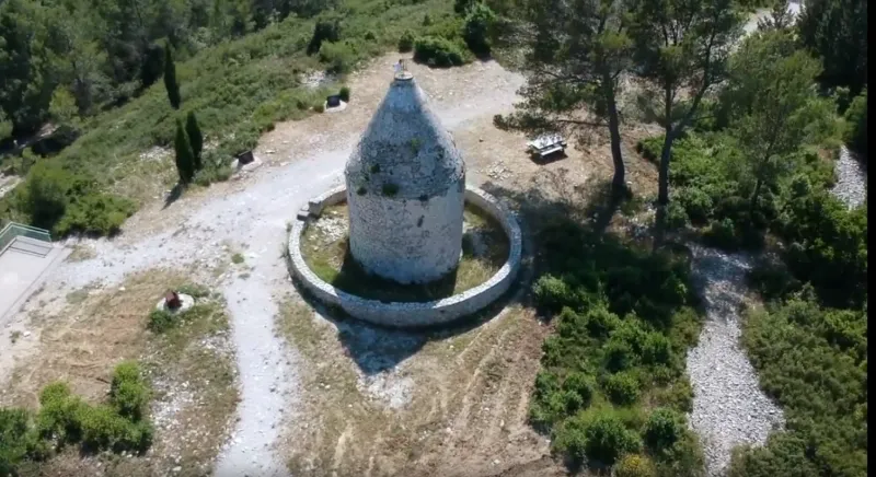
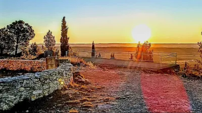
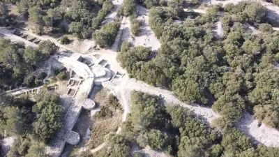
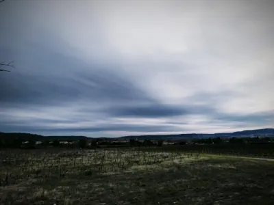
The summit of the Roc de Gachone, at 167 metres, is a must-see visit and offers a breathtaking view of the plain. You will find four mills, one of which was destroyed in 1838 by a storm, only the base remains. The second, repaired in 1928, carries the orientation table. The third, the pointed mill, is called the "Cassini signal". The fourth, has recently been consolidated.
Originally four mills dating from the 17th and 18th centuries dominated the place, the first one was destroyed during a storm in 1838, only the base remains as the only vestige. The second one, the mill at the top, called "Signal de Cassini", nowadays of pointed shape, carries at its top the device which was used, at the end of the XVIIIth century, by Cassini to map the region. The intensification of viticulture throughout the 19th century and the arrival of the railway in Vaunage led to a sharp drop in cereal cultivation and the abandonment of mills.
Map and restricted areas
Open in the main mapNearby aerodromes
Open aerodromes within 25 km of the spot, heliports included, with their distance and direction from the spot. Near an aerodrome, drone flying is prohibited or height-limited: check the UAS zones map.
| Aerodrome | Type | Distance | Elevation | Difference |
|---|---|---|---|---|
| Nîmes-Arles-Camargue Airport | Airport | 19 km E | 94 m | spot 73 m higher |
| Nîmes Courbessac Airport | Aerodrome | 20 km NE | 60 m | spot 107 m higher |
| Aérodrome de Montpellier - Candillargues | Aerodrome | 21 km SW | 2 m | spot 166 m higher |
Aviation weather (METAR and TAF)
LFTW – Nîmes-Arles-Camargue Airport VFR
METAR
METAR LFTW 211100Z AUTO 01003KT 330V050 CAVOK 14/09 Q1020 NOSIG
- Wind
- 010°, 6 km/h
- Visibility
- 10 km or more
- Clouds
- –
- Temperature
- 14 °C, dew point 9 °C
- QNH
- 1020 hPa
- Flight category
- VFR: ceiling > 3,000 ft and visibility > 5 mi
TAF
TAF LFTW 210800Z 2109/2209 VRB03KT CAVOK TEMPO 2120/2206 14015G25KT 4000 SHRA BKN012 BKN025TCU BECMG 2206/2208 25015G25KT
| Period (local time) | Change | Wind | Visibility | Weather | Clouds |
|---|---|---|---|---|---|
| 21/11 10:00 → 22/11 07:00 | Initial conditions | Variable, 6 km/h | 10 km or more | No significant weather | No significant cloud |
| 21/11 21:00 → 22/11 07:00 | Temporarily | 140°, 28 km/h, gusts 46 km/h | 4.0 km | Showers of rain | Broken (5-7/8) at 1,200 ft (370 m) ; Broken (5-7/8) at 2,500 ft (760 m) (towering cumulus) |
| 22/11 07:00 → 22/11 10:00 | Becoming | 250°, 28 km/h, gusts 46 km/h | 10 km or more | No significant weather | No significant cloud |
Weather and Kp index
| Day | Weather | Temp. min. / max. | Wind | Rain | Max Kp |
|---|---|---|---|---|---|
| Sat 21 Nov | Partly cloudy | 11° / 15° | 16 km/h E | 1.0 mm | 2 |
| Sun 22 Nov | Partly cloudy | 11° / 15° | 30 km/h W | 1.3 mm | 2 |
| Mon 23 Nov | Fair | 6° / 14° | 19 km/h NW | – | 4 |
| Tue 24 Nov | Cloudy | 5° / 10° | 13 km/h N | 9.1 mm | 2 |
| Wed 25 Nov | Heavy rain | 7° / 10° | 27 km/h E | 58 mm | – |
| Thu 26 Nov | Clear sky | 3° / 12° | 7 km/h N | – | – |
| Fri 27 Nov | Fair | 2° / 11° | 10 km/h N | – | – |
Hour by hour: Saturday 21 November
| Time | Weather | Temp. | Wind | Rain | Clouds | Kp |
|---|---|---|---|---|---|---|
| 12:00 | Fair | 14° | 3 km/h N | – | 34 % | 2 |
| 13:00 | Partly cloudy | 15° | 3 km/h E | – | 39 % | 1 |
| 14:00 | Partly cloudy | 15° | 4 km/h E | – | 48 % | 1 |
| 15:00 | Partly cloudy | 15° | 5 km/h SE | – | 59 % | 1 |
| 16:00 | Partly cloudy | 15° | 5 km/h SE | – | 74 % | 2 |
| 17:00 | Partly cloudy | 12° | 6 km/h E | – | 66 % | 2 |
| 18:00 | Partly cloudy | 11° | 7 km/h E | – | 98 % | 2 |
| 19:00 | Partly cloudy | 11° | 8 km/h E | – | 98 % | 2 |
| 20:00 | Cloudy | 11° | 9 km/h E | – | 100 % | 2 |
| 21:00 | Rain | 11° | 10 km/h E | 0.5 mm | 100 % | 2 |
| 22:00 | Light rain | 11° | 14 km/h E | 0.3 mm | 100 % | 2 |
Hour by hour: Sunday 22 November
| Time | Weather | Temp. | Wind | Rain | Clouds | Kp |
|---|---|---|---|---|---|---|
| 06:00 | Cloudy | 14° | 11 km/h SW | – | 100 % | 2 |
| 07:00 | Cloudy | 13° | 9 km/h SW | – | 100 % | 2 |
| 08:00 | Partly cloudy | 13° | 24 km/h W | – | 86 % | 2 |
| 09:00 | Cloudy | 13° | 23 km/h W | – | 88 % | 2 |
| 10:00 | Partly cloudy | 14° | 23 km/h W | – | 79 % | 2 |
| 11:00 | Fair | 15° | 30 km/h W | – | 23 % | 2 |
| 12:00 | Fair | 15° | 27 km/h W | – | 33 % | 2 |
| 13:00 | Partly cloudy | 15° | 29 km/h W | – | 61 % | 2 |
| 14:00 | Partly cloudy | 15° | 28 km/h W | – | 64 % | 2 |
| 15:00 | Partly cloudy | 15° | 26 km/h W | – | 46 % | 2 |
| 16:00 | Fair | 14° | 28 km/h W | – | 26 % | 2 |
| 17:00 | Partly cloudy | 13° | 23 km/h NW | – | 47 % | 2 |
| 18:00 | Partly cloudy | 12° | 22 km/h W | – | 51 % | 2 |
| 19:00 | Partly cloudy | 12° | 21 km/h W | – | 73 % | 2 |
| 20:00 | Partly cloudy | 12° | 19 km/h W | – | 60 % | 2 |
| 21:00 | Partly cloudy | 12° | 20 km/h W | – | 53 % | 2 |
| 22:00 | Partly cloudy | 12° | 20 km/h W | – | 49 % | 2 |
Sunrise and sunset
| Day | Dawn | Sunrise | Golden hour | Sunset | Dusk | Day length |
|---|---|---|---|---|---|---|
| Sat 21 Nov | 07:14 | 07:45 | 07:45–08:30 · 16:29–17:13 | 17:13 | 17:44 | 9 h 27 |
| Sun 22 Nov | 07:15 | 07:47 | 07:47–08:31 · 16:28–17:12 | 17:12 | 17:44 | 9 h 25 |
| Mon 23 Nov | 07:16 | 07:48 | 07:48–08:33 · 16:27–17:12 | 17:12 | 17:43 | 9 h 23 |
| Tue 24 Nov | 07:17 | 07:49 | 07:49–08:34 · 16:26–17:11 | 17:11 | 17:42 | 9 h 21 |
| Wed 25 Nov | 07:19 | 07:50 | 07:50–08:35 · 16:25–17:10 | 17:10 | 17:42 | 9 h 20 |
| Thu 26 Nov | 07:20 | 07:51 | 07:51–08:37 · 16:24–17:10 | 17:10 | 17:41 | 9 h 18 |
| Fri 27 Nov | 07:21 | 07:53 | 07:53–08:38 · 16:24–17:09 | 17:09 | 17:41 | 9 h 16 |


Reviews
Log in to review this spot. Log in · Create a free account
Alex74
Merci pour le spot il est génial ;)