Skip to content
Mountain

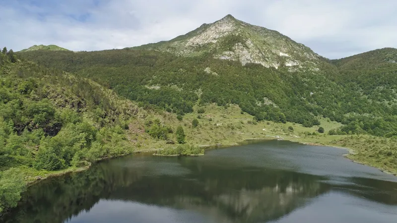
Pond of the harrow
Ariège

The video is only loaded from YouTube (youtube-nocookie.com) when you start it.

No reviews yet

Have you flown here? Share your experience with other pilots.

+ Write the first review

Description

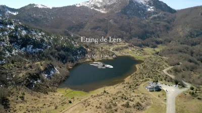
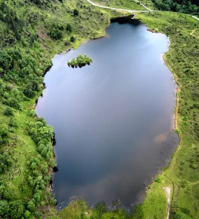
Natural lake located in the Ariège Pyrenees at an altitude of 1264 metres, 3 car parks for parking, flight ceiling 150 metres.

Map and restricted areas

Open in the main map

Nearby aerodromes

Open aerodromes within 25 km of the spot, heliports included, with their distance and direction from the spot. Near an aerodrome, drone flying is prohibited or height-limited: check the UAS zones map.

Aerodrome Type Distance ElevationDifference
Altiport d'Ustou Aerodrome 13 km W 1,797 mspot 502 m lower
Altisurface d'Aleu Aerodrome 13 km NW 1,050 mspot 245 m higher
Altisurface de la Plagne-Bouirex Aerodrome 21 km W 1,600 mspot 305 m lower
Centre Hospitalier Heliport Heliport 25 km NE 450 mspot 845 m higher

Indicative list: it does not replace official aeronautical information.

Aviation weather (METAR and TAF)

No METAR station within 50 km.

METAR and TAF from NOAA (Aviation Weather Center), for guidance only: they do not replace flight planning with official sources (SIA, Météo-France). Nearest station that issues a METAR, not necessarily the nearest aerodrome.

Plan the light

Weather and Kp index

Loading forecast…

Sunrise and sunset

Local times at the spot (UTC+01:00). The golden hour, the warm, low light sought after for photos and videos, runs from sunrise until the sun reaches 6° above the horizon, and in the evening from 6° until sunset.

Day Dawn Sunrise Golden hour Sunset Dusk Day length
Sat 21 Nov07:23 07:54 07:54–08:37 · 16:43–17:27 17:27 17:589 h 33
Sun 22 Nov07:24 07:55 07:55–08:39 · 16:43–17:26 17:26 17:579 h 31
Mon 23 Nov07:25 07:56 07:56–08:40 · 16:42–17:26 17:26 17:569 h 29
Tue 24 Nov07:26 07:57 07:57–08:41 · 16:41–17:25 17:25 17:569 h 27
Wed 25 Nov07:27 07:59 07:59–08:43 · 16:40–17:24 17:24 17:559 h 25
Thu 26 Nov07:29 08:00 08:00–08:44 · 16:40–17:24 17:24 17:559 h 24
Fri 27 Nov07:30 08:01 08:01–08:45 · 16:39–17:23 17:23 17:559 h 22

Nearby on Wikipedia

  • Étang de Lers · 0.3 km away

    L'étang de Lers (ou Lhers ou L'Hers) est situé dans les Pyrénées ariégeoises, à m d'altitude. Sur la commune du Port, il se trouve entre Aulus-les-Bains au sud-ouest, Vicdessos au sud-est et Massat au nord-ouest. (...)

  • Gouffre Georges · 1.4 km away

    Le réseau du gouffre Georges (ou gouffre du Mont Béas) est le second gouffre d'Ariège par sa profondeur (- 724 m) pour une longueur de 3 490 m. Il comporte sept entrées (A0, A5, A3, gouffre Georges, A9, gouffre des Feuilles Mortes et le Tube) et il est situé a proximité de l'étang de Lers, sur la (...)

  • Mont Béas · 1.6 km away

    Le mont Béas, également appelé La Pique, est un sommet des Pyrénées françaises situé dans le département de l'Ariège en région Occitanie. Il culmine à d'altitude. (...)

  • Col d'Agnes · 1.6 km away

    Le col d'Agnes est un col situé dans les Pyrénées en France. Dans le département de l'Ariège, il se trouve à la limite entre les communes d'Aulus-les-Bains et du Port. Ce col relie les localités d'Aulus-les-Bains au sud à Massat au nord ou Vicdessos à l'est. Il culmine à d'altitude (...)

  • Port de Lers · 2.5 km away

    Le port de Lers ou port de l'Hers ou port de Massat est un col de la chaîne pyrénéenne, dans le département de l'Ariège. Il culmine à , au pied du pic des Trois-Seigneurs. Il est emprunté par la route des cols. (...)

Articles found by GeoNames from the spot's position.

Nearby spots

Reviews

Log in to review this spot. Log in · Create a free account

No reviews yet. Share yours!

Connection to the site lost. Trying again…

The site is not responding. Trying again in seconds.

The site is no longer responding.

The site has been updated. Reloading the page…

This page has expired.

Resuming failed. Please reload the page.

The site is no longer responding.