

Water
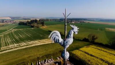
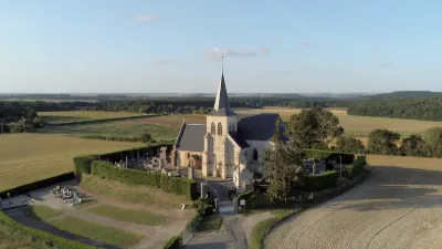
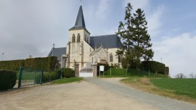
Canada's water body at Beauvais
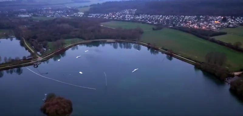
Description
Overview of Canada's Water Body at Beauvais Limited flying height
Map and restricted areas
Open in the main mapNearby aerodromes
Open aerodromes within 25 km of the spot, heliports included, with their distance and direction from the spot. Near an aerodrome, drone flying is prohibited or height-limited: check the UAS zones map.
| Aerodrome | Type | Distance | Elevation | Difference |
|---|---|---|---|---|
| Centre Hospitalier Heliport | Heliport | 1.3 km E | 92 m | spot 13 m lower |
| Paris Beauvais Tillé Airport | Airport | 4.5 km E | 109 m | spot 30 m lower |
| Base ULM de Flavacourt | Aerodrome | 20 km SW | 139 m | spot 60 m lower |
Aviation weather (METAR and TAF)
LFOB – Paris Beauvais Tillé Airport MVFR
METAR
METAR LFOB 210630Z AUTO VRB02KT 7000 NSC 05/05 Q1018 TEMPO 4000 DZRA VV///
- Wind
- Variable, 4 km/h
- Visibility
- 7 km
- Clouds
- –
- Temperature
- 5 °C, dew point 5 °C
- QNH
- 1018 hPa
- Flight category
- MVFR: ceiling 1,000–3,000 ft or visibility 3–5 mi
TAF
TAF LFOB 210500Z 2106/2206 VRB04KT 9999 BKN030 PROB40 TEMPO 2106/2111 4000 DZRA BKN009 PROB30 TEMPO 2106/2108 2000 BR OVC004 PROB40 TEMPO 2106/2108 0400 FG VV/// TEMPO 2110/2118 BKN012 BECMG 2118/2120 09008KT PROB40 TEMPO 2121/2206 BKN009 PROB30 TEMPO 2202/2206 DZRA BKN004
| Period (local time) | Change | Wind | Visibility | Weather | Clouds |
|---|---|---|---|---|---|
| 21/11 07:00 → 21/11 19:00 | Initial conditions | Variable, 7 km/h | 10 km or more | Broken (5-7/8) at 3,000 ft (910 m) | |
| 21/11 07:00 → 21/11 12:00 | Temporarily, probability 40% | 4.0 km | Drizzle ; rain | Broken (5-7/8) at 900 ft (270 m) | |
| 21/11 07:00 → 21/11 09:00 | Temporarily, probability 30% | 2.0 km | Mist | Overcast (8/8) at 400 ft (120 m) | |
| 21/11 07:00 → 21/11 09:00 | Temporarily, probability 40% | 400 m | Fog | ||
| 21/11 11:00 → 21/11 19:00 | Temporarily | Broken (5-7/8) at 1,200 ft (370 m) | |||
| 21/11 19:00 → 22/11 07:00 | Becoming | 090°, 15 km/h | 10 km or more | Broken (5-7/8) at 3,000 ft (910 m) | |
| 21/11 22:00 → 22/11 07:00 | Temporarily, probability 40% | Broken (5-7/8) at 900 ft (270 m) | |||
| 22/11 03:00 → 22/11 07:00 | Temporarily, probability 30% | Drizzle ; rain | Broken (5-7/8) at 400 ft (120 m) |
Weather and Kp index
Sunrise and sunset
| Day | Dawn | Sunrise | Golden hour | Sunset | Dusk | Day length |
|---|---|---|---|---|---|---|
| Sat 21 Nov | 07:36 | 08:12 | 08:12–09:04 · 16:11–17:03 | 17:03 | 17:39 | 8 h 51 |
| Sun 22 Nov | 07:38 | 08:14 | 08:14–09:06 · 16:10–17:02 | 17:02 | 17:38 | 8 h 48 |
| Mon 23 Nov | 07:39 | 08:15 | 08:15–09:07 · 16:09–17:01 | 17:01 | 17:37 | 8 h 46 |
| Tue 24 Nov | 07:41 | 08:17 | 08:17–09:09 · 16:08–17:00 | 17:00 | 17:36 | 8 h 43 |
| Wed 25 Nov | 07:42 | 08:18 | 08:18–09:11 · 16:07–17:00 | 17:00 | 17:36 | 8 h 41 |
| Thu 26 Nov | 07:43 | 08:19 | 08:19–09:13 · 16:06–16:59 | 16:59 | 17:35 | 8 h 39 |
| Fri 27 Nov | 07:45 | 08:21 | 08:21–09:14 · 16:05–16:58 | 16:58 | 17:34 | 8 h 37 |
Reviews
Log in to review this spot. Log in · Create a free account
Taflecorps
On peut survol ici ?
sylvain2007
A l'époque où j'ai filmé ici c'était encore autorisé
fafa1202
Vol interdit sur geo portail je suis deg