

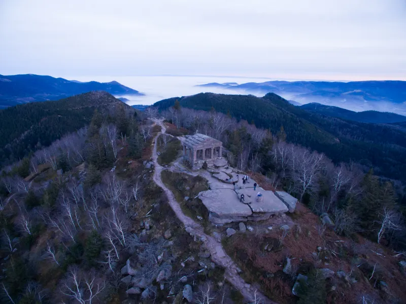
The Donon Temple
No reviews yet
Have you flown here? Share your experience with other pilots.
+ Write the first reviewDescription
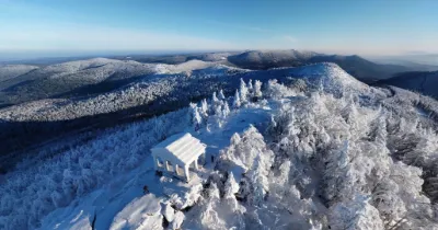
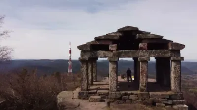
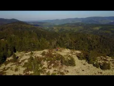
This natural promontory, frequented since the Neolithic period, served as a temporary refuge during the Iron Age before being converted into a place of worship sheltered by an enclosure at the end of the Celtic period. Widely developed by the Romans between the 1st and 3rd century AD, the sanctuary is mainly dedicated at that time to the god Mercury. Numerous reception and cult buildings were built there, enriched with votive stelae and columns of the horseman god Jupiter. This site, abandoned at the fall of the Roman Empire, was neglected until it was rediscovered by Benedictine monks in search of the legendary necropolis of the first Merovingian kings. We owe them the first studies on the Donon. Archaeological excavations carried out since the 18th century have yielded many remains. In 1869, a Temple Museum was built on the summit platform. It was to be the signal for the site; it housed some of the lapidary remains discovered by archaeologists. The bombing of the site during the First World War revealed many remains, encouraging archaeologists to undertake the first scientific excavations in the 1930s. During the First World War, the French were only masters of the summit for a fortnight in August 1914. The Germans took it back and then occupied it until the end of the war. 400 French and German soldiers died in the Donon massif.
Map and restricted areas
Open in the main mapNearby aerodromes
Open aerodromes within 25 km of the spot, heliports included, with their distance and direction from the spot. Near an aerodrome, drone flying is prohibited or height-limited: check the UAS zones map.
| Aerodrome | Type | Distance | Elevation | Difference |
|---|---|---|---|---|
| Aérodrome d'Albé - Val de Villé | Aerodrome | 22 km SE | 380 m | spot 584 m higher |
| Sarrebourg Buhl Airfield | Aerodrome | 24 km N | 266 m | spot 698 m higher |
Aviation weather (METAR and TAF)
LFST – Strasbourg Airport MVFR
METAR
METAR LFST 211100Z AUTO 00000KT 9999 FEW017 SCT022 BKN027 09/05 Q1021 NOSIG
- Wind
- Calm
- Visibility
- 10 km or more
- Clouds
- Few (1-2/8) at 1,700 ft (520 m) ; Scattered (3-4/8) at 2,200 ft (670 m) ; Broken (5-7/8) at 2,700 ft (820 m)
- Temperature
- 9 °C, dew point 5 °C
- QNH
- 1021 hPa
- Flight category
- MVFR: ceiling 1,000–3,000 ft or visibility 3–5 mi
TAF
TAF LFST 210500Z 2106/2206 35005KT 9999 SCT020 BKN050 TEMPO 2106/2108 4000 -SHRA FEW025TCU PROB40 TEMPO 2203/2206 3000 BR BKN007
| Period (local time) | Change | Wind | Visibility | Weather | Clouds |
|---|---|---|---|---|---|
| 21/11 07:00 → 22/11 07:00 | Initial conditions | 350°, 9 km/h | 10 km or more | Scattered (3-4/8) at 2,000 ft (610 m) ; Broken (5-7/8) at 5,000 ft (1520 m) | |
| 21/11 07:00 → 21/11 09:00 | Temporarily | 4.0 km | Showers of rain light | Few (1-2/8) at 2,500 ft (760 m) (towering cumulus) | |
| 22/11 04:00 → 22/11 07:00 | Temporarily, probability 40% | 3.0 km | Mist | Broken (5-7/8) at 700 ft (210 m) |
Weather and Kp index
| Day | Weather | Temp. min. / max. | Wind | Rain | Max Kp |
|---|---|---|---|---|---|
| Sat 21 Nov | Partly cloudy | 0° / 6° | 9 km/h W | – | 2 |
| Sun 22 Nov | Heavy rain | -1° / 3° | 14 km/h E | 12 mm | 2 |
| Mon 23 Nov | Fog | -5° / -1° | 12 km/h NE | – | 4 |
| Tue 24 Nov | Clear sky | -6° / 0° | 10 km/h E | – | 2 |
| Wed 25 Nov | Partly cloudy | -5° / 2° | 13 km/h E | – | – |
| Thu 26 Nov | Cloudy | -4° / -1° | 10 km/h E | 1.3 mm | – |
| Fri 27 Nov | Cloudy | -0° / 2° | 9 km/h SW | 0.1 mm | – |
Hour by hour: Saturday 21 November
| Time | Weather | Temp. | Wind | Rain | Clouds | Kp |
|---|---|---|---|---|---|---|
| 12:00 | Cloudy | 5° | 8 km/h SW | – | 93 % | 2 |
| 13:00 | Partly cloudy | 6° | 9 km/h W | – | 77 % | 1 |
| 14:00 | Partly cloudy | 6° | 9 km/h W | – | 51 % | 1 |
| 15:00 | Fair | 6° | 8 km/h W | – | 29 % | 1 |
| 16:00 | Partly cloudy | 5° | 5 km/h W | – | 39 % | 2 |
| 17:00 | Fair | 3° | 3 km/h SE | – | 20 % | 2 |
| 18:00 | Fair | 2° | 5 km/h SE | – | 17 % | 2 |
| 19:00 | Fair | 1° | 7 km/h S | – | 25 % | 2 |
| 20:00 | Partly cloudy | 1° | 7 km/h S | – | 75 % | 2 |
| 21:00 | Fog | 1° | 6 km/h S | – | 86 % | 2 |
| 22:00 | Fog | 0° | 7 km/h S | – | 98 % | 2 |
Hour by hour: Sunday 22 November
| Time | Weather | Temp. | Wind | Rain | Clouds | Kp |
|---|---|---|---|---|---|---|
| 06:00 | Fog | 1° | 13 km/h SE | – | 100 % | 2 |
| 07:00 | Fog | 2° | 13 km/h SE | – | 100 % | 2 |
| 08:00 | Light rain | 2° | 14 km/h E | 0.1 mm | 100 % | 2 |
| 09:00 | Light rain | 2° | 13 km/h SE | 0.2 mm | 100 % | 2 |
| 10:00 | Rain | 3° | 12 km/h SE | 0.5 mm | 100 % | 2 |
| 11:00 | Rain | 3° | 10 km/h SE | 0.8 mm | 100 % | 2 |
| 12:00 | Heavy rain | 3° | 10 km/h SE | 1.3 mm | 100 % | 2 |
| 13:00 | Heavy rain | 3° | 10 km/h SE | 1.5 mm | 100 % | 2 |
| 14:00 | Sleet | 2° | 11 km/h SE | 1.3 mm | 100 % | 2 |
| 15:00 | Sleet | 2° | 10 km/h E | 1.3 mm | 100 % | 2 |
| 16:00 | Sleet | 1° | 9 km/h E | 1.3 mm | 100 % | 2 |
| 17:00 | Snow | 1° | 10 km/h E | 1.4 mm | 100 % | 2 |
| 18:00 | Snow | 0° | 11 km/h E | 1.1 mm | 100 % | 2 |
| 19:00 | Snow | 0° | 11 km/h NE | 0.8 mm | 100 % | 2 |
| 20:00 | Snow | -0° | 11 km/h NE | 0.5 mm | 100 % | 2 |
| 21:00 | Snow | -0° | 12 km/h NE | 0.3 mm | 100 % | 2 |
| 22:00 | Fog | -0° | 11 km/h NE | – | 100 % | 2 |
Sunrise and sunset
| Day | Dawn | Sunrise | Golden hour | Sunset | Dusk | Day length |
|---|---|---|---|---|---|---|
| Sat 21 Nov | 07:13 | 07:48 | 07:48–08:39 · 15:56–16:46 | 16:46 | 17:21 | 8 h 57 |
| Sun 22 Nov | 07:15 | 07:50 | 07:50–08:40 · 15:55–16:45 | 16:45 | 17:20 | 8 h 55 |
| Mon 23 Nov | 07:16 | 07:51 | 07:51–08:42 · 15:53–16:44 | 16:44 | 17:19 | 8 h 53 |
| Tue 24 Nov | 07:17 | 07:53 | 07:53–08:44 · 15:52–16:43 | 16:43 | 17:19 | 8 h 50 |
| Wed 25 Nov | 07:19 | 07:54 | 07:54–08:45 · 15:51–16:43 | 16:43 | 17:18 | 8 h 48 |
| Thu 26 Nov | 07:20 | 07:55 | 07:55–08:47 · 15:50–16:42 | 16:42 | 17:17 | 8 h 46 |
| Fri 27 Nov | 07:21 | 07:57 | 07:57–08:48 · 15:49–16:41 | 16:41 | 17:17 | 8 h 44 |


Reviews
Log in to review this spot. Log in · Create a free account
No reviews yet. Share yours!